
Showers Thunderstorms Severe Weather & Flash Flood Risk
Hot Humid Through Wednesday

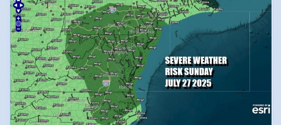
We have weather issues across Eastern Pennsylvania to Southern New England. The Storm Prediction Center is indicating a marginal risk for isolated severe thunderstorms across much of Pennsylvania into New Jersey, southward top Maryland and Delaware and Virginia. Much of the same area is also under a 15 to 40 percent chance for flash flooding per the Weather Prediction Center.
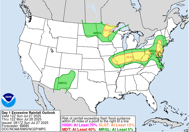
This is more of an issue of localized flash flooding rather than widespread flooding. Lots of tropical air and thunderstorms moving along a stalled frontal boundary could be problematic for some locally heavy rain. Lots of clouds will be around today and that will keep temperatures down. Most highs will be in the low to middle 80s. Humidity levels remain very high today.
SATELLITE WITH LIGHTNING STRIKES

WEATHER RADAR

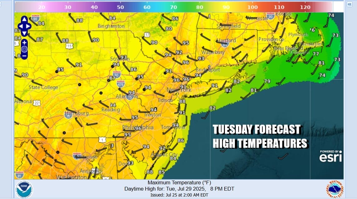
The highest chance for downpours and storms will be from midday until evening. Then we will see showers and downpours wind down and exit to the east. Most lows Monday morning will be in the upper 60s to mid 70s. Monday begins 3 days of very hot and humid conditions. Sunshine will take highs Monday and Tuesday into the low and even some middle 90s. Thunderstorm risk will be rather low through Wednesday.

Thursday will bring a cold front from the northwest and this is going to be a very important weather front. Showers and thunderstorms are likely ahead of it and there might be some severe weather risk. Behind it however we will see a strong dome of high pressure dropping southeast from Central Canada. This brings a beautiful and cool air mass for Friday and for next weekend. Lots of sunshine, cool temperatures and low humidity look to be with us for Friday and next weekend.
BE SURE TO DOWNLOAD THE FREE METEOROLOGIST JOE CIOFFI WEATHER APP &
ANGRY BEN’S FREE WEATHER APP “THE ANGRY WEATHERMAN!
MANY THANKS TO TROPICAL TIDBITS FOR THE USE OF MAPS
Please note that with regards to any severe weather, tropical storms, or hurricanes, should a storm be threatening, please consult your local National Weather Service office or your local government officials about what action you should be taking to protect life and property.


