
Showers Around Ahead of Very Cold Air Monday Through Wednesday
Gusty Winds Below Average Temperatures
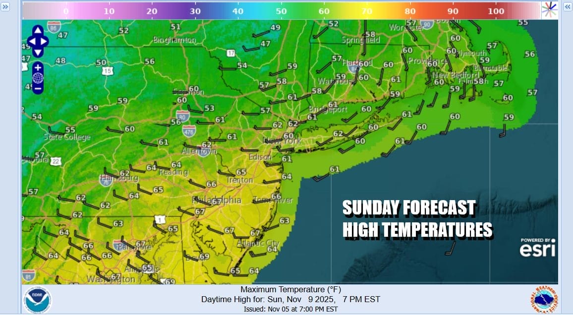
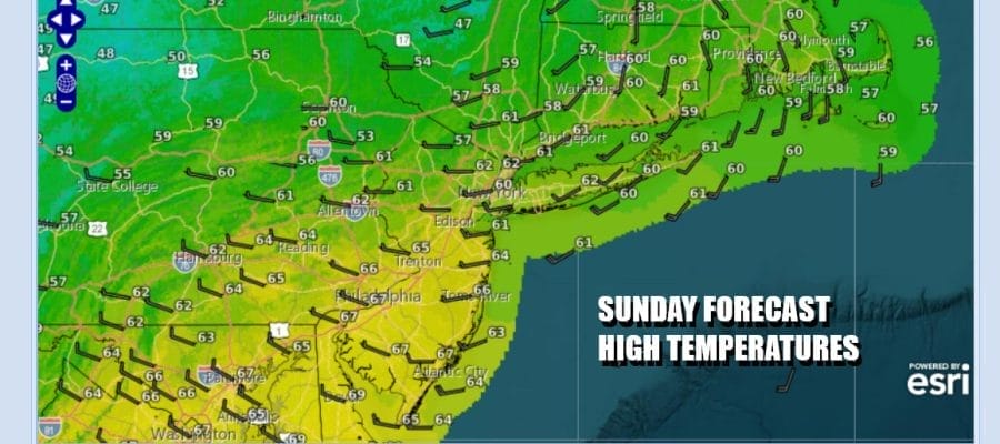
This is going to be the last “warm” day for awhile as we shift to a much colder weather pattern for the week ahead. In fact this is a very cold air mass coming southward out of Canada for this time of year. While the coldest air will settle into the Tennessee Valley & the Deep South, we will see temperatures across the Northeast and Mid Atlantic running 10 to 15 degrees below average at least into the first part of Wednesday. Today it is about arriving clouds and shower chances later today as a cold front approaches. Highs today will be in the 60s. Showers are more likely later this afternoon and overnight though we expect the shower areas to be patchy in nature and rainfall amounts generally running under a quarter of an inch.
SATELLITE WITH LIGHTNING STRIKES

WEATHER RADAR

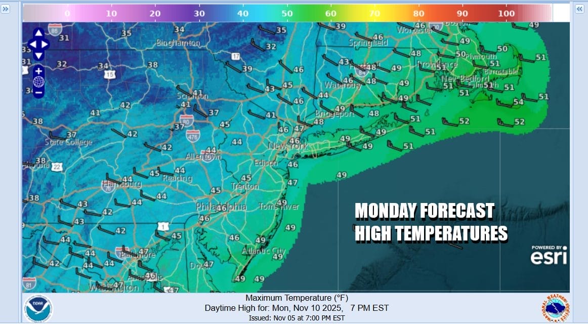
Most showers will be done by daybreak and overnight lows will generally be in the 40s. Monday is going to be a day of clouds giving way to ineffective sunshine and we will also see a gusty northwest wind develop. This is going to keep temperatures Monday during the day in the 40s so the high temperatures for Monday will be leftover from the prior overnight period. We will also see snow showers and squalls on radars Monday to the north and to the west but well inland.
Monday night into Tuesday morning will be the coldest period with gusty winds of 20 to 30 mph overnight. So whatever the temperature is, subtract at least 10 degrees in terms of what it will feel like. Skies will be clear and by Tuesday morning we will have widespread freezes with lows in the 20s just about everywhere. Only the warmest urban areas will see temperatures settle near or just over 30 degrees.

Tuesday will be a windy cold day with some sunshine but high temperatures will be just in the low to mid 40s and then we head down to the mid 20s to lower 30s Wednesday morning. We will see temperatures bounce Wednesday with highs in the upper 40s and lower 50s along with some sunshine however it will still be on the breezy to windy side. Thursday and Friday will be pretty much the same with gusty winds and sunshine with highs back into the lower 50s on average which is below average for this time of year. No rain is forecast all week long.
BE SURE TO DOWNLOAD THE FREE METEOROLOGIST JOE CIOFFI WEATHER APP \&
ANGRY BEN’S FREE WEATHER APP “THE ANGRY WEATHERMAN!
MANY THANKS TO TROPICAL TIDBITS FOR THE USE OF MAPS
Please note that with regards to any severe weather, tropical storms, or hurricanes, should a storm be threatening, please consult your local National Weather Service office or your local government officials about what action you should be taking to protect life and property.


