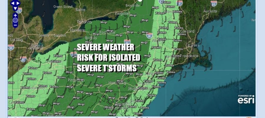

Shower Thunderstorm Risk Late Today & Evening Severe Weather Risk Inland
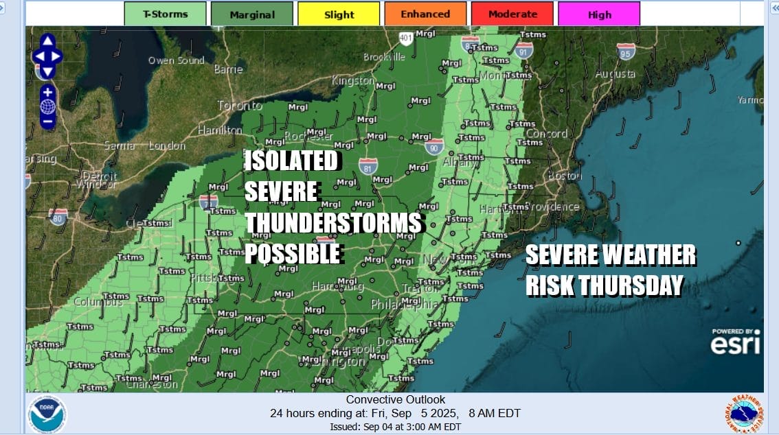
Finally we have a weather front that is approaching and when we check out satellite and radars we see showers and some thunderstorms that are moving eastward. The Storm Prediction Center has indicated an area of marginal risk for severe weather from New York state southward all the way to Virginia and North Carolina. Marginal risk means isolated severe thunderstorms are possible in a mix of general shower and thunderstorm activity.

Much of the day however will see some sunshine with temperatures reaching the upper 70s and lower 80 until later this afternoon and evening when the front nears and so do the showers and thunderstorms. However notice on the HRRR model above that these storms begin to weaken as they head eastward out of Pennsylvania and we expect that most of these storms will likely weaken and fall apart before they reach the coast. The highest risk for storms is probably west of Interstate 87 in Upstate NY and also along and west of Interstate 81 in Pennsylvania. Places like Long Island and Southern New England likely won’t see much from this cold front.
SATELLITE WITH LIGHTNING STRIKES

WEATHER RADAR

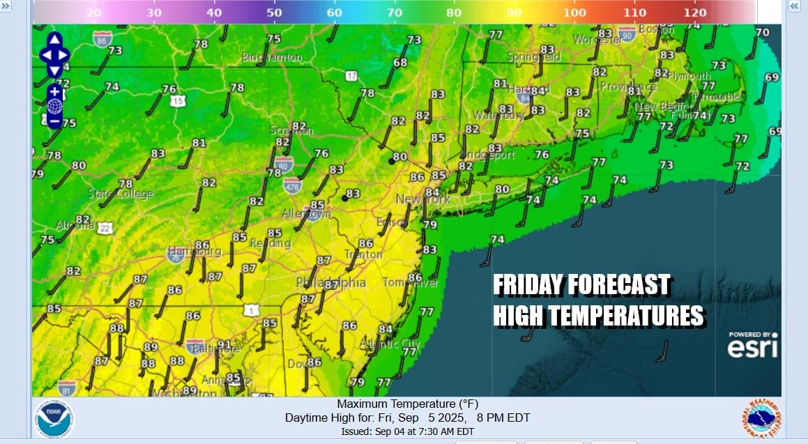
Once we get the front to pass through it leaves us just as warm behind it as was ahead of it. In fact it will be a bit warmer behind it for Friday and Saturday as highs both days will reach the low and even a few middle 80s, though it may be a little cooler at the beaches. Expect no worse than partly sunny skies Friday.
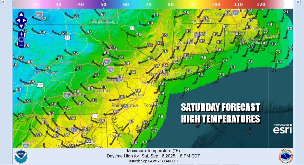
You will notice on the Saturday forecast high temperature map that highs in Central Pennsylvania and points west will be in the 60s. That is because we have a cold front that will approach Saturday and produce some showers and maybe even a thunderstorm or two during the afternoon and evening. Once that passes a much cooler and dry Canadian air mass builds in. Sunday will be 10 to 15 degrees lower with some sunshine and a few clouds. Highs will just reach the lower 70s on average.
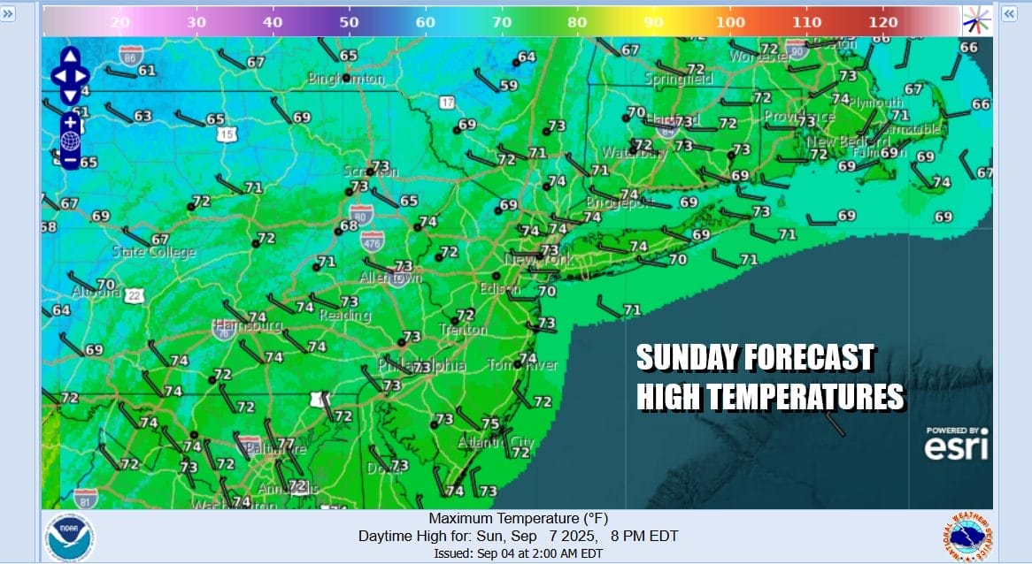
Very cool air will carry us into next week as high pressure builds into the Eastern and Southern US with below average temperatures at least into Wednesday. No rain is forecast as this looks to be another one of those high pressure areas that will take its sweet time moving eastward and offshore. Next week will definitely have the feel of early Autumn with sunny pleasant days and clear cool nights.
BE SURE TO DOWNLOAD THE FREE METEOROLOGIST JOE CIOFFI WEATHER APP \\\&
ANGRY BEN’S FREE WEATHER APP “THE ANGRY WEATHERMAN!
MANY THANKS TO TROPICAL TIDBITS FOR THE USE OF MAPS
Please note that with regards to any severe weather, tropical storms, or hurricanes, should a storm be threatening, please consult your local National Weather Service office or your local government officials about what action you should be taking to protect life and property.


