Severe Weather Risk Wednesday Ahead of Slow Moving Weather Front
We have a hot humid day ahead of us but we also have a weather front that is moving east across the Eastern Great Lakes south to the Central Appalachians and this opens the door to the risk for thunderstorms this afternoon and evening. The Storm Prediction Center is indicating risk for isolated severe thunderstorms from Northern Virginia to Central New England and this includes much of Southern and Eastern Pennsylvania, New Jersey, New York City, the Hudson Valley and Southern New England.
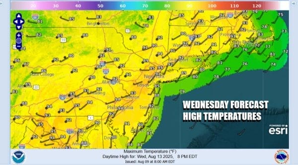
Ahead of any showers or thunderstorms we are going have a hot humid day. Dew points are back into the 70s and temperatures should reach the lower 90s just about everywhere except perhaps right on the beaches. The risk for thunderstorms will increase after lunch time and last into this evening and in the mix, one or two cells will be severe. Also we could see heavy rain and there is always the risk that a storm sits over on particular spot and produces localized flash flooding. Finally there will be some areas that could miss the thunderstorms entirely. That is just how summer weather works.
SATELLITE WITH LIGHTNING STRIKES
WEATHER RADAR
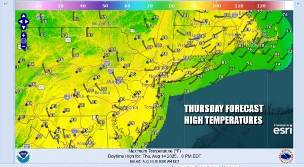
Showers and thunderstorms should wind down this evening leaving us with leftover clouds overnight. Lows will be in the upper 60s to middle 70s. The front is going to slow and will be still lying to the west. This leaves us in another very warm and humid day with highs reaching the mid to upper 80s. Showers and a few thunderstorms will be running around until the front passes offshore.
From the standpoint of a weather front, this really isn’t much of one. Friday we will see some sunshine but it will still be warm and only slightly less humid from Northern New Jersey and NYC north and east. Friday highs will be in the mid to upper 80s. The weekend will be very warm to hot both Saturday and Sunday with highs reaching the upper 80s and lower 90s. Sunday also brings an approaching cold front and the risk for showers and thunderstorms late in the day.
BE SURE TO DOWNLOAD THE FREE METEOROLOGIST JOE CIOFFI WEATHER APP \&
ANGRY BEN’S FREE WEATHER APP “THE ANGRY WEATHERMAN!
MANY THANKS TO TROPICAL TIDBITS FOR THE USE OF MAPS
Please note that with regards to any severe weather, tropical storms, or hurricanes, should a storm be threatening, please consult your local National Weather Service office or your local government officials about what action you should be taking to protect life and property.


