
Severe Weather Risk Later Today Into Tonight
Warm Humid Wednesday Storms Later Thursday
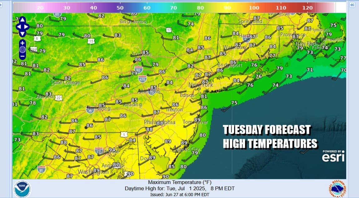
Today it will be about the risk for severe thunderstorms developing later this afternoon and evening. We have a weather front and an upper trough approaching and that will be the catalyst for showers and thunderstorms which will start to form around midday and become more numerous during the afternoon and evening hours. Temperatures today will top out mostly in the low to mid 80s with high humidity.
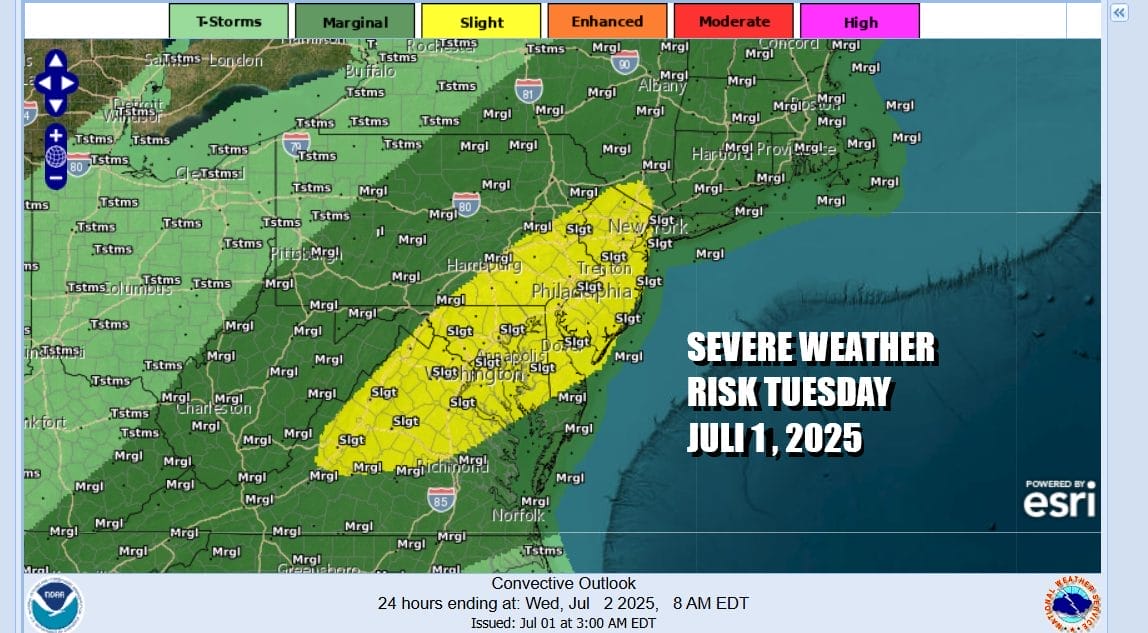
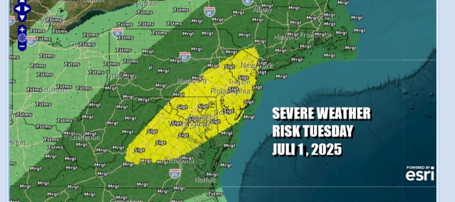
The Storm Prediction Center is forecasting a slight risk or a 15 percent chance for severe thunderstorms in an area that extends from Northern Virginia, to Maryland, Delaware, Eastern and Southeastern Pennsylvania, all of New Jersey touching the Hudson Valley and New York City. Risks for isolated severe thunderstorms today extend as far north as Southern Maine and as far south as the Gulf Coast from Florida to Mississippi
SATELLITE WITH LIGHTNING STRIKES

WEATHER RADAR

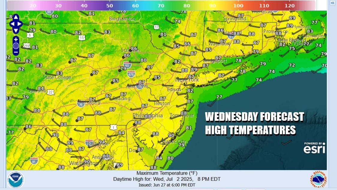
Showers and thunderstorms will linger overnight into early Wednesday morning because the weather front will slow down when it reaches the coast but it should start moving again tomorrow morning. Weather conditions will improve during Wednesday with leftover clouds giving way to some sunshine. Humidity will remain high with temperatures topping in the low to middle 80s.
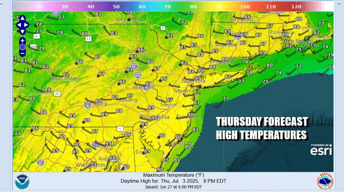
Low pressure and a cold front will drop southward from Upstate New York Thursday so we could see another chance for showers and thunderstorms Thursday afternoon and evening. The front marks the leading edge of cooler drier air. Thunderstorms Thursday will be confined to a short time period in the late afternoon. Thursday highs will be in the mid to upper 80s. There is a marginal risk for isolated severe thunderstorms in the Storm Prediction Center outlook.
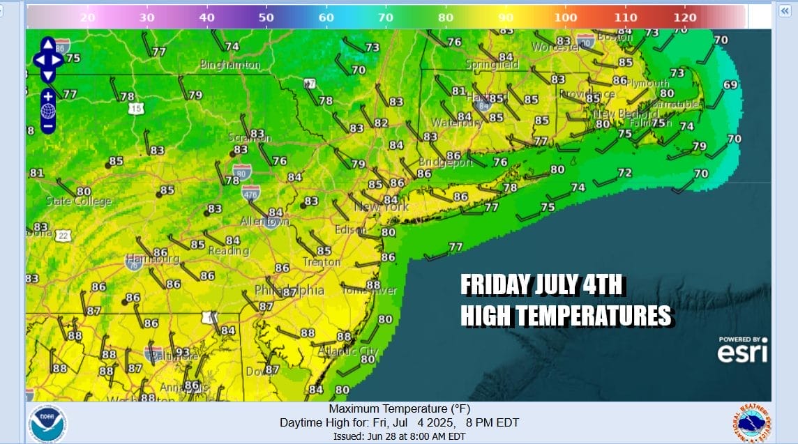
Once the front passes we will see northwest winds bring dry air southward from Eastern Canada so humidity levels will drop considerably for Friday. Independence day will feature a good deal of sunshine but it will be a nice comfortable summer day. Most highs will be in the low to mid 80s and there is no chance for any shower or thunderstorm activity. Friday night will also be clear with reasonable temperatures so fireworks shows will go off without a weather hitch.
Over the weekend we will see warmer and more humid conditions but other than an isolated shower or thunderstorm, the weekend will be rain free. Saturday sunshine will take highs to the mid to upper 80s. Sunday will be hot as we highs will reach the lower 90s. Temperatures both days will be cooler along the coast with local sea breezes developing during afternoon and evening hours.
BE SURE TO DOWNLOAD THE FREE METEOROLOGIST JOE CIOFFI WEATHER APP &
ANGRY BEN’S FREE WEATHER APP “THE ANGRY WEATHERMAN!
MANY THANKS TO TROPICAL TIDBITS FOR THE USE OF MAPS
Please note that with regards to any severe weather, tropical storms, or hurricanes, should a storm be threatening, please consult your local National Weather Service office or your local government officials about what action you should be taking to protect life and property.


