
Risks Rise For Snow Sunday Night Into Monday Morning But How Much?
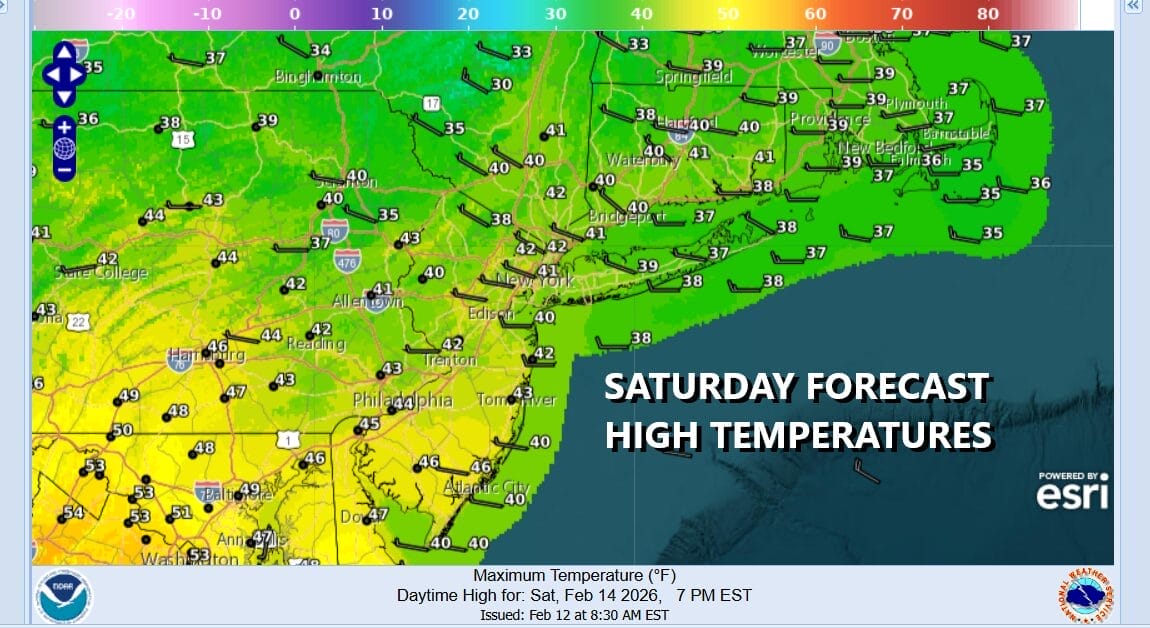
Welcome to the holiday weekend and Valentines Day. The last several days we have been watching a storm system forecast to head east and offshore with no issues. Guess what? We now have issues for Sunday night into Monday morning. Ahead of this at least we have a day of clouds and some sun. There is an upper trough with a weak cold front pushing through today. Other than clouds, radars are mostly quiet and we should see temperatures reach the upper 30s and lower 40s this afternoon.
SATELLITE WITH LIGHTNING STRIKES

WEATHER RADAR

Tonight we should clear out with most lows Sunday morning in the 20s. Sunday is going to be dry during the day with any sun giving way to increasing clouds. Most highs will reach the upper 30s to around or just over 40 degrees. Then we look for precipitation to develop Sunday evening from southwest to northeast.

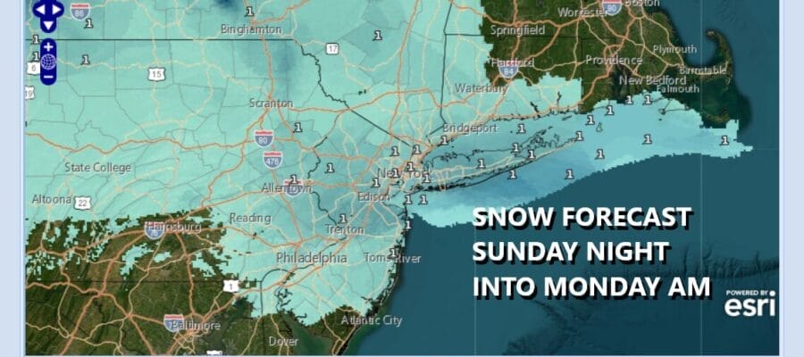
We have seen probably half of doze of these storm systems this winter that have passed to the south. They for one reason or another were not able to climb northward to bring snow to Eastern Pennsylvania to Southern New England. I thought that would be the case this time around as well but we have an upper trough in the Great Lakes that will sharpen just enough to pull this system a little further to the north. The result is snow Sunday night into Monday morning. Right now I’m an thinking along the lines of a 2 to 4 inch snowfall possible across Northern New Jersey, New York City and Long Island with lower amounts in the Lower Hudson Valley and Coastal Connecticut. The highest amounts are likely to be in a stripe across Central New Jersey between Interstates 195 and and 78. Snow will be less further south but where that southern flank lies becomes a little tricky to figure out and we will sort that all between now and Sunday. Weather conditions will improve Monday as sunshine returns and highs climb back up to the upper 30s and lower 40s.
BE SURE TO DOWNLOAD THE FREE METEOROLOGIST JOE CIOFFI WEATHER APP &
ANGRY BEN’S FREE WEATHER APP “THE ANGRY WEATHERMAN!
MANY THANKS TO TROPICAL TIDBITS FOR THE USE OF MAPS
Please note that with regards to any severe weather, tropical storms, or hurricanes, should a storm be threatening, please consult your local National Weather Service office or your local government officials about what action you should be taking to protect life and property.


