
Rain Wind & Some Thunderstorms Into This Evening Dry But Windy Friday

We have low pressure moving northward up the Appalachians today and it is accomplishing to things. The first is widespread rain and even a few thunderstorms in the mix from Virginia to New England. The second is the dragging of Hurricane Melissa to the northeast, where it will pass close to Bermuda tonight and then out to sea from there so at least the tropical system is not an issue for us. However we are seeing clouds and rain on satellites and radar and you can expect some heavy rain across Pennsylvania, New York, New Jersey and New England especially this afternoon and evening. Gusty southeast winds will create some minor coastal flooding issues at high tide along the coast.
SATELLITE WITH LIGHTNING STRIKES

WEATHER RADAR

Between the wind off the ocean and the rain, the feel of today is that gloom & doom sense with temperatures mostly in the upper 50s to lower 60s. Once the front clears the coast this evening we will see skies start to clear out to some degree and winds turning northwest and picking up by daybreak. Lows will be in the 40s to around 50 degrees.
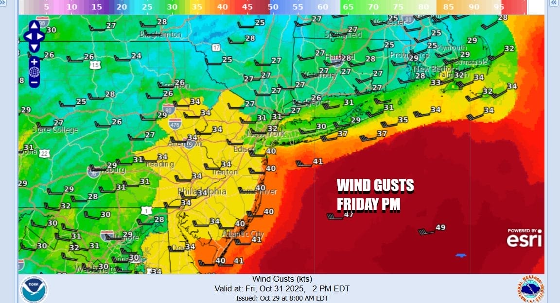
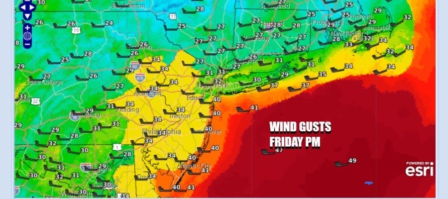
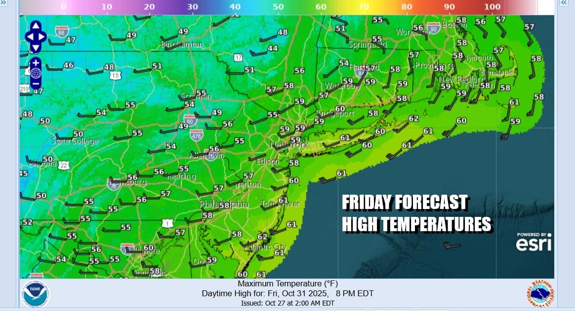
You may have noticed on the loop of the European model above that the pressure gradient gets very tight for Friday. Winds from the northwest will increase to 20 to 30 mph and we will see gusts over 40 mph in some places. Wind Advisory criteria is borderline so we will see what the National Weather Service does with this. Otherwise Friday will be a day of mix sun and clouds with highs in the 50s.
Over the weekend we are looking at dry conditions. It might still be windy Saturday at least through the first half of the day. Both Saturday and Sunday will feature no worse than partly sunny skies. Definitely we will see less wind Sunday. Highs both days will generally be in the mid 50s on average with nighttime lows in the 30s inland and lower 40s near the coast Saturday night into Sunday morning. Much of next week is looking dry and uneventful.
BE SURE TO DOWNLOAD THE FREE METEOROLOGIST JOE CIOFFI WEATHER APP \&
ANGRY BEN’S FREE WEATHER APP “THE ANGRY WEATHERMAN!
MANY THANKS TO TROPICAL TIDBITS FOR THE USE OF MAPS
Please note that with regards to any severe weather, tropical storms, or hurricanes, should a storm be threatening, please consult your local National Weather Service office or your local government officials about what action you should be taking to protect life and property.


