
Rain Heavy At Times Into Tonight Colder Windy Sunday
Week Ahead Outlook
There is a change in the forecast today. The warm front that will be heading back northward today is going to have a really tough time getting up the coast. As a result temperatures today are going to struggle. Instead of pushing up into the 50s and even some low 60s, it appears that we are going to see temperatures having a tough time getting out of the 40s today in many locations. The highs of the day will likely be reached sometime between 7pm and midnight.

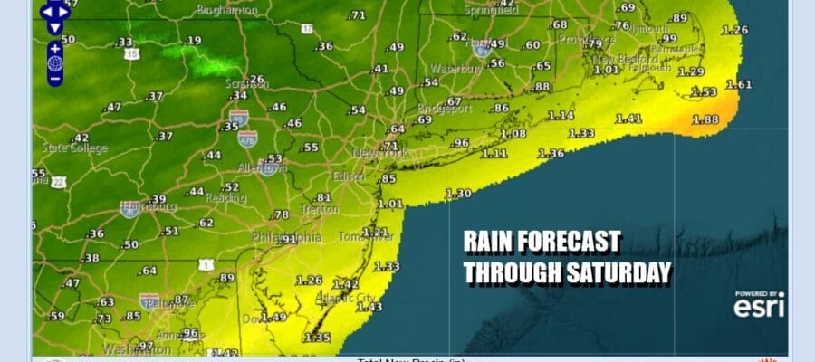
Otherwise today remains a gloom & doom kind of day with radars showing areas of rain, some of which is on the moderate to heavy side sliding northeastward and we will get into that steadier rain as the day wears on. Total rainfall from last night and today combined will be on the order of 3/4 inch to an inch or so in most places though a few areas could wind up with higher amounts near the coast and lower amounts inland and north.
SATELLITE WITH LIGHTNING STRIKES

WEATHER RADAR

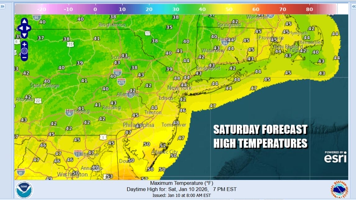
Once the rain plays through this evening a cold front will pass offshore. Low pressure in Eastern Canada redevelops in the Gulf of Maine Sunday and that will bring down colder air on gusty northwest winds. Wind gusts will reach 30 mph or more at time. We expect to see sunshine and some clouds for Sunday. As for temperatures they are likely to hover in the low to mid 40s for much of the day with the highs of the day being reached during the early morning hours of Sunday.

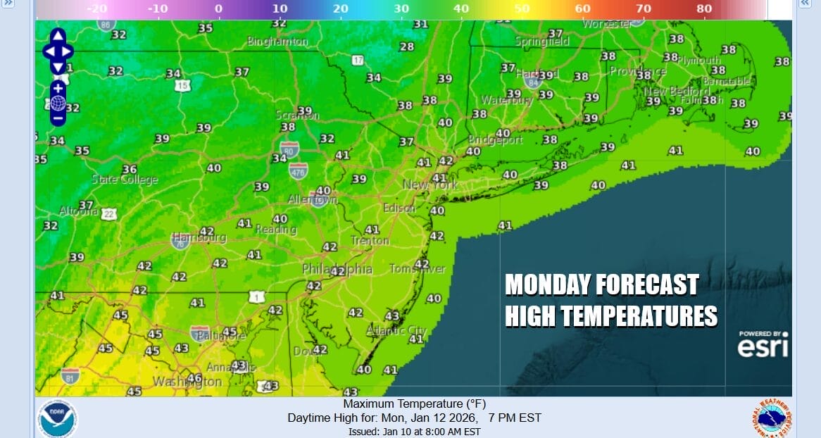
Skies should clear Sunday night and it will remain breezy with lows Monday morning in the mid 20s to near 30 degrees in most places. Winds should abate some Monday as the weather settles down and pressure gradient loosens up. We expect to see sunshine Monday with near average highs in the upper 30s to lower 40s.
The facebook weather cesspool is likely to be talking about a storm system possibly developing later this week coupled with the arrival of colder air. Both things are likely to happen but how and where they happen remains a mystery at this point. We can say that Tuesday and Wednesday, ahead of all this we will see at least some sun both days and highs will reach into the 40s each day. A cold front will pass through Wednesday evening and then it becomes a matter of whether a wave develops on the front Thursday as cold air is arriving. It is certainly conceivable that all the development is offshore and that would leave us in a place where precipitation (if any) is on the light side. We will sit back and watch models play out over the weekend and look at where we are come Monday with all of this.
BE SURE TO DOWNLOAD THE FREE METEOROLOGIST JOE CIOFFI WEATHER APP &
ANGRY BEN’S FREE WEATHER APP “THE ANGRY WEATHERMAN!
MANY THANKS TO TROPICAL TIDBITS FOR THE USE OF MAPS
Please note that with regards to any severe weather, tropical storms, or hurricanes, should a storm be threatening, please consult your local National Weather Service office or your local government officials about what action you should be taking to protect life and property.


