

Onshore Winds Next Few Days Keeps Temperatures In Check
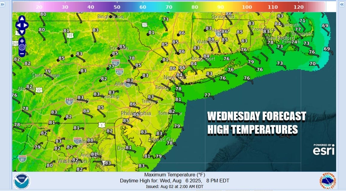
Clouds coming up from the southwest are due to blow off from rain and thunderstorms in the Southeast US that has persisted for the last several days. Other than that cloud cover we are not at any risk for rain. We see the radars showing rain offshore New Jersey and Long Island and that is generally sliding to the east and diminishing. Today should wind up being no worse than partly sunny. We are seeing a wind direction change and that is due to high pressure building southward from Eastern Canada. High temperatures today will range from the 70s near the ocean to 80 to 85 inland. We are going to throw in the mention for an isolated shower or thunderstorm thanks to the sea breeze front. We saw this happen yesterday but it was very isolated on Long Island. Today perhaps one or two cells could pop up in Eastern Pennsylvania and Western New Jersey.
SATELLITE WITH LIGHTNING STRIKES

WEATHER RADAR

This strengthening high will be the dominant player weather wise for the Northeast and Mid Atlantic states through Friday as it produces an easterly flow of air off the ocean. The position of the high is such that the flow off the ocean is not particularly moist from the standpoint of clouds. We expect this condition to last through Friday across Eastern Pennsylvania to Southern New England.

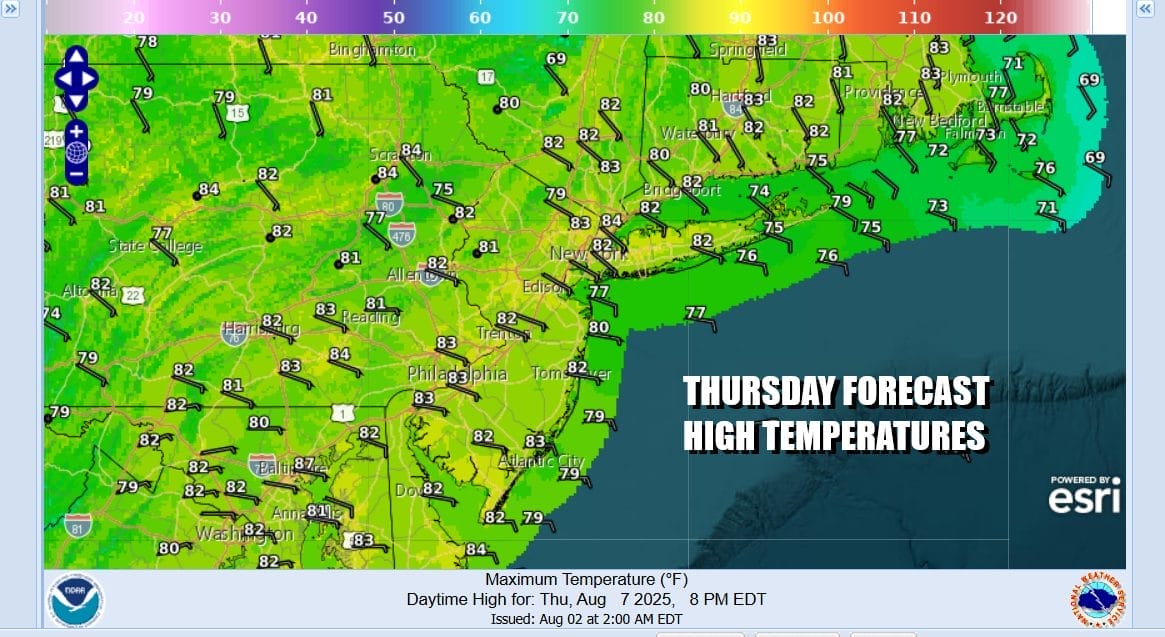
Gradually that high will move southward and then shift offshore bending winds over the weekend to more from the south and southwest. That will allow temperatures to rise and dew points to rise to uncomfortable levels. However as far as rain is concerned, we expect it to continue to be shunted to the south and east. Thursday will be partly sunny with highs again 70s along the shore and mostly lower 80s inland.
Low pressure will probably develop off the Southeast US coast late this week and might be the one factor that could change things over the weekend if it were to move north or northwestward. However it appears that high will force any developing system to the northeast and offshore and that is the most likely outcome. This leaves Friday with partly sunny skies and an onshore flow with highs 80 to 85 inland and 70s near the coast. Over the weekend Saturday and Sunday will also be no worse than partly sunny. Highs both days will reach the mid to upper 80s with some warm spots back to the 90 degree mark. No rain is forecast in general for the next 7 days.
BE SURE TO DOWNLOAD THE FREE METEOROLOGIST JOE CIOFFI WEATHER APP &
ANGRY BEN’S FREE WEATHER APP “THE ANGRY WEATHERMAN!
MANY THANKS TO TROPICAL TIDBITS FOR THE USE OF MAPS
Please note that with regards to any severe weather, tropical storms, or hurricanes, should a storm be threatening, please consult your local National Weather Service office or your local government officials about what action you should be taking to protect life and property.


