
Onshore Flow Keeps It Cooler Today Tuesday Through Friday Nice Dry Weather
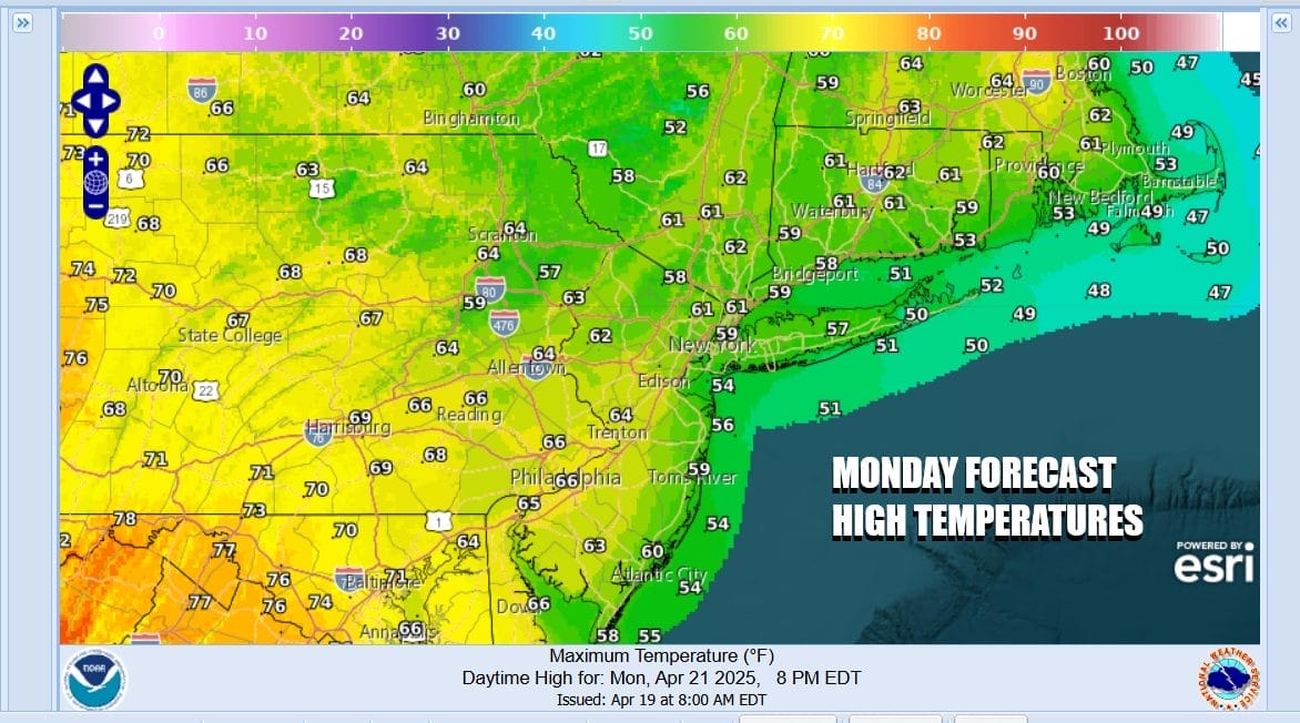
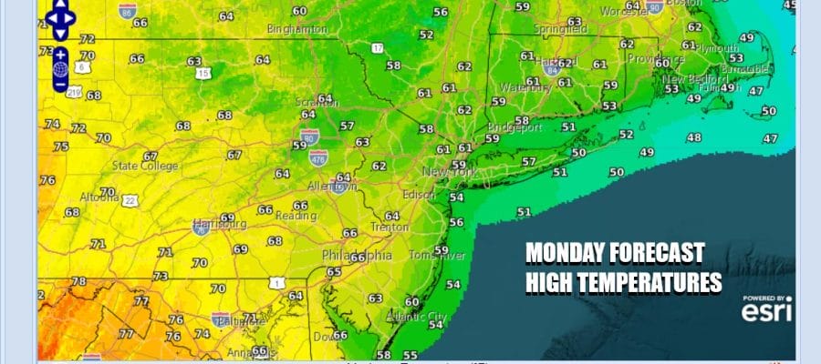
The new work week is here and unless you are extending your holiday, it is back to the grind. The weekend weather was about as nice as it can be this time of year and now today we have the winds from the southeast off the ocean. Ocean water temperatures are running mostly in the mid to upper 40s off the coasts of Southern New England, Long Island & New Jersey and that is actually a good 5 degrees below average. Needless to say that will impact temperatures today as well as an increase in cloud cover. Highs today will be in the mid 50s to around 60 degrees with the coolest temperatures over Long Island and Coastal New Jersey.
SATELLITE WITH LIGHTNING STRIKES

WEATHER RADAR

We are starting to see some showers on the regional radar to the west and this is ahead of an approaching cold front that will move through overnight. The front is likely to weaken as it heads to the east so we anticipate only a low chance for a scattered shower or thunderstorm overnight. Once the front passes the winds will shift to the west Tuesday.

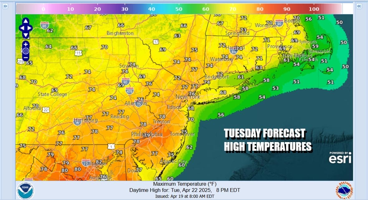
The remainder of the week will be relatively quiet with day to day weather dependent on the wind direction and the amount of sunshine. Most of the time this week both factors will be be in favorable positions. Tuesday will actually be warmer than today thanks to sunshine and a northwest wind. Highs Tuesday afternoon will be mostly in the 70s expect perhaps a little cooler along the immediate coast.
Wednesday we will see a fair amount of sunshine and temperatures may be slightly lower than Tuesday but still on the warm side of average. Afternoon highs will be in the 70s. Thursday and Friday look to be along the same path of at least some sunshine and highs in the 70s. The next cold front will approach Saturday and with it the risk for showers and thunderstorms followed by cooler drier air Sunday.
BE SURE TO DOWNLOAD THE FREE METEOROLOGIST JOE CIOFFI WEATHER APP &
ANGRY BEN’S FREE WEATHER APP “THE ANGRY WEATHERMAN!
MANY THANKS TO TROPICAL TIDBITS FOR THE USE OF MAPS
Please note that with regards to any severe weather, tropical storms, or hurricanes, should a storm be threatening, please consult your local National Weather Service office or your local government officials about what action you should be taking to protect life and property.


