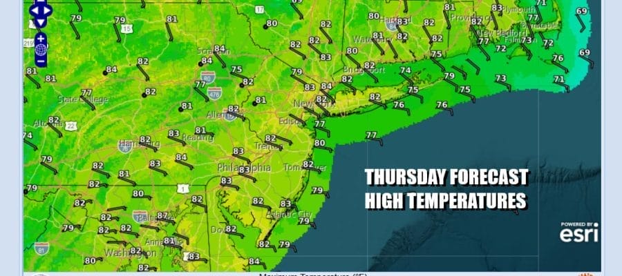

Onshore Flow Continues Through Friday Warmer Humid Over the Weekend
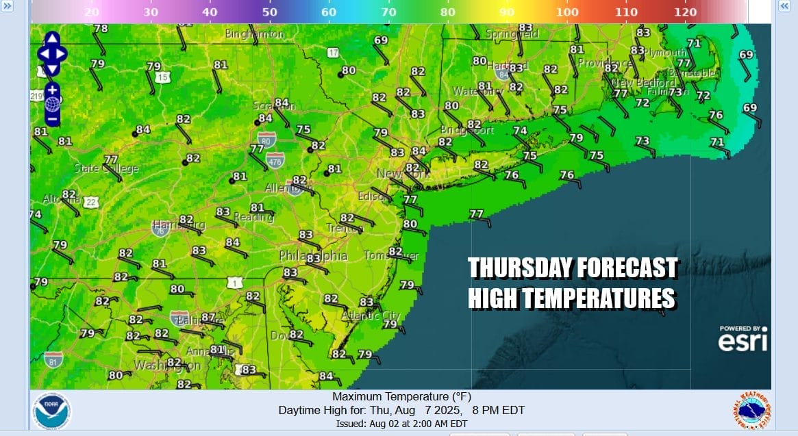
Yesterday we saw southern moisture nose its way northward and actually bring some rain to places in New Jersey to New York City and parts of Long Island but that moisture stream axis is now southeast and offshore and we will be in much better shape today. We will have some sunshine today mixed with some clouds. The flow of air is onshore, that is, it is off the ocean so these east winds will hold temperatures down. Highs today will be mostly between 80 and 85 degrees inland. Coastal locations will see highs mostly in the 70s to around 80 or so.
SATELLITE WITH LIGHTNING STRIKES

WEATHER RADAR

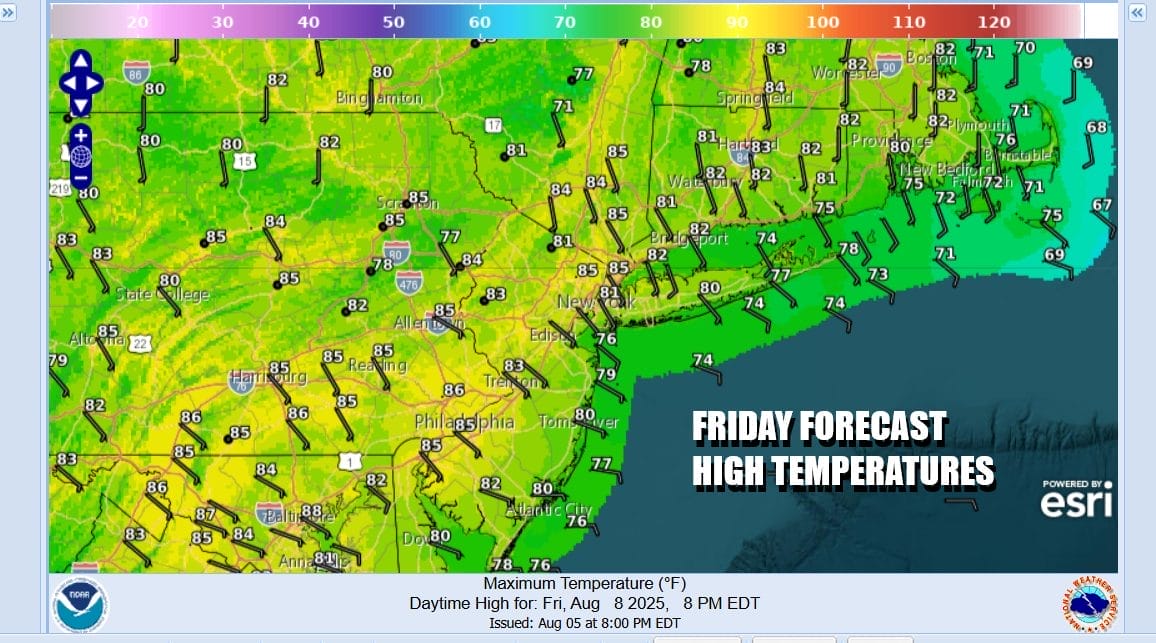
Tonight will be nice and clear perhaps to start though some low clouds could develop especially at the coast. Lows overnight will be in the 60s to near 70 degrees. Friday will be a repeat performance of today with onshore winds and high pressure just to the north. We should see no worse than partly sunny skies. Highs along the shore will be in the 70s to near 80. Highs inland will reach the low and middle 80s.
We are in kind of a no mans land as far as the upper flow is concerned. While the Canadian jet stream has pulled back into Canada, we are left in a situation where upper air winds are light and variable aloft. There is no real push in any one direction. This is going to leave some of the hazy smoke from the Canada wildfires lingering round for the next few days.

As far as the weekend is concerned, the high moves offshore and then reforms in the Mid Atlantic states. The onshore flow is reduced, slowly but surely. Moisture off the Southeast US coast could wind up as a another low developing and moving northeast and offshore. The outcome for Eastern Pennsylvania to Southern New England is a weekend of some sunshine by day and some low clouds developing at night. Little to no rain is forecast.

You can expect temperatures to start edging a little higher over the weekend. Saturday with winds still off the water, inland highs will be in the low to mid 80s with 70s to near 80 at the beaches. Sunday with winds turning more to the south and southwest we will see partly sunny skies. Highs Sunday will reach the middle to upper 80s. Some warm spots will perhaps touch 90 degrees. Cooler temps will prevail at the shore.

We are looking for very warm to hot and humid conditions for all of next week. We also see a pattern where few weather fronts will be coming through and the risk for rain next week is very low. Maybe we get a day or two where we have to throw in the chance for a scattered shower or thunderstorm. Other than that, we could go all of next week without a drop of rain in the forecast. The tropics at the moment are not relevant to the weather outlook for the US shorelines. We are in the August dog days!
BE SURE TO DOWNLOAD THE FREE METEOROLOGIST JOE CIOFFI WEATHER APP &
ANGRY BEN’S FREE WEATHER APP “THE ANGRY WEATHERMAN!
MANY THANKS TO TROPICAL TIDBITS FOR THE USE OF MAPS
Please note that with regards to any severe weather, tropical storms, or hurricanes, should a storm be threatening, please consult your local National Weather Service office or your local government officials about what action you should be taking to protect life and property.


