

USE THE COUPON CODE “summer2026” AND GET 10 PERCENT OFF ON ANY PURCHASE

One More Nice Day Followed By Several Days of Gloom & Doom Type Conditions
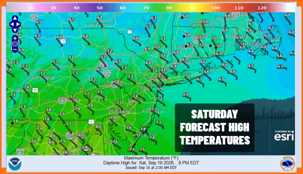
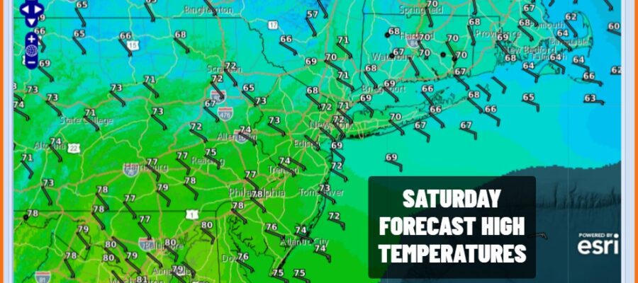
The last weekend of summer is here and it is going to be a 50/50 weekend with today being definitely the better of the two weekend days. Satellite loops show some high clouds streaming eastward from the next weather system heading our way. However today will be no worse than partly sunny. Dew points are low and temperatures today will top out mostly in the 70s. The exception to this will areas north and east of New York City where highs may either stop at 70 or just stay in the 60s. Radars are quiet for now but we will see clouds increase and thicken tonight and some rain could develop overnight and pass through into daybreak Sunday. Most lows tonight will be in the 50s to near 60.
SATELLITE WITH LIGHTNING STRIKES

WEATHER RADAR

The next few days we will be dealing with an onshore flow and that is going keep things rather gloomy much of the time. Weather systems rippling along in the flow will bring some rain from time to time. The good news here is that we don’t have a true tropical feed so we should avoid torrential downpours like the ones we have seen many times this summer. Sunday will be cloudy with on and off rain.
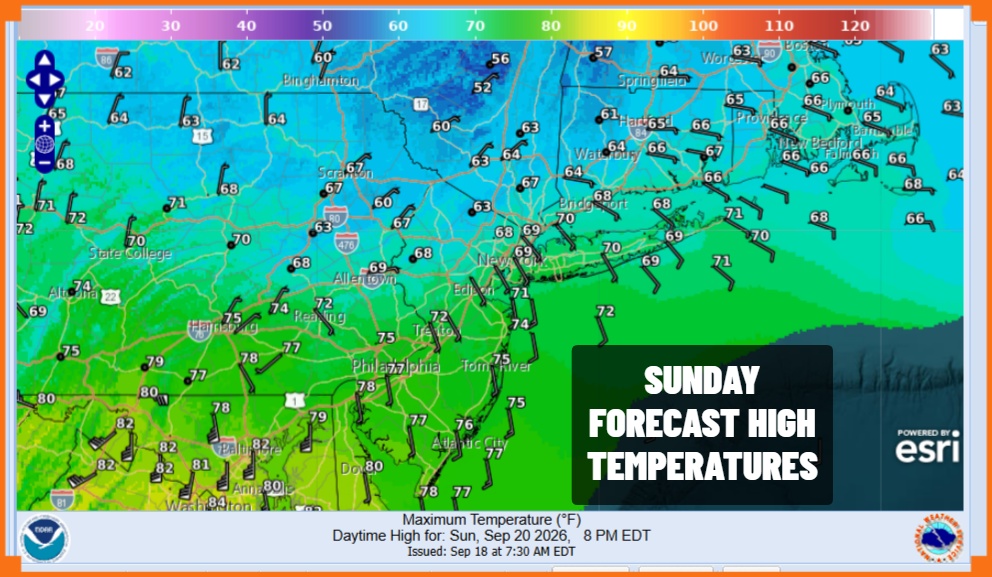
Areas in Central and South Jersey as well as Southern Pennsylvania will see far less rain than areas from Northern New Jersey to New York City north and east. High temperatures Sunday will range from the 60s in areas to the north and low to a few middle 70s in areas to the south. On and off rain will continue overnight into Monday and then another surge of rain comes in late Monday lasting into Tuesday.
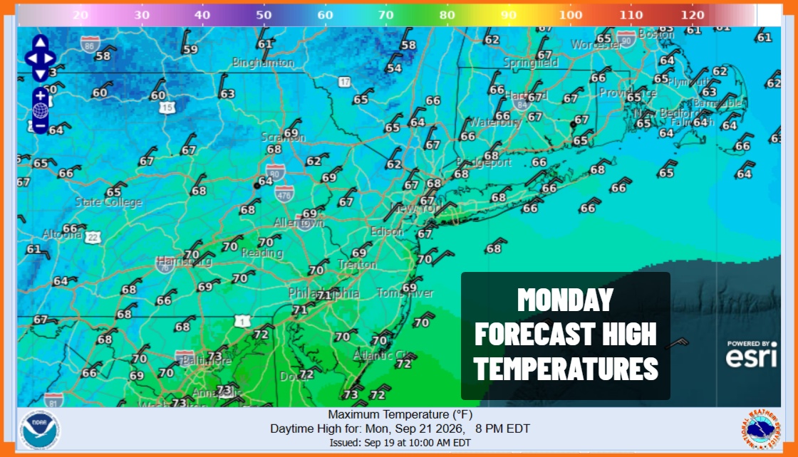
Monday highs will be mostly in the 60s especially in areas where it is raining. Tuesday will be even cooler with northeast winds and highs just in the low to mid 60s with rain for much of the day before the area of rain sinks southward in the afternoon and evening. As for rainfall amounts we could see and inch to an inch and half total spread out over the 3 day period so I’m not anticipating any flash flood issues at this time.
MANY THANKS TO TROPICAL TIDBITS FOR THE USE OF MAPS
Please note that with regards to any severe weather, tropical storms, or hurricanes, should a storm be threatening, please consult your local National Weather Service office or your local government officials about what action you should be taking to protect life and property.