
Nice Weather Rolls Along Mostly Dry Cool Weather Through Labor Day
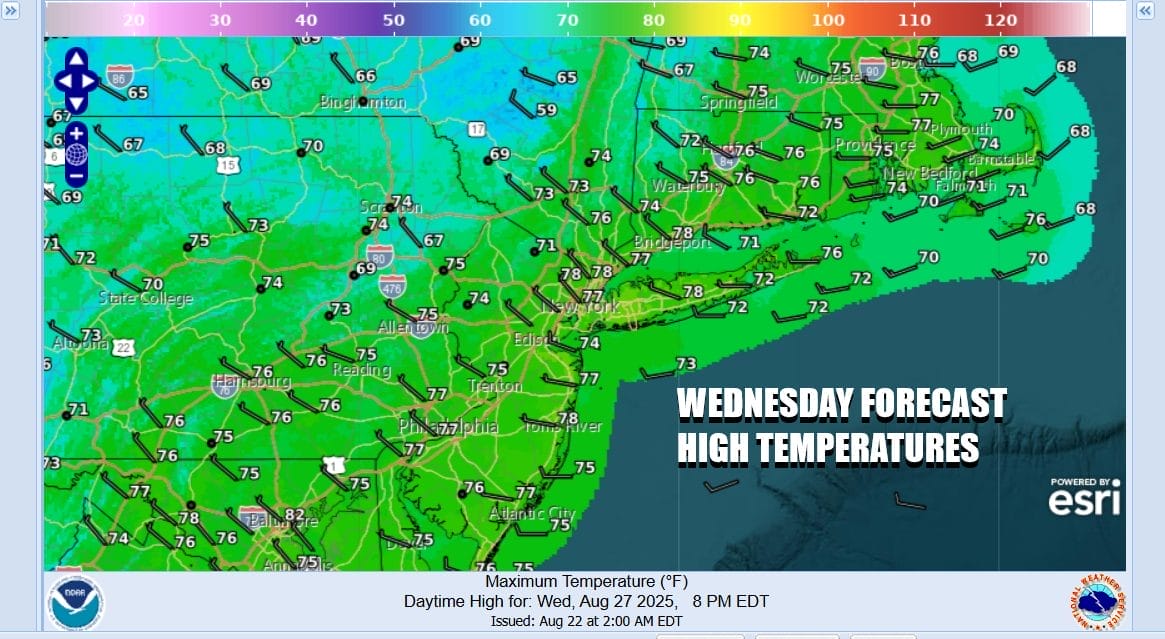
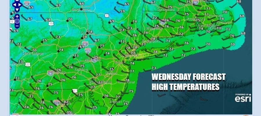
We are at the middle of the week and nothing much has changed in terms of the rest of the week, the weekend, and the long range. We continue to be in a northwest flow from Canada which creates some instability and there for some clouds do develop but overall for much of today it will be no worse than partly sunny. Winds still remain from the west which is a dry wind and dew points are very low so humidity is not an issue at all. High temperatures today will be mostly in the middle 70s with some spots a tad higher and others a tad lower. Radars are nice and quiet. We have another night of clear skies and cool conditions with most lows in the 50s. Cool spots inland and north will be in the 40s while warmer urban locations and the coast will see lows closer to 60 degrees.
SATELLITE WITH LIGHTNING STRIKES

WEATHER RADAR

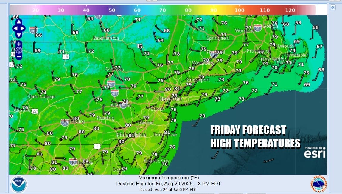
In terms of the overall pattern we have a cold front that will be moving southeastward from Eastern Canada Thursday and it will pass through the Northeast Friday. Tropical air and moisture is mostly cut off so this front is probably going to weaken as it moves southeastward. It really marks the leading edge of another dry air mass that replace or re-enforce the one we already have.

The only place over the next 6 or 7 days where issues will develop is in the Southeast US where pressures are going to be lower than normal and we will likely see some sort of low form on an old frontal boundary and meander there over the weekend and into early next week. There is no mechanism for any low that develops there to move up the coast during the holiday weekend.
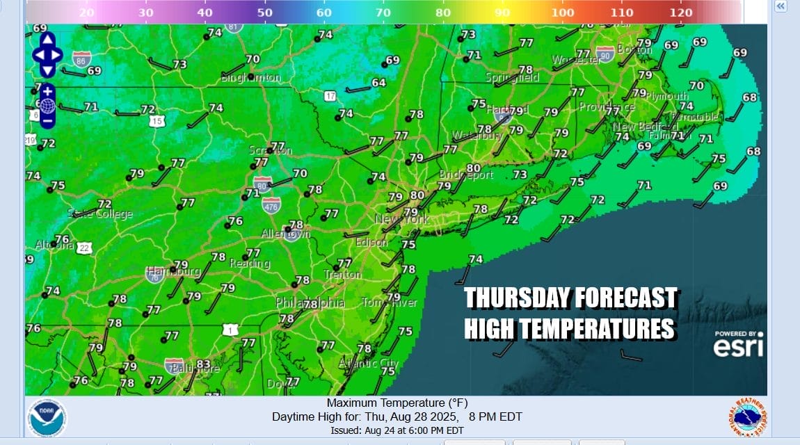
We do not see any weather issues regarding Thursday. Skies should be no worse than partly sunny. After a chilly start, highs will reach the middle to a few upper 70s. Some local sea breezes could develop as winds turn more south and southwest. Friday we will see clouds and some sun along with the risk for a scattered shower or two. Highs will be in the 70s.
Saturday through Monday will be three nice weather days of no worse than partly sunny skies each day. Humidity continues to run on the low side as a new dry air mass takes hold behind the cold front that passes Friday. Highs each day will be in the mid to upper 70s on average and nights will generally be in the 50s to lower 60s. No rain is in the forecast at all through Monday Labor Day and the first chance for any rain many wait until the middle of next week at the very least.
BE SURE TO DOWNLOAD THE FREE METEOROLOGIST JOE CIOFFI WEATHER APP \&
ANGRY BEN’S FREE WEATHER APP “THE ANGRY WEATHERMAN!
MANY THANKS TO TROPICAL TIDBITS FOR THE USE OF MAPS
Please note that with regards to any severe weather, tropical storms, or hurricanes, should a storm be threatening, please consult your local National Weather Service office or your local government officials about what action you should be taking to protect life and property.


