

USE THE COUPON CODE “SPRING2026” AND GET 10 PERCENT OFF ON ANY PURCHASE

Mostly Dry Weather & Sunshine For The Rest of the Week
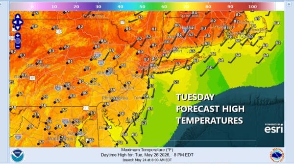
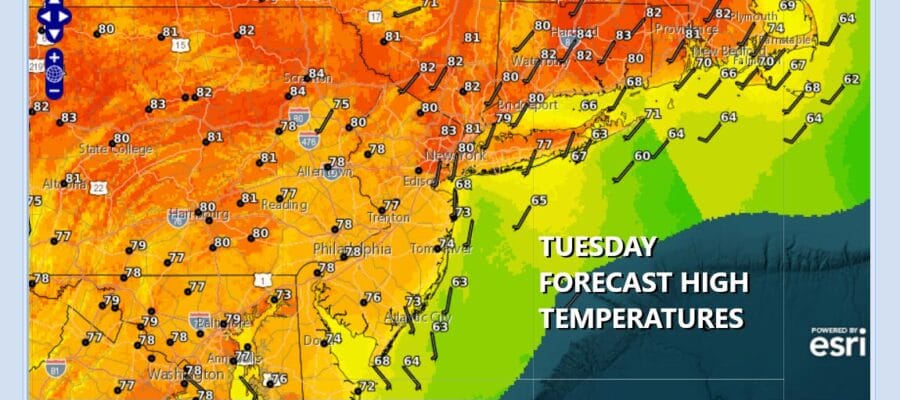
Of course the title today says it all. Mostly dry weather and sunshine for the rest of the week which basically rubs it in about how miserable the Memorial Day holiday weekend was. At least we saw some improvement yesterday afternoon and that continues today. Satellite loops show mainly clear skies. Blow off clouds from rains in the deep south reach up into the Mid Atlantic states but they are not problematic. There will be plenty of sunshine today. We are at the time of year where temperatures will reflexively head up toward 80 degrees as long as there isn’t an issue with the sun or an ocean wind. Highs today will reach the upper 70s and lower 80s in most places with temperatures a little cooler along the coast. Radars are nice and quiet.
SATELLITE WITH LIGHTNING STRIKES

WEATHER RADAR

Much of the time this week a northerly flow of air from an upper air storm system in Atlantic Canada and this establishes its self beginning Wednesday and lasting into the weekend. We will have a few clouds around tonight. Also some rain from the moisture in the south will briefly reach Southern Pennsylvania and Southern New Jersey before drying out Wednesday morning. Wednesday dayside should be no worse than partly sunny. Highs again will reach the upper 70s and lower 80s.
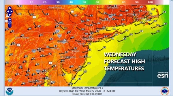
The northerly flow aloft does tend to create a cold unstable atmosphere aloft so there will be some instability clouds to deal with Thursday along with the risk for a scattered shower or two, mostly inland. Otherwise it should be a day of sunshine and some passing clouds for most. Highs Thursday will be in the 70s to near 80 degrees. Friday looks about the same, no worse than partly sunny with highs in the low to middle 70s. Right now the weekend is looking to be nice and dry for both Saturday and Sunday.
