
More Week Weather Fronts On The Way Shot of Cold Air Next Week
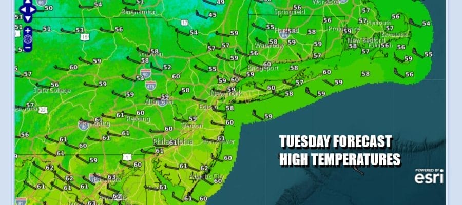
We have a storm system over Atlantic Canada that is strengthening and that means the wind machine is about to get turned on again though this time it will not be as harsh and wind advisories are not posted. We will be under advisory criteria but northwest winds still be gusting 25 to 35 mph at times. We also have plenty of dry air so we should enjoy a good deal of sunshine today. Most high temperatures will be in the mid to upper 50s. Some warm spots in South Jersey and points south could hit 60 or so. Radars are going to be nice and quiet today into Wednesday.
SATELLITE WITH LIGHTNING STRIKES

WEATHER RADAR

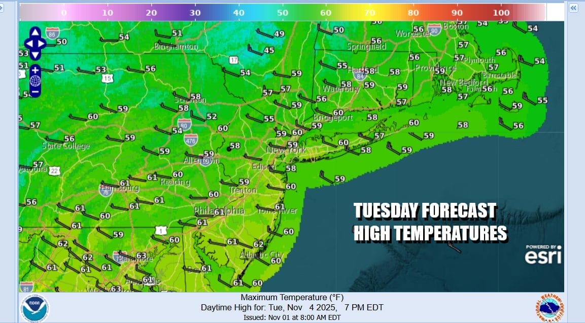
Most lows tonight will be in the 30s inland and lower 40s along the coast under mainly clear skies. There will be enough of a wind to keep temperatures uniform. Wednesday winds will be from the west ahead of low pressure that will head across the Great Lakes and into New England. A trailing cold front will set off some scattered showers Wednesday evening but they will be spread out and it is quite possible that most of you will not see much of anything other than a wind shift when the front passes.
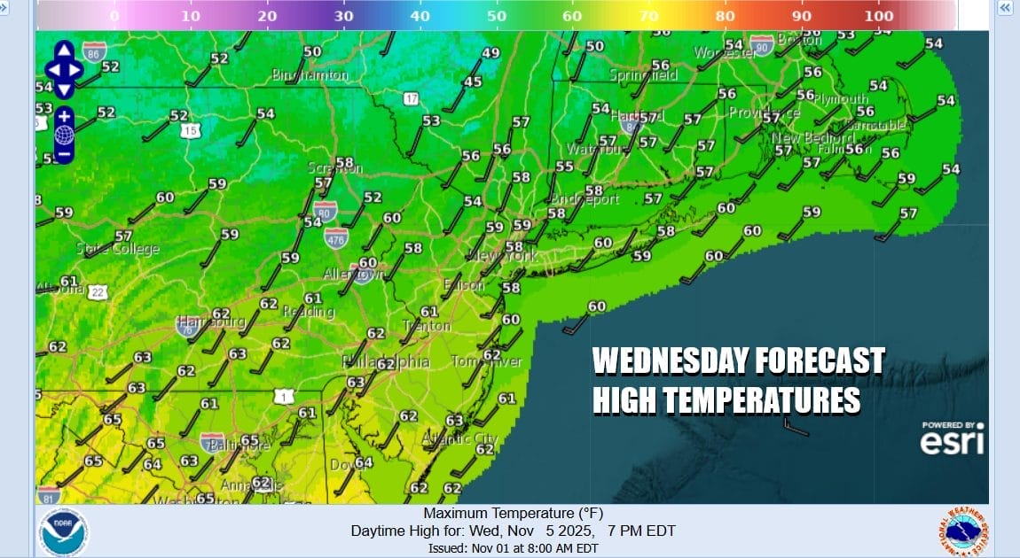
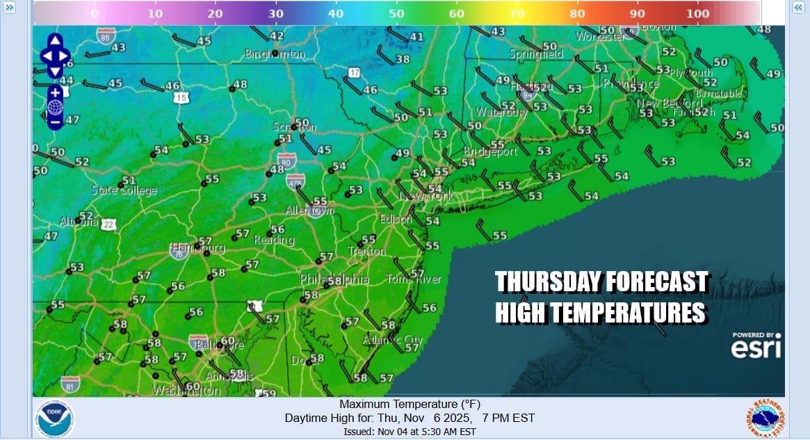
Skies Wednesday will be no worse than partly sunny with most highs reaching the upper 50s and lower 60s. Once the front passes, the wind machine goes on again as winds turn northwest. Thursday is going to be another windy day with clouds and some sunshine. There is a quick shot of chilly air behind this front and Thursday highs will likely be only in the low to middle 50s.
The roller coaster continues Friday as another front approaches so it should be a day of sunshine for the most part and a southwest wind. Highs will reach back into the 60s. Then another cold front will pass Friday night into Saturday morning with some showers. The amount of rain from the cold fronts is minimal. We should see weather improve Saturday but we are setting up for a shot of very cold air for this time of year which will begin to arrive Sunday night and be firmly planted in the Eastern US for the first half of next week.
BE SURE TO DOWNLOAD THE FREE METEOROLOGIST JOE CIOFFI WEATHER APP &
ANGRY BEN’S FREE WEATHER APP “THE ANGRY WEATHERMAN!
MANY THANKS TO TROPICAL TIDBITS FOR THE USE OF MAPS
Please note that with regards to any severe weather, tropical storms, or hurricanes, should a storm be threatening, please consult your local National Weather Service office or your local government officials about what action you should be taking to protect life and property.


