
More Rain & Severe Weather Risk Thursday Watching the Tropics

A cold front passed through last night and is now stalling to the south across the Mid Atlantic states. This front is going to back up northward as a warm front and that is going to keep us in rather cloudy humid conditions today. Some areas could see some breaks to sun while others could see patches of showery rains that will develop later today. Most temperatures will be topping out in the upper 70s to around 80 degrees inland and lower 70s or even upper 60s along south and east facing shorelines
SATELLITE WITH LIGHTNING STRIKES

WEATHER RADAR

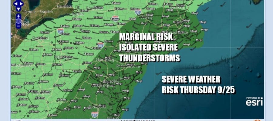
Showery rains and perhaps a thunderstorm or two will be around tonight with most lows in the upper 50s to middle 60s. Thursday we are going to see a slow moving cold front approach and this is going to create more showers and thunderstorms as well as severe weather risk. The Storm Prediction Center is indicating a marginal risk for isolated severe thunderstorms from Central and Southeast New England and the up and down much of the US East Coast including Eastern Pennsylvania, Southeast New York and Long Island, New Jersey Delaware Maryland and Virginia.
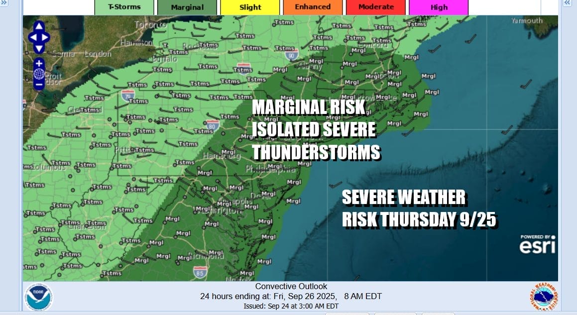
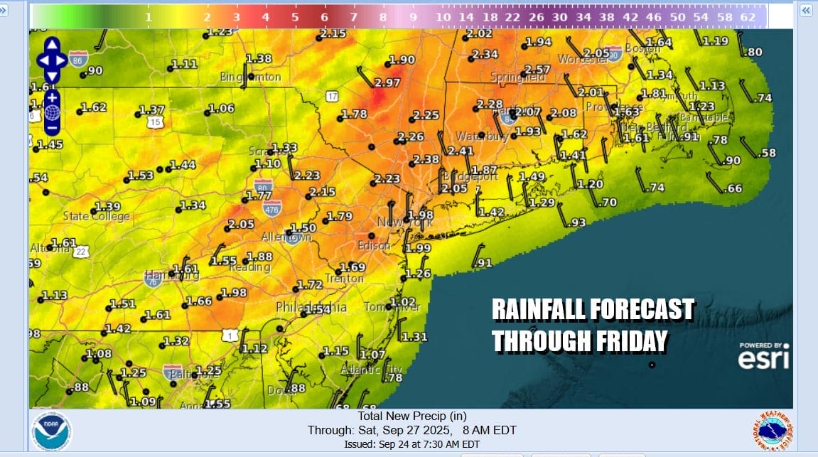
Thursday will start rather cloudy and gloomy and we will see showers, downpours and thunderstorms develop beginning around midday and then increasing during the afternoon and evening. Temperatures Thursday will be mostly in the 70s. Showery rains and thunderstorms will continue Thursday night but should be mostly done by Friday morning. If this all plays out according to plan, 1.5 to 2.5 inches of rain are possible.
We will start to see improving weather conditions settle in for Friday and Saturday however things are about to get rather complicated along the East Coast. Weather models are indicating that over the weekend and early next week, not one but possibly 2 tropical cyclones will develop off the US Southeast Coast. These storms will be about 600 miles apart and the close proximity of the two storms means that these cyclones will influence each other regarding track and strength.

This is going to create a high degree of forecast uncertainty as well as a high degree of forecasting difficulty for the folks at the National Hurricane Center as well as for myself. It could be that one storm becomes the dominate feature and winds up “eating” the other one. On the other hand both storms could wind up developing at similar strengths and the spend there time rotating off the East Coast for several days or more. Clearly we will be monitoring this developing situation rather carefully and of course we will discuss this in detail later today on the Joe & Joe Weather Show Podcast tonight at 7:35pm LIVE on youtube.
BE SURE TO DOWNLOAD THE FREE METEOROLOGIST JOE CIOFFI WEATHER APP &
ANGRY BEN’S FREE WEATHER APP “THE ANGRY WEATHERMAN!
MANY THANKS TO TROPICAL TIDBITS FOR THE USE OF MAPS
Please note that with regards to any severe weather, tropical storms, or hurricanes, should a storm be threatening, please consult your local National Weather Service office or your local government officials about what action you should be taking to protect life and property.


