

Moderating Temperatures Over The Weekend Cold Returns For The Week Ahead
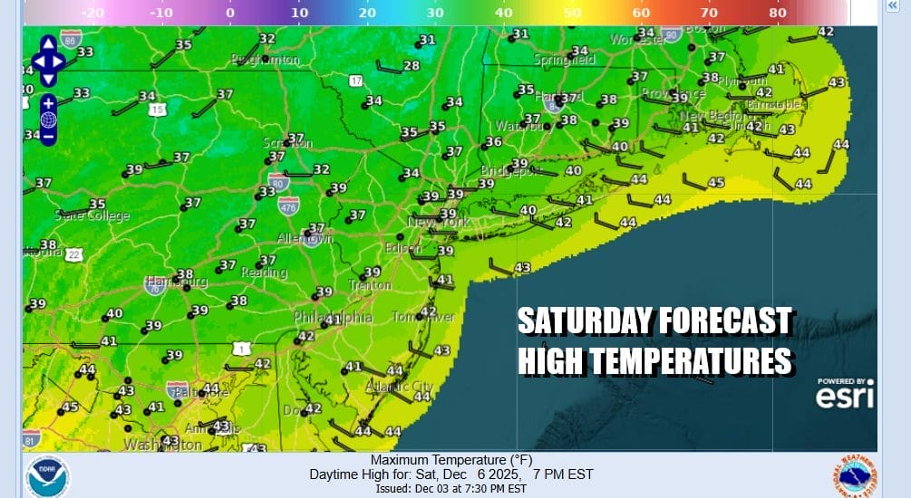
The weekend is underway and we are trying to warm up a bit from the very cold temperatures of Friday. However satellite loops show a large amount of clouds around so this is going to cut back on any sunshine we get today. There has been some spotty light snow or freezing drizzle overnight. Some snow flakes could still linger today at least into the afternoon. Temperatures will probably have a tough time reaching the upper 30s and lower 40s in most places. Tonight will be cold but temperatures will not fall much. Most lows by Sunday morning will be in the mid 20s to lower 30s.
SATELLITE WITH LIGHTNING STRIKES

WEATHER RADAR

Moving on to Sunday we have a weak cold front approaching and what will be left of a weakening low in the Midwest which today is producing another snowfall for this region. It is the 4th system of consequence to move through in the last 2 weeks. That seems to be the target area so far this early winter.
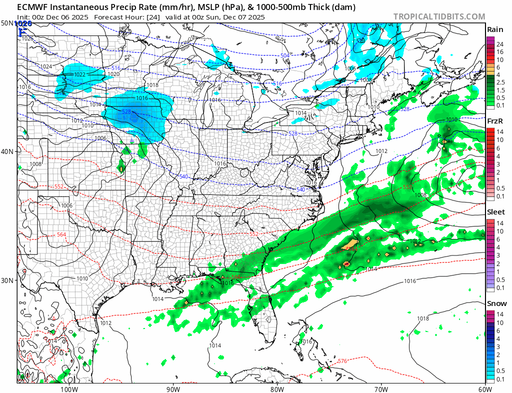
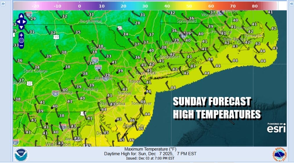
The weakening weather front heading east for Sunday won’t have much moisture with it so we are leaving precipitation out of the forecast and instead going for clouds with some periods of sunshine in the mix. Temperatures might be able to nudge a little higher with most highs in the low to middle 40s.
The northwest flow in the upper atmosphere remains the dominant feature in our weather pattern and we see no signs of that changing anytime soon. Another shot of cold air comes in for Monday and Tuesday though it will not be as harsh as what we saw Friday. We should see a fair amount of sunshine but the new cold air mass means most highs Monday won’t get much above the low and middle 30s.

A weak weather system will pass to our north Tuesday so other than some clouds, we will be dry. There will be some sunshine though in the mix and highs will be mostly in the 30s. Wednesday sees yet another cold front approaching and that front could set off a few rain showers as it goes by later in the day. Wednesday highs will be in the 40s before the front passes. Then another cold shot of air comes in to finish off the work week. Next weekend we might see a more complex system move into the east and behind that one is a very cold air mass from Canada that will be settling in for mid month.
BE SURE TO DOWNLOAD THE FREE METEOROLOGIST JOE CIOFFI WEATHER APP \&
ANGRY BEN’S FREE WEATHER APP “THE ANGRY WEATHERMAN!
MANY THANKS TO TROPICAL TIDBITS FOR THE USE OF MAPS
Please note that with regards to any severe weather, tropical storms, or hurricanes, should a storm be threatening, please consult your local National Weather Service office or your local government officials about what action you should be taking to protect life and property.


