
Moderating Temperatures & Not Much Precipitation For The Week Ahead

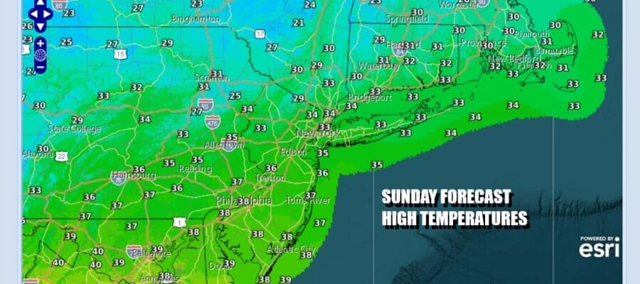
Low pressure well offshore as evidenced by the satellite loop is heading eastward but it is pulling down one last gasp of cold air into the Northeast and Northern Mid Atlantic states for today into Monday. Some light snow from a northern stream system in New England brought a bit of light snow to Connecticut and Long Island this morning but that makes an exit and we should see some sunshine developing today. Temperatures will likely sit in the low to middle 30s for highs this afternoon followed by a cold night of mainly clear skies. Most lows tonight will be in the teens to lower 20s.
SATELLITE WITH LIGHTNING STRIKES

WEATHER RADAR

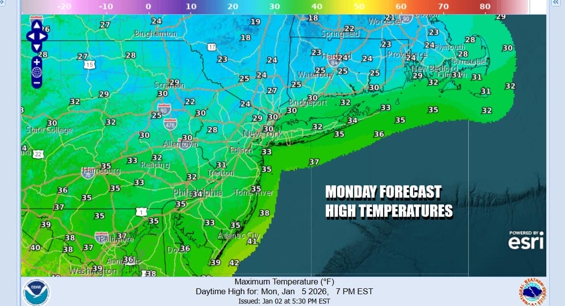
The core of the cold air will begin to move out Monday being helped along by another one of these fast moving lows across Southern Canada and a weak warm front that will extend south from that low center. Clouds will develop during Monday and there is likely to be another shot of light snows across New York State and Southern New England Monday afternoon and evening. The bulk of the precipitation passes mostly north of New York City. Monday highs will reach into the 30s.
Once this system passes offshore the leftover air will be warmer so temperatures Monday night into Tuesday morning will be mostly in the 20s. Another weather system follows Tuesday and once again this system will pass to the north late Tuesday and Tuesday night. Most if not all of the precipitation with this system will also pass to the north in Upstate New York and New England.

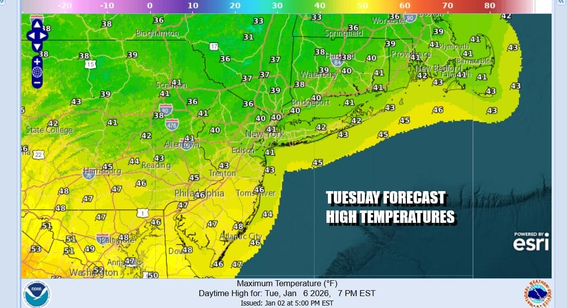
We will see temperatures moderating from the cold weather of recent weeks and we will be above average temperature wise all week long. As far as precipitation goes we likely will have to wait for the weekend. The warm will be noticeable but by no means are we going to anything extreme as far as warm weather goes. Tuesday highs with clouds and some sun will reach the 40s except for areas north of New York City where clouds will hold temperatures down but even in these areas highs will reach the upper 30s to near 40.
Wednesday and Thursday should see some sunshine both days and we will likely see temperatures reach the upper 40s and even the lower 50s in some places. Late week and next weekend we will watch low pressure heading for the Great Lakes. This could bring some rain. It will also result in a shot of colder air returning once any cold fronts pass through. No significant rain or snow is in the forecast though the pattern may turn colder again next week.
BE SURE TO DOWNLOAD THE FREE METEOROLOGIST JOE CIOFFI WEATHER APP &
ANGRY BEN’S FREE WEATHER APP “THE ANGRY WEATHERMAN!
MANY THANKS TO TROPICAL TIDBITS FOR THE USE OF MAPS
Please note that with regards to any severe weather, tropical storms, or hurricanes, should a storm be threatening, please consult your local National Weather Service office or your local government officials about what action you should be taking to protect life and property.


