
Moderating Temperatures Into The Weekend
Weather Front Pushes Through With Showers Friday PM
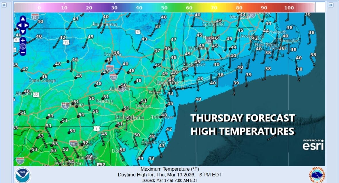
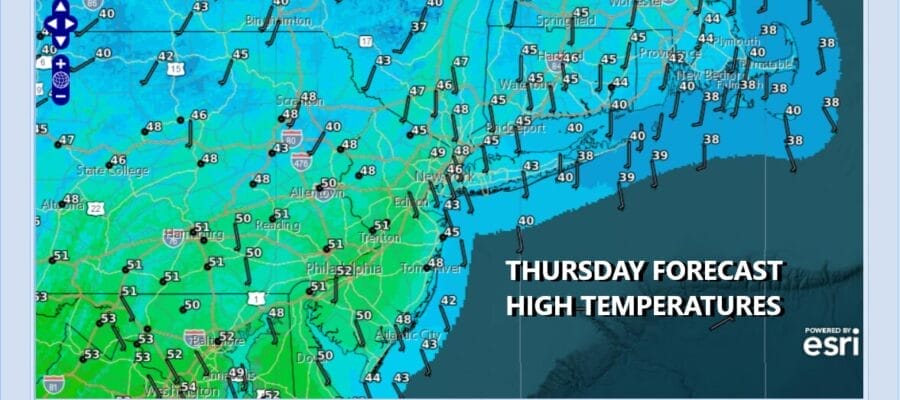
Today is Saint Joseph’s Day and for all the Joe’s out there, happy name day. We are trying to moderate our way out of a cold air mass and we should have some success today as temperatures rise to the upper 40s and lower 50s. We probably would go higher than that were it not for clouds. We can see them moving east and southeast from a broad upper air disturbance moving through the Great Lakes and Northeast. Precipitation with this is well to the north. Across Eastern Pennsylvania to Southern New England we may see some breaks of sun through the clouds and highs will reach the upper 40s and lower 50s. Probably there will be more sun as you head south and less as you head north.
SATELLITE WITH LIGHTNING STRIKES

WEATHER RADAR

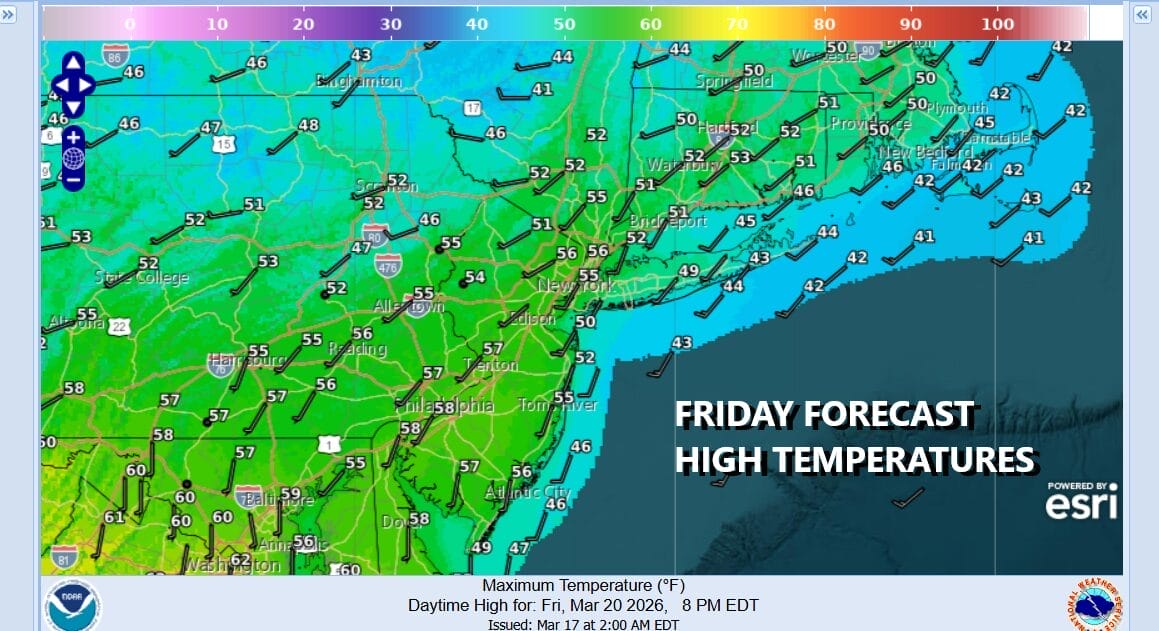
This too shall pass and we will see skies tonight at least partially clear with most lows in the 30s. Friday ahead of the next cold front, we should see no worse than partly sunny skies for much of the day before the front nears and clouds take over. Highs Friday should reach the mid 50s to lower 60s inland but coastal areas will have to deal with the wind off the ocean which will keep temperatures lower in those areas.
Friday night into early Saturday morning we will see some showers. I don’t think the rain amounts to much. Most places will see a tenth of an inch or less. The showers should be done by daybreak Saturday or sooner and then we will see sky conditions improve during the day Saturday with some developing sunshine. The air behind the front will not be all that cold so highs should reach the mid 50s to lower 60s.

Sunday will be partly sunny for much of the day with highs in the 60s. We do have another weather front coming for Sunday night but I think the rain stays away during the dayside. This weather front does have a colder air mass behind it and that will mean lower temperatures for the first couple of days of next week before the cycle starts all over again. No major storms are on the horizon.
BE SURE TO DOWNLOAD THE FREE METEOROLOGIST JOE CIOFFI WEATHER APP &
ANGRY BEN’S FREE WEATHER APP “THE ANGRY WEATHERMAN!
MANY THANKS TO TROPICAL TIDBITS FOR THE USE OF MAPS
Please note that with regards to any severe weather, tropical storms, or hurricanes, should a storm be threatening, please consult your local National Weather Service office or your local government officials about what action you should be taking to protect life and property.


