
March Goes Out Warm April Starts Cooler
Showers Thunderstorm Chances Late Wednesday

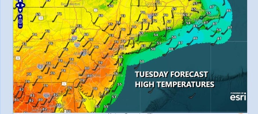
Satellite and radars show thunderstorms and some heavy rain moving across Upstate New York and Northern New England but that means that the warm front is now to our north. We are on the southern flank of cloud cover today and that means we should see no worse than partly sunny skies for this Tuesday. Warm air is surging northward and high temperatures today will be in the mid to upper 70s inland and some warm spots could hit 80 degrees. South and east facing shorelines will continue to deal with sea breeze issues developing during the afternoon and evening so shave at least 10 degrees off the highs in those areas.
SATELLITE WITH LIGHTNING STRIKES

WEATHER RADAR

BE SURE TO DOWNLOAD THE FREE METEOROLOGIST JOE CIOFFI WEATHER APP &
ANGRY BEN’S FREE WEATHER APP “THE ANGRY WEATHERMAN!
MANY THANKS TO TROPICAL TIDBITS FOR THE USE OF MAPS
Please note that with regards to any severe weather, tropical storms, or hurricanes, should a storm be threatening, please consult your local National Weather Service office or your local government officials about what action you should be taking to protect life and property.


