

Labor Day Weekend Spectacular Sunshine & Cool Dry Air Through Monday
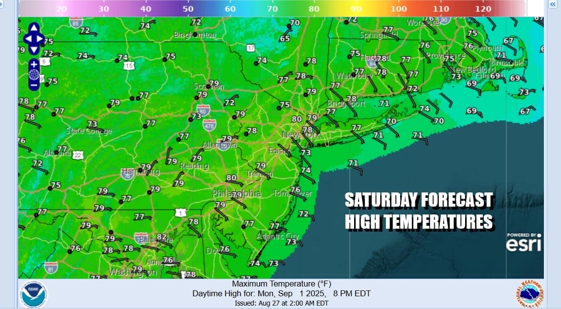
The Labor Day holiday weekend is upon us and we are going to finish off the summer vacation season in a grand way. Satellite loops show nothing more than some passing clouds. We have a dry air mass covering the Northeast and Middle Atlantic states back to the Great Lakes and Ohio Valley. Any rain is confined to the Gulf Coast. Finally the tropics are quiet and we have no tropical storms or hurricanes running around anywhere this weekend. We will have partly to mostly sunny skies today. Temperatures are mostly going to top out in the mid to upper 70s both at the beaches and in inland areas. Radars are on vacation this weekend as well with little activity anywhere.
SATELLITE WITH LIGHTNING STRIKES

WEATHER RADAR

Cool dry days lead to cool dry nights as well. Skies tonight will be mostly clear. Most lows will be in the 50s including urban areas. North and west as well as north and east of the coast temperatures will be dropping into the 40s. Sunday high pressure remains firm. Skies will be partly to mostly sunny. High temperatures again both at the coast and inland will be in the 70s. Humidity is not an issue whatsoever.

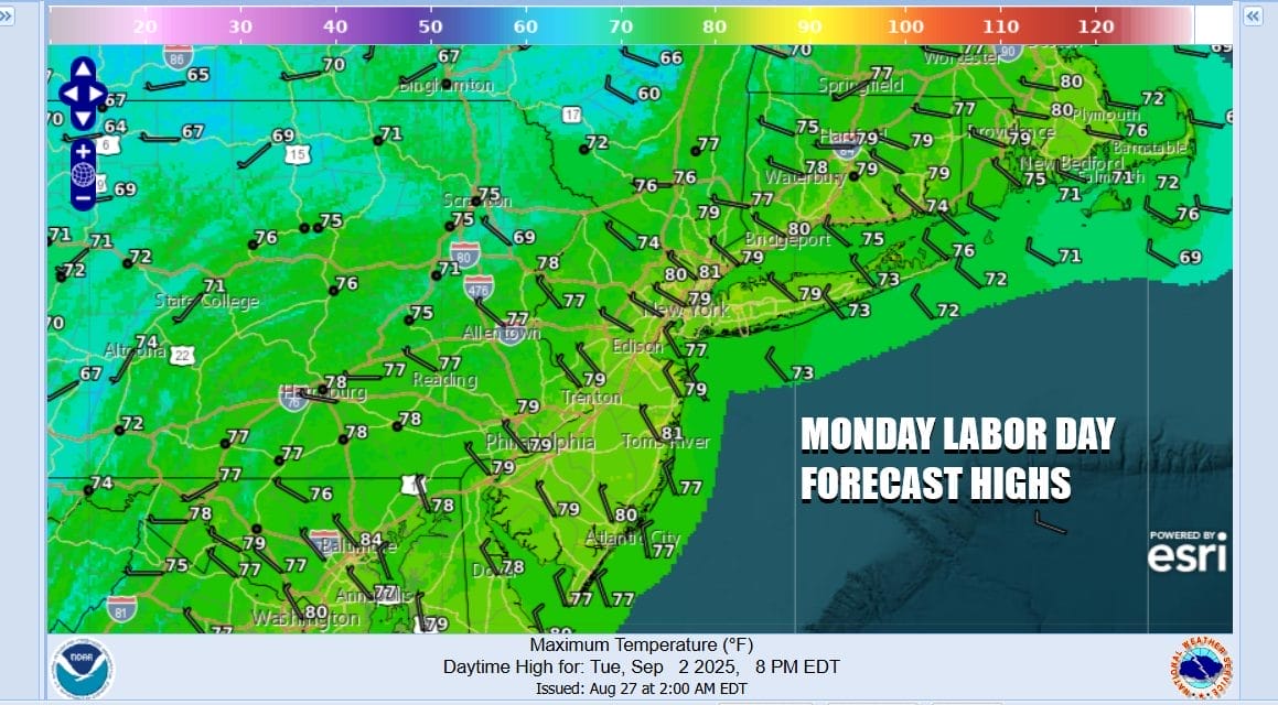
Monday Labor day finishes off the weekend with partly to mostly sunny skies. Temperatures after a cool morning start will top in the 70s. Some warm spots could approach 80 degrees. Radars remain in shutdown mode and humidity levels continue to remain subdued as moisture remains trapped along the Gulf Coast.
This large dry dome of Canadian air will be very slow and very stubborn to get out of the way. Low pressure and a cold front will be moving into the Northern Great Lakes with a trailing cold front to the south. Rain will begin to develop in the Mississippi and Ohio Valley Tuesday and start slowly moving eastward Wednesday.

Ahead of this front however it will remain dry with some sunshine for both Tuesday and Wednesday and dew points will be very slow to rise so humidity levels will remain tame through Wednesday. Temperatures will be topping out by day in the mid 70s to around 80 degrees with partly to mostly sunny skies Tuesday as well as Wednesday though some clouds will start to arrive later Wednesday. Rain will be coming in Thursday as the front approaches and another dry cool air mass follows for Friday and next weekend.
BE SURE TO DOWNLOAD THE FREE METEOROLOGIST JOE CIOFFI WEATHER APP \&
ANGRY BEN’S FREE WEATHER APP “THE ANGRY WEATHERMAN!
MANY THANKS TO TROPICAL TIDBITS FOR THE USE OF MAPS
Please note that with regards to any severe weather, tropical storms, or hurricanes, should a storm be threatening, please consult your local National Weather Service office or your local government officials about what action you should be taking to protect life and property.
You can support this podcast by shopping on Amazon directly through this link. https://amzn.to/3OpLiB6 Amazon is an affiliate of the Joe & Joe Weather Show Podcast.
You can support this channel by subscribing to Patreon for full winter weather coverage. https://patreon.com/meteorologistjoecioffi


