
January Thaw Next 4 Days Highs Could Reach 60 In Some Places Thursday Through Saturday
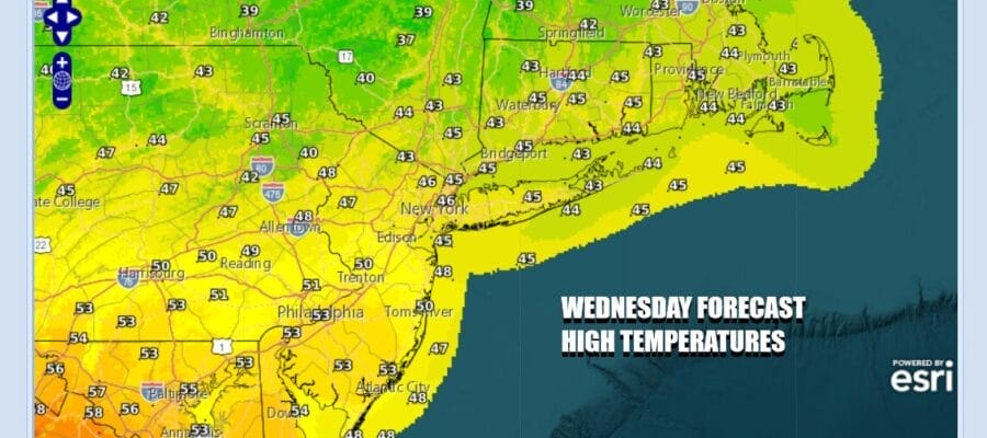
Weather conditions continue to improve as we head into and through the afternoon. Low pressure is exiting to the east and what is left is a warmer air mass that will be settling in for the next couple of days. This is our first stretch of 4 above normal days since mid Autumn. We are seeing leftover clouds and some sunshine for this afternoon. High temperatures will be mostly in the mid to upper 40s with the exception of South Jersey and Southern Pennsylvania where highs will reach into the 50s. Local radars are quiet and should remain so into at least the early part of Friday.
SATELLITE WITH LIGHTNING STRIKES

WEATHER RADAR

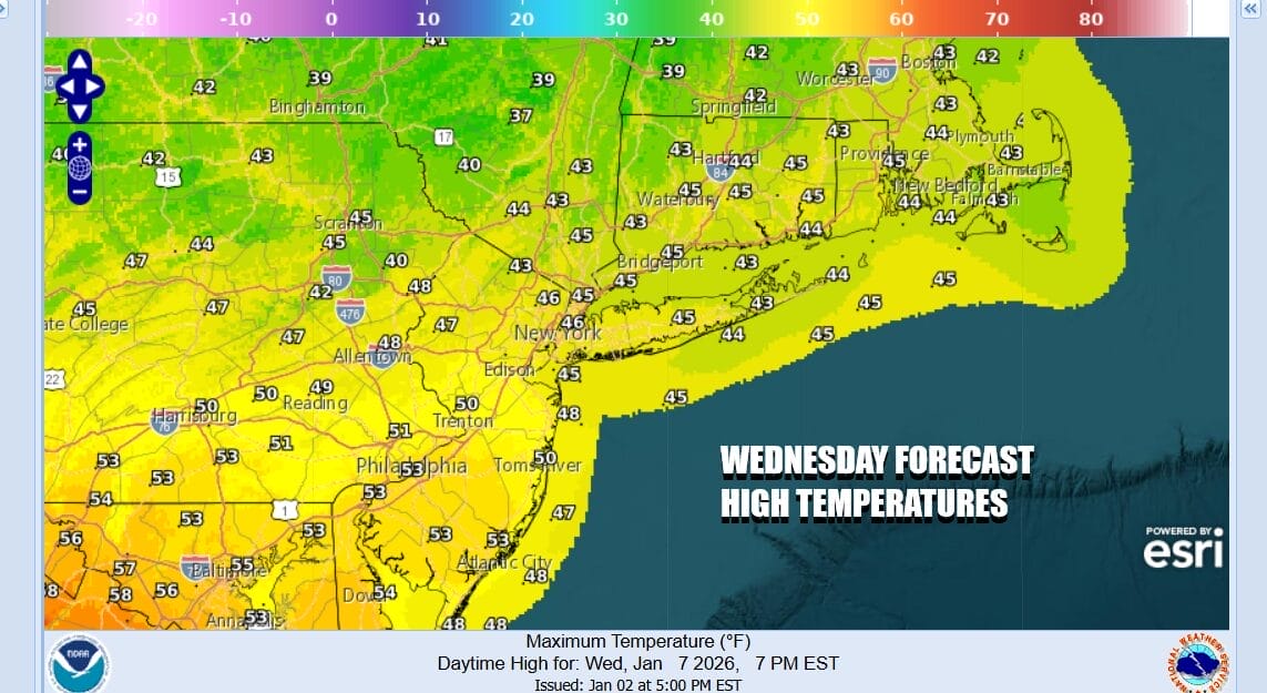
Skies tonight will be partly to mostly clear. Thursday morning lows will bottom mostly in the low to middle 30s just above everywhere. Thursday looks like the best weather day of this week with sunshine. It will also be on the mild side with most highs reaching the upper 40s and lower 50s. Temperatures along south and east facing shorelines could see local sea breezes develop and highs there will be a few degrees lower.

Friday the high pressure cell will be offshore and south to southwest winds will continue to warm up. We also have low pressure heading to our west Friday with a trailing cold front. That front will pass Friday evening with a few showers ahead of it. Friday starts with sun giving way to arriving clouds. Highs will reach the 50s everywhere. Some warm spots in South Jersey and points south could hit 60 degrees.
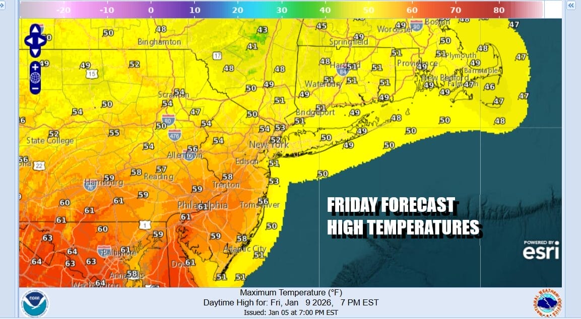
The Friday night cold front will stall to our south and another developing storm system coming out of Texas will head up the west side of the Appalachians to Northern Ohio Saturday and from there into Southeastern Canada. A second cold front approaches Saturday so rain returns and there could even be a few heavier convective downpours in the mix.

Temperatures Saturday will be in the mid 50s to lower 60s for highs. The front will pass offshore late Saturday night and drier and colder air will begin to arrive Sunday. We xpect to see some sunshine and clouds Sunday. The highs for the day will be acheived very early on, probably leftover from midnight. During the day temperatures Sunday will likely be in the 40s to near 50 degrees. Next week will be colder as the northwest flow from Canada resumes.
BE SURE TO DOWNLOAD THE FREE METEOROLOGIST JOE CIOFFI WEATHER APP &
ANGRY BEN’S FREE WEATHER APP “THE ANGRY WEATHERMAN!
MANY THANKS TO TROPICAL TIDBITS FOR THE USE OF MAPS
Please note that with regards to any severe weather, tropical storms, or hurricanes, should a storm be threatening, please consult your local National Weather Service office or your local government officials about what action you should be taking to protect life and property.


