

In & Out Sunshine With Gusty Winds Today
Warming Up Into Tuesday Ahead of Cold Front
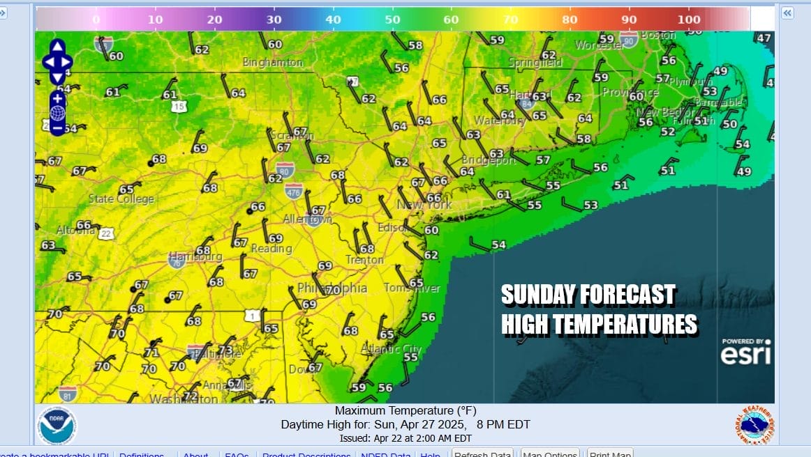
While a cold front has passed far offshore, strong low pressure remains in New England and you can see the rather strong rotation on satellite and radar loops. The pressure gradient across the Northeast is very tight. While most areas are not under a wind advisory, you can expect northwest winds to gust 30 to 40 mph at times today as daytime heating in an unstable atmosphere help to create windy conditions. Also we will see clouds around and it will be a day of in and out sunshine. Highs will just be in the 60s. Regional radars show showers in Upstate NY and New England but they should move east rather than south and not be an issue for Eastern Pennsylvania to Southern New England.
SATELLITE WITH LIGHTNING STRIKES

WEATHER RADAR

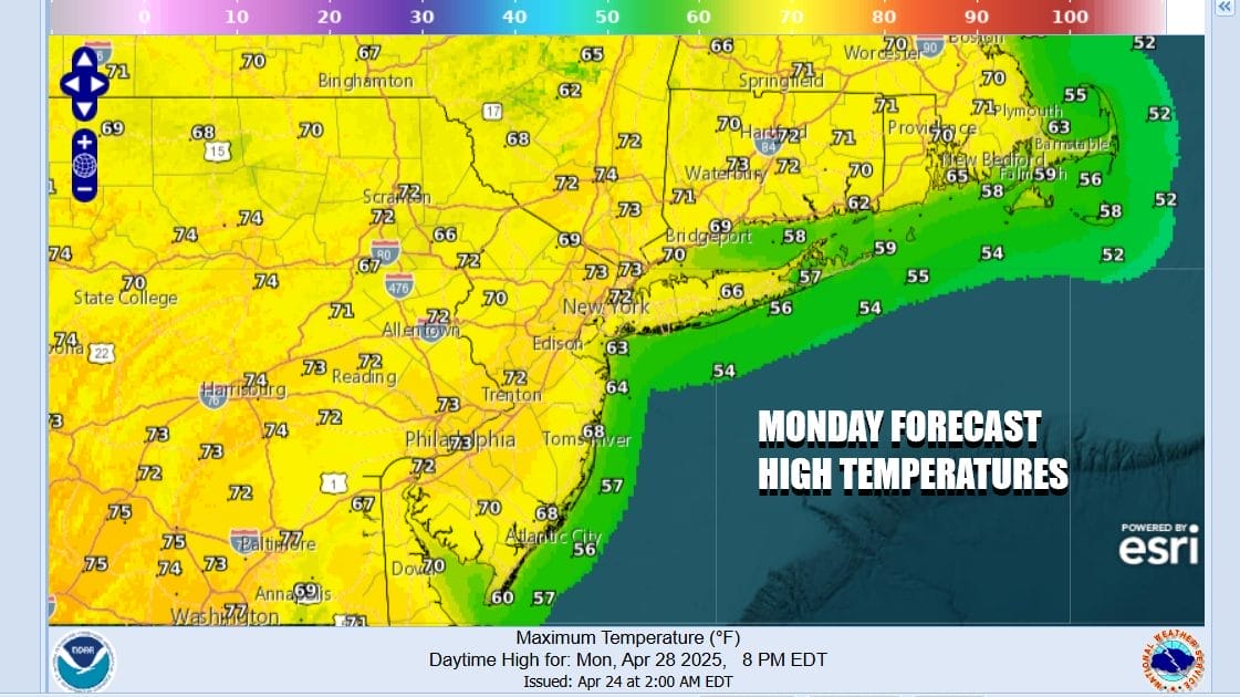
Tonight we should see skies clear and winds diminish with most lows in the 40s along with a few 30s well inland. Monday things will settle down and we will have a fair amount of sunshine. Temperatures should rebound back into the 70s areas wide except near the coast where local sea breezes will likely develop during the afternoon and evening.
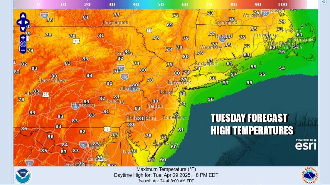
A strong cold front will be moving through the Upper Midwest Monday and low pressure from this front heads eastward across the Great Lakes. There will be a widespread severe weather outbreak in the Upper Midwest Monday. Tuesday the front will set up across Upstate NY southwestward into the Middle Mississippi River Valley. That will allow a big warm up to get underway in the Eastern US.

We will also see severe thunderstorm risk develop Tuesday from Western NY and the western half of Pennsylvania (mostly west of I-81) but we do not expect these storms to reach the coast. Tuesday we will see sunshine with a west to southwest winds for much of the day. Temperatures will climb into and in some cases through the 80s. There will be local sea breezes at area beaches but sea breezes will be confined to the coast.
When the front reaches the coast late Tuesday night or early Wednesday it likely will not have much shower and thunderstorm activity with it as the front is forecast to weaken. There will be some leftover warm air around Wednesday with partly sunny skies. Most highs will be in the mid to upper 70s. Thursday looks like a nice day with sunshine and highs in the 70s. Friday will be warm and there is the chance of some late thunderstorms ahead of next weekend.
BE SURE TO DOWNLOAD THE FREE METEOROLOGIST JOE CIOFFI WEATHER APP &
ANGRY BEN’S FREE WEATHER APP “THE ANGRY WEATHERMAN!
MANY THANKS TO TROPICAL TIDBITS FOR THE USE OF MAPS
Please note that with regards to any severe weather, tropical storms, or hurricanes, should a storm be threatening, please consult your local National Weather Service office or your local government officials about what action you should be taking to protect life and property.


