

USE THE COUPON CODE “SPRING2026” AND GET 10 PERCENT OFF ON ANY PURCHASE

Improving Weather Though Humidity Remains High Showers Storms Late Thursday
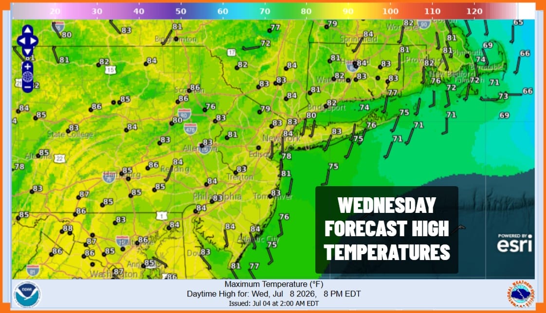
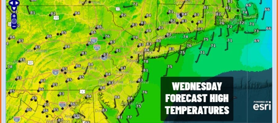
Low pressure offshore and the upper trough driving it are now to the east and we are going to enjoy a nice day of sunshine across Eastern Pennsylvania to Southern New England. The humidity levels however will still be somewhat high but we do not expect to see any shower or thunderstorm activity today. Most high temperatures will reach into the 80s except for shore locations where local sea breezes will be in play. We will also remain rain free tonight though it will be warm and humid with most lows Thursday morning in the mid 60s to lower 70s.
SATELLITE WITH LIGHTNING STRIKES

WEATHER RADAR

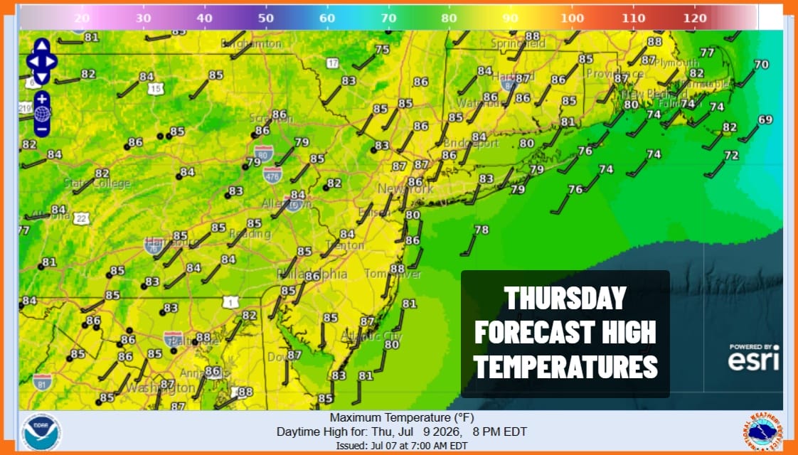
Upper troughs in the northwest flow will continue to bring weather systems through the Northeast. We have one that will approach Thursday. Winds will be southwest and dew points will climb back up to around 70 which is high. Early sunshine will eventually give way to showers and thunderstorms developing in the afternoon and evening. Highs Thursday will be in the low to mid 80s.
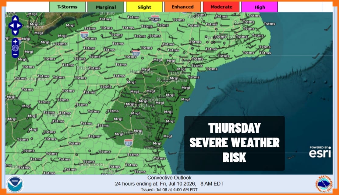
We do not want to see a repeat performance of the rains of Sunday night and Monday. This system is not as well organized, nor do we have inflow from the east to feed in a ton of tropical moisture. There is a marginal risk for isolated severe thunderstorms from Central New Jersey and Eastern Pennsylvania southward. That could be expanded slightly further north. We will watch for the odd thunderstorm that might sit over an area for a short period of time but the risk for isolated flash flooding is marginal at this point.
Friday brings another upper trough and a cold front so we will see the risk for showers and a thunderstorm or two later Friday afternoon and evening. It will be very warm and humid ahead of this and highs will reach the upper 80s and even the odd 90 degree high is possible before any storms arrive. As long as the upper trough and front keep on moving we should see improving weather conditions over the weekend especially Sunday when dew points should drop sharply into the 50s making for very comfortable conditions. Saturday and Sunday high temperatures will be in the low to middle 80s in most places.
DOWNLOAD THE UPSIDE APP & EARN CASH AT GAS STATIONS, RESTAURANTS, & SUPERMARKETS

BE SURE TO DOWNLOAD THE FREE METEOROLOGIST JOE CIOFFI WEATHER APP &
ANGRY BEN’S FREE WEATHER APP “THE ANGRY WEATHERMAN!
MANY THANKS TO TROPICAL TIDBITS FOR THE USE OF MAPS
Please note that with regards to any severe weather, tropical storms, or hurricanes, should a storm be threatening, please consult your local National Weather Service office or your local government officials about what action you should be taking to protect life and property.
