

Improving Weather Conditions & A Dry Weather Week Ahead
No Issues From Humberto or Future Imelda

We had some rain overnight as a wave of low pressure on an old frontal boundary moved northeast up the coast. Now that wave is moving away and we see dry weather conditions returning to the Northeast and Northern Mid Atlantic states that will last all week long. Today is a day of decreasing clouds and increasing amounts of sunshine. Temperatures today will be topping out mostly in the 70s. Radars are calming down as rain moves offshore and they should be in quiet mode all week long. Tonight skies should be mostly clear and lows Monday morning will be mostly in the mid 50s to lower 60s except for the warmest urban areas which will bottom out at around 65 degrees or so.
SATELLITE WITH LIGHTNING STRIKES

WEATHER RADAR

We have two tropical systems in the Southwest Atlantic. Major Hurricane Humberto briefly became a category 5 hurricane yesterday and remains a strong category 4 hurricane today. It is the storm on the lower right of the GFS model loop for the upcoming week. To the west and off the Southeast US Coast and Florida we have tropical depression 9 which will likely become Tropical Storm Imelda later today or tonight.

The two storms seem to be moving in tandem northward and then when Humberto turns to the east Tuesday, Imelda follows. Models are not showing and landfall along the Southeast US coast though rain does move into coastal areas from the Carolinas to Georgia and the Florida east coast. To the north we have a large dome of high pressure in Eastern Canada that will build and strengthen later this week.
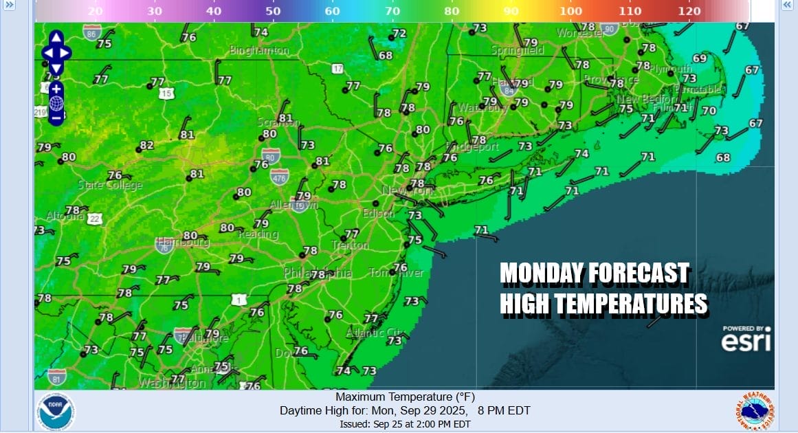
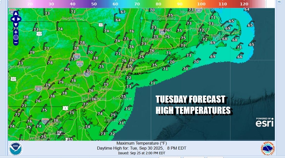
There will be rough ocean seas that will develop later this week thanks to these two storms but they are not coming up the coast. This leaves us in a solid position of nice weather for the week ahead. Monday and Tuesday will be on the warm side with highs both days in the 70s and we will be no worse than partly sunny both days. The high to the north begins to build Tuesday and winds turn to the northeast.
The gradient along the coast of the Northeast and Mid Atlantic will tighten up and the big high will send down rather cool air down the coast into the Mid Atlantic states. Beginning Wednesday it will be breezy inland and windy at times along the coast with gusts over 30 mph developing. Wednesday will be a mostly sunny day but high temperatures will be in the 60s in most places. Thursday will be quite cool and breezy with sunshine and highs just between 60 and 65 degrees. Friday the wind will slacken sun but it will still be a sunny day with highs in the mid to upper 60s. Next weekend will likely be warm and dry so unless we see a surprise change, and I’m not expecting that, we could see dry weather conditions lasting through next weekend.
BE SURE TO DOWNLOAD THE FREE METEOROLOGIST JOE CIOFFI WEATHER APP &
ANGRY BEN’S FREE WEATHER APP “THE ANGRY WEATHERMAN!
MANY THANKS TO TROPICAL TIDBITS FOR THE USE OF MAPS
Please note that with regards to any severe weather, tropical storms, or hurricanes, should a storm be threatening, please consult your local National Weather Service office or your local government officials about what action you should be taking to protect life and property.


