

Hot More Humid Sunday & Monday
Thunderstorm Risks Increase Monday & Tuesday
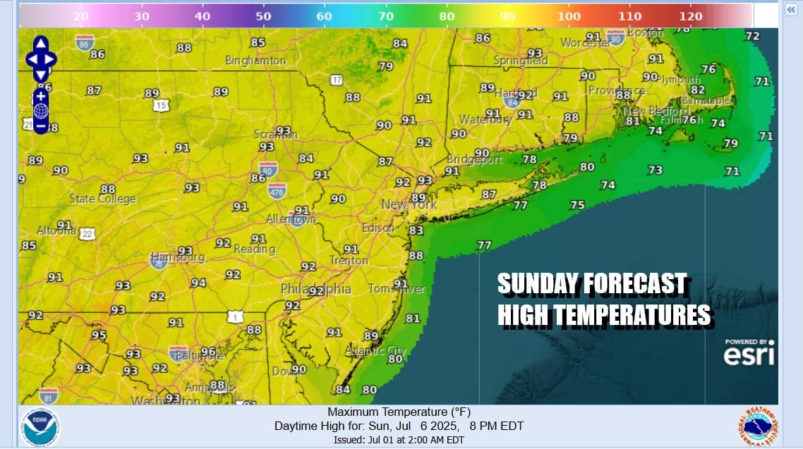
We have arrived at the last day of the Independence Day holiday weekend (unless you are stretching it to a 4 day weekend by taking Monday off). Temperatures and humidity levels are trending higher today. To the south in South Carolina and North Carolina we have Tropical Storm Chantal which has moved inland. There is a fairly well defined core of balled up rain and thunderstorms but this stays well to the south today. We see a day of sunshine. High temperatures this afternoon will be generally in the upper 80s to around or just over 90 degrees inland. Along the coast it will be cooler with a mostly south to southwest wind. No rain is in the forecast today or tonight which will be warm and humid with lows in the low to middle 70s in most places.
SATELLITE WITH LIGHTNING STRIKES

WEATHER RADAR

Monday we will see the remnant low that is Chantal heading northeast into Southeast Virginia and we will likely see tropical moisture being forced northward into an unstable atmosphere during Monday. Downpours and one or two thunderstorms could develop from mid morning until early evening though timing and specifics are difficult to pinpoint. These thunderstorms are the kind that emphasize heavy rain.

Monday also will be a day of very warm to hot and humid conditions. Temperatures will likely reach the upper 80s to near 90 degrees inland but it will be a little cooler at the coast given a south wind. There is the chance for some localized flash flooding and I would guess that the highest chance for that could be along the axis of heavy rain. That will basically lie across Eastern Pennsylvania and Western New Jersey.

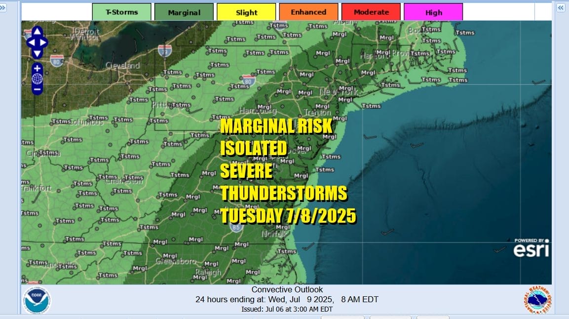
Chantal moisture will diminish and exit to the northeast Monday night however Tuesday brings a weather front moving southeast from Upstate New York and the Great Lakes. This will open the door for more showers and thunderstorms Tuesday afternoon and evening. The Storm Prediction Center is indicating the risk for isolated severe thunderstorms covering much of Eastern Pennsylvania including Philadelphia, New Jersey, the Hudson Valley to New York City and Southern New England.
Tuesday will once again be very warm and humid with highs in the mid 80s to near 90 inland and a little lower along the coast. We are likely to see a little break from the risk for showers and storms Wednesday however that could return later Thursday as low pressure heads our way from the Ohio Valley and a weather front pushes eastward to the coast late Thursday and Thursday night.
BE SURE TO DOWNLOAD THE FREE METEOROLOGIST JOE CIOFFI WEATHER APP &
ANGRY BEN’S FREE WEATHER APP “THE ANGRY WEATHERMAN!
MANY THANKS TO TROPICAL TIDBITS FOR THE USE OF MAPS
Please note that with regards to any severe weather, tropical storms, or hurricanes, should a storm be threatening, please consult your local National Weather Service office or your local government officials about what action you should be taking to protect life and property.


