
High Wind Warning & Wind Advisories Cover
Much of the Northeast & Northern Mid Atlantic

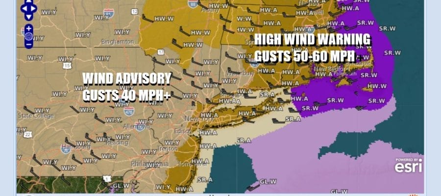
Another round of strong winds will develop late this afternoon and evening and last into Thursday morning. A High Wind Warning has been posted for the coastal counties of New Jersey to New York City, Long Island and Southern and Southeastern New England. Winds in the warning area could gust to 50 to 60 mph especially along the coast. Where we don’t have high wind warnings, we have Wind Advisories and they cover most areas inland. Winds in the advisory area will gust to over 40 mph at times.
SATELLITE WITH LIGHTNING STRIKES

WEATHER RADAR

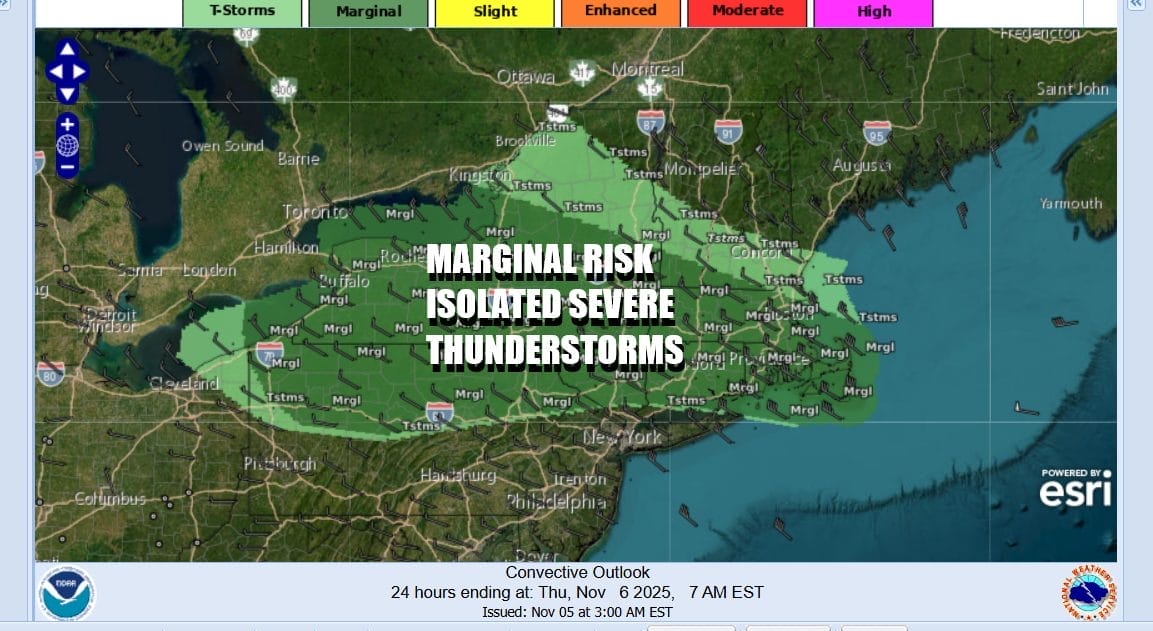
Ahead of this today we will see breezy conditions develop on a west wind. Look for some sunshine and arriving clouds. Highs will reach into the 60s. The cold front has a limited amount of moisture so we are not expecting very much when it passes however there the chance that we could see some fast moving thunderstorms develop in areas across Northern Pennsylvania, the southern half of NY State (except near the coast) and much of Southern New England. The Storm Prediction Center is indicating the risk for isolated severe thunderstorms as the cold front passes eastward.
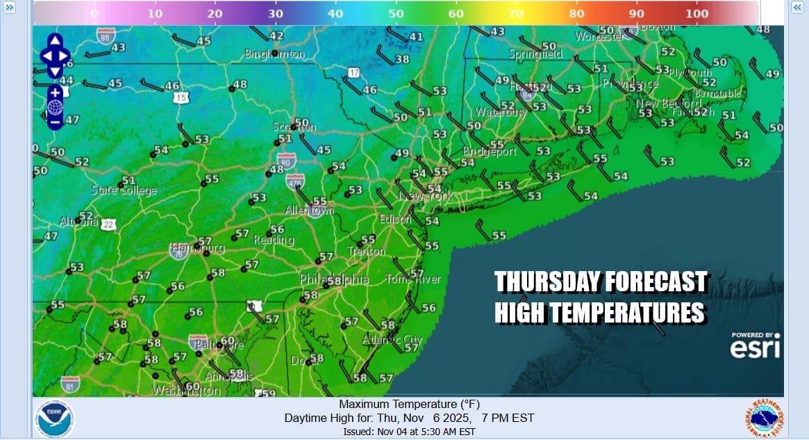
Once low pressure makes its way into New England the low will intensify, the pressure gradient will tighten, and winds will howl from the northwest all night long into Thursday morning. Skies will partially clear and most lows will be in the 40s. Thursday is going to be a very cool day with highs mostly in the low to mid 50s along with sunshine. Winds will actually start to ease rather quickly during the morning hours and while still gusty, will be generally under 30 mph during the afternoon.
Friday we will turn to the west again as another cold front and low pressure area will move eastward. Friday we will see sunshine giving way to arriving clouds with highs into the 60s. Showers are possible Friday night into Saturday morning as that front passes and weather conditions will improve Saturday. However a more important cold front will approach Sunday with some showers but behind this front we will see rather cold air for this time of year up and down the Eastern Seaboard back to the Midwest. Much of next week will feature below average temperatures and we will likely see widespread freezes. Also areas well inland in the Appalachians to the lee shores of Lake Erie and Lake Ontario could see their first round of lake effect snows.
BE SURE TO DOWNLOAD THE FREE METEOROLOGIST JOE CIOFFI WEATHER APP &
ANGRY BEN’S FREE WEATHER APP “THE ANGRY WEATHERMAN!
MANY THANKS TO TROPICAL TIDBITS FOR THE USE OF MAPS
Please note that with regards to any severe weather, tropical storms, or hurricanes, should a storm be threatening, please consult your local National Weather Service office or your local government officials about what action you should be taking to protect life and property.


