

Heat & Increasing Humidity Into Wednesday With Midweek Storms Possible
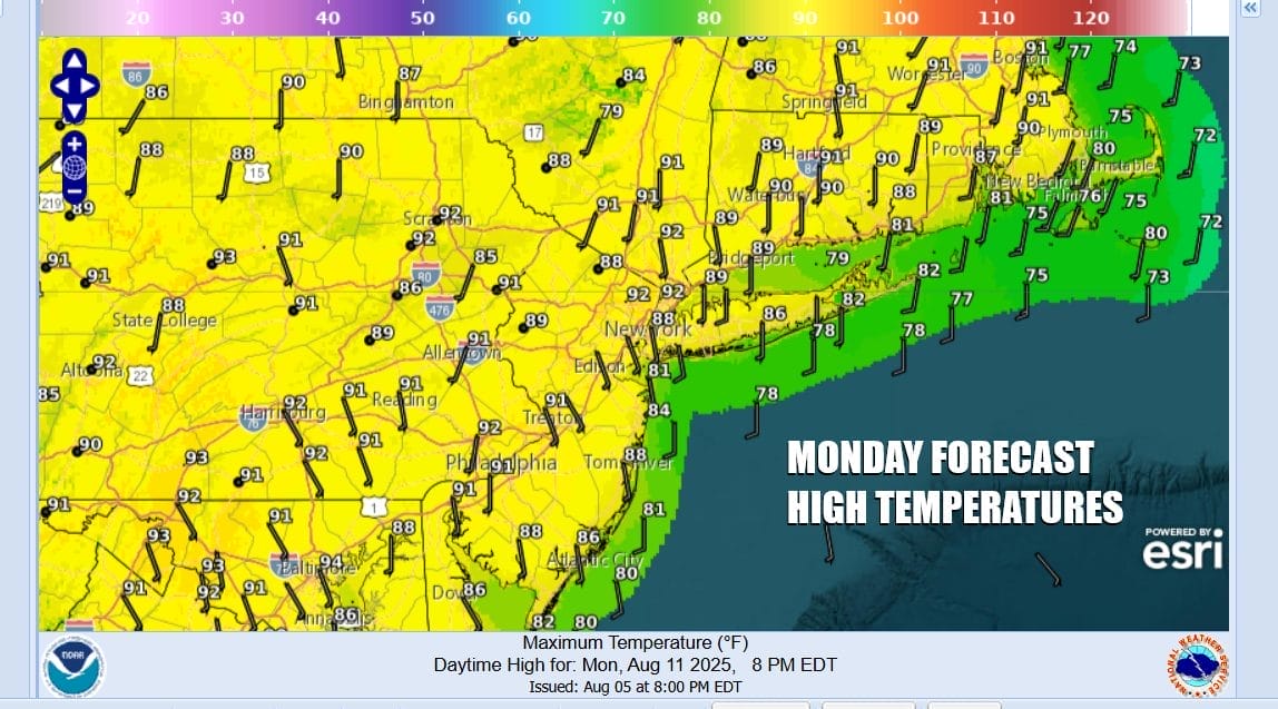
We have a hot weather day ahead of us as the onshore flow continues to relax and winds bend around to a more southerly direction and eventually will go southwest. Humidity levels have only been rising slowly rather than shooting up in a big way. While the discomfort level is going to rise today it will still be in a place which I would regard as reasonable. We have lots of sun forecast today. Perhaps there will be a little bit of haze. Temperatures will reach into the 90s in many inland locations while it will be about 10 degrees cooler along south and east facing shorelines. Radars are absolutely quiet across much of the Northeast and Northern Mid Atlantic states and we expect no rain anywhere across Eastern Pennsylvania to Southeast New York, New Jersey and Southern New England.
SATELLITE WITH LIGHTNING STRIKES

WEATHER RADAR

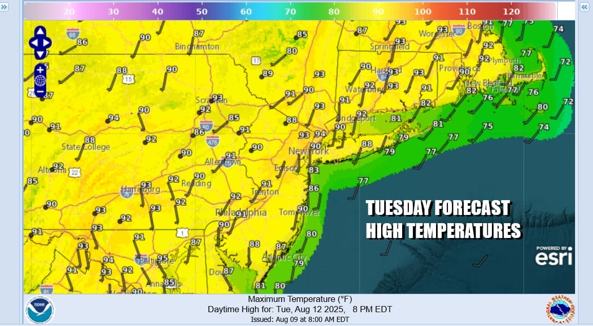
Tonight will be mostly clear but most lows will be in the 60s with just a few 50s noted inland. Warmer urban areas will be close to 70 degrees. Not much of change in the outlook for Tuesday with sunshine taking highs back up to the lower 90s Possibly a few places could reach 94 or 95 or so. Shore areas will continue to be about 10 or so degrees cooler with local sea breezes and no showers or thunderstorms are forecast.

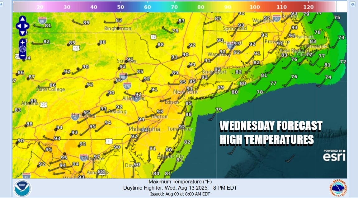
Wednesday we begin to see a frontal boundary now in the Plains and Upper Midwest getting close enough to set off some scattered thunderstorms in the afternoon and evening. It won’t be much rain and not everyone participates but the risk is there. Temperatures Wednesday will reach the low and middle 90s and it is likely to be the hottest day of this 3 to 4 day heatwave.
The frontal boundary is likely to slow down and get hung up for awhile so we might see some showers and thunderstorms running around Wednesday night and Thursday though it doesn’t rain straight through. There will be dry stretches and there will be periods of some sun Thursday. Temperatures will ease somewhat Thursday so highs will be in the mid to upper 80s. Friday we will be cooler with east winds returning and a mix of sun and clouds. Highs Friday will be in the low to mid 80s inland and 70s to near 80 near the coast.
BE SURE TO DOWNLOAD THE FREE METEOROLOGIST JOE CIOFFI WEATHER APP &
ANGRY BEN’S FREE WEATHER APP “THE ANGRY WEATHERMAN!
MANY THANKS TO TROPICAL TIDBITS FOR THE USE OF MAPS
Please note that with regards to any severe weather, tropical storms, or hurricanes, should a storm be threatening, please consult your local National Weather Service office or your local government officials about what action you should be taking to protect life and property.


