

USE THE COUPON CODE “SPRING2026” AND GET 10 PERCENT OFF ON ANY PURCHASE

Heat Humidity & Thunderstorm Risk Continue Into The Weekend
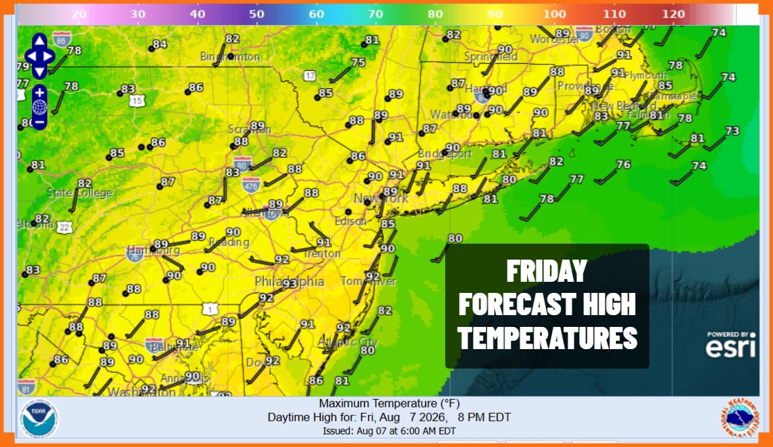
We have made it to the end of the week but there seems to be no end to the extremely humid conditions that cover Eastern Pennsylvania to Southern New England. Dew points are going to be ridiculous today reaching the low and middle 70s which basically means that you are living inside a wet sponge. Sunshine will take highs to the upper 80s and lower 90s which is not extreme but the humidity is so high that it will feel like it is 100 degrees outside.
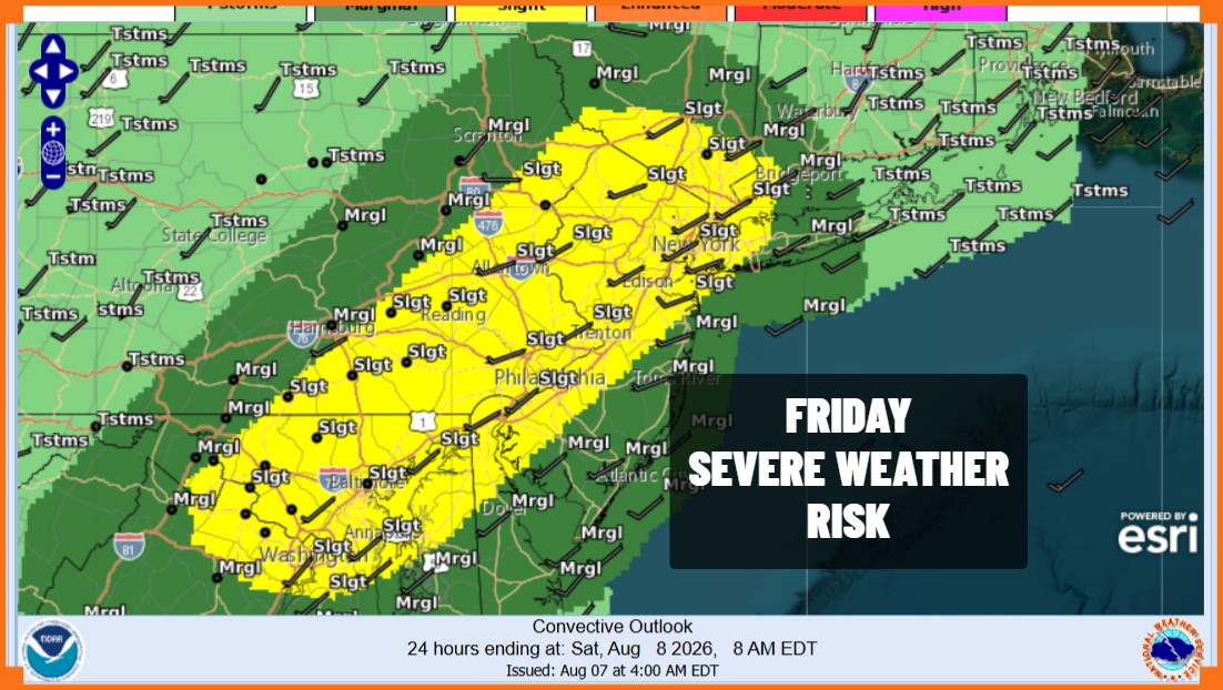
All this tropical moisture in an unstable atmosphere means that we have thunderstorm risk this afternoon and evening. The Storm Prediction Center has elevated the risk to a slight risk or 15 percent chance for severe thunderstorms. Also we have continue to have a marginal risk for flash flooding since any thunderstorm could choose to sit over a particular area for a time. Localized flash flooding from storms is certainly a possibility.
SATELLITE WITH LIGHTNING STRIKES

WEATHER RADAR

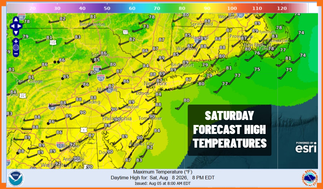
Once we get through the evening hours, storms will disappear leaving us in very warm and humid conditions overnight. Most lows Saturday morning will be in the upper 60s inland and low to mid 70s everywhere else. Saturday is pretty much a repeat performance of today with very high dew points in the low to mid 70s, sunshine taking highs into the 90s, and the risk for thunderstorms in the afternoon and evening.
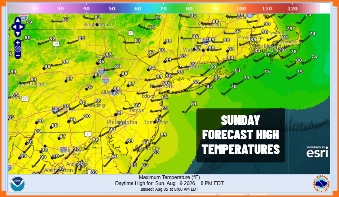
Sunday is likely to see the same weather conditions though there is a slight, and I do mean slight lowering of few points from the mid 70s to the upper 60s which is still humid but not quite as extreme. In other words it will be slightly less miserable but still miserable from the stand point of humidity. Highs will be in the upper 80s and lower 90s and again there is the risk for downpours and thunderstorms.
As far as when this all ends the answer is not anytime soon. The overall pattern will continue at least through Tuesday. We could see temperatures ease a bit Wednesday and Thursday but humidity levels will remain high until we get a genuine cold front passing through with some Canadian air behind it. That is not likely to happen until late next week. Enjoy your weekend. The beaches are probably the place to be.
MANY THANKS TO TROPICAL TIDBITS FOR THE USE OF MAPS
Please note that with regards to any severe weather, tropical storms, or hurricanes, should a storm be threatening, please consult your local National Weather Service office or your local government officials about what action you should be taking to protect life and property.
