

USE THE COUPON CODE “SPRING2026” AND GET 10 PERCENT OFF ON ANY PURCHASE

Heat Humidity Through Tuesday But Low Storm Chances Today
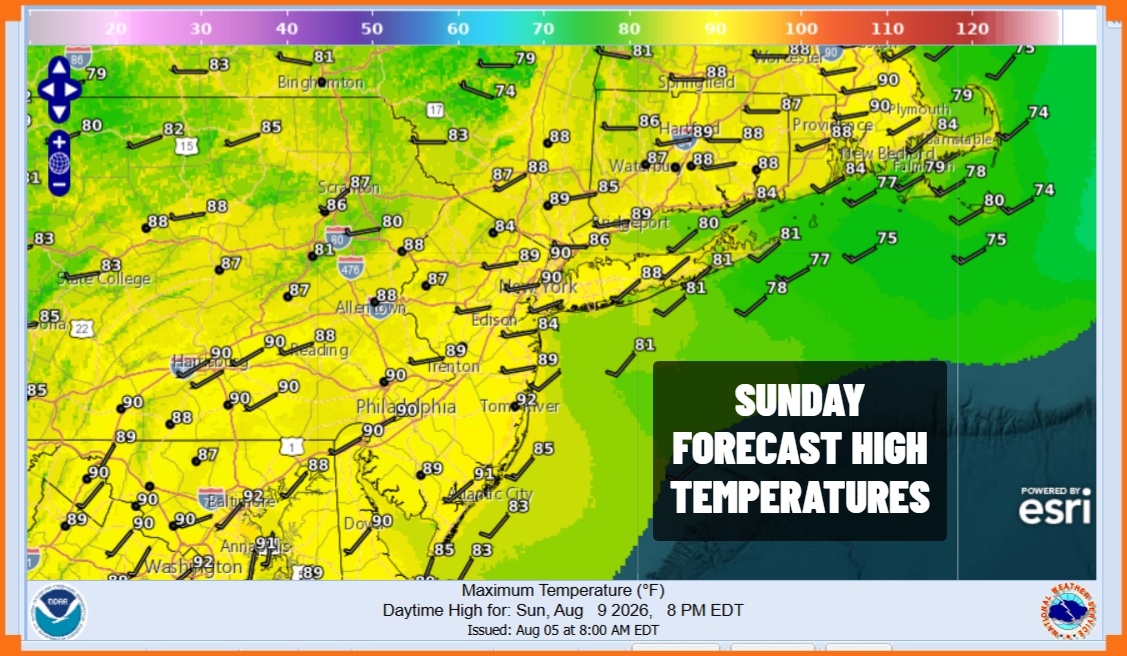
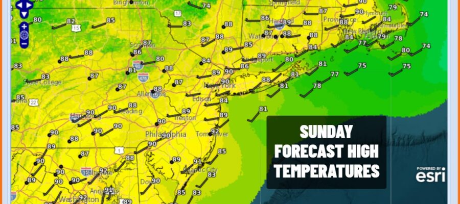
We are getting a break this afternoon from what seems like an endless parade of afternoon and evening thunderstorms. A weak weather front is moving through and it will lower the dew points a touch late this afternoon and tonight but this will be only slight and brief relief from the high humidity. Sunshine is taking temperatures to the upper 80s and lower 90s this afternoon. Radars are mostly quiet so unless we get an isolated shower or thunderstorm, the rest of today and tonight will be rain free. Skies should at least be partially clear tonight with most lows in the mid to upper 60s inland and lower 70s along the coast.
SATELLITE WITH LIGHTNING STRIKES

WEATHER RADAR

Monday we see dew points climb back up to 70 or lower 70s so the humidity levels go up again. There is an upper air disturbance and cold front in the Midwest today that will head east Monday and Tuesday. We could see some scattered showers and thunderstorms Monday afternoon and evening and the Storm Prediction Center is indicating a marginal risk for isolated severe thunderstorms.
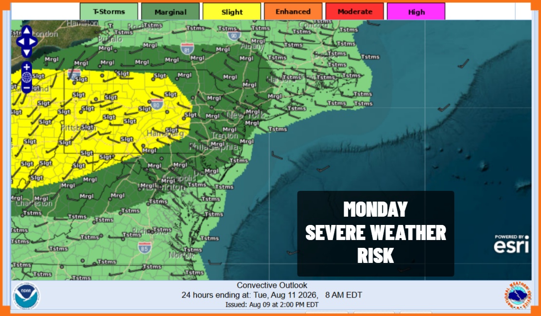
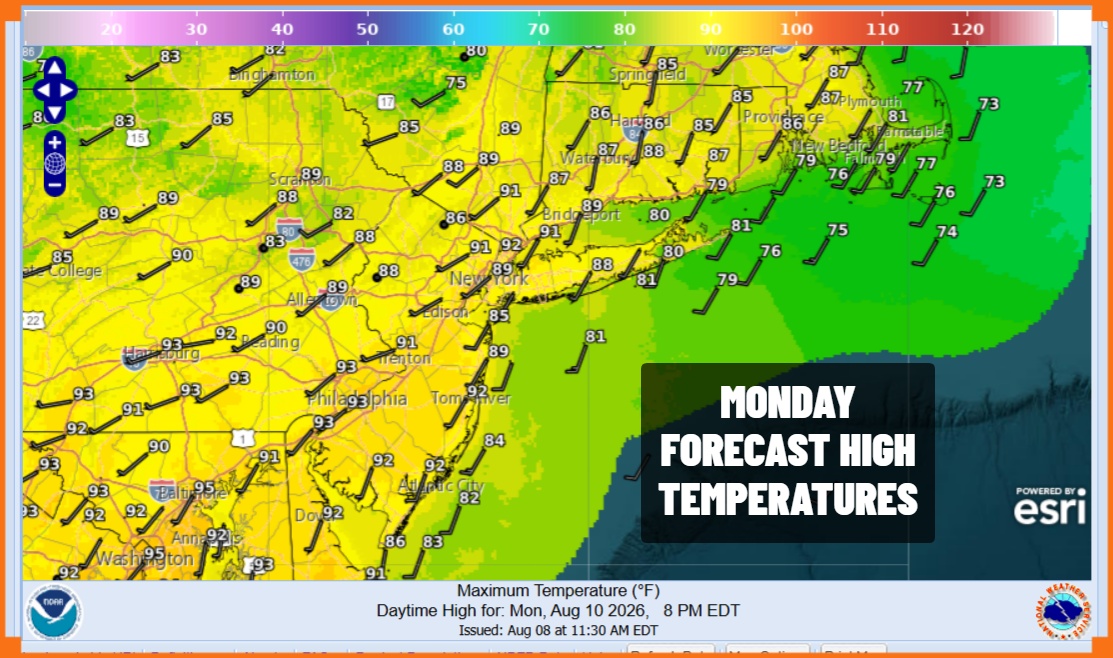
The marginal risk zone has been pushed further east to cover much of Eastern Pennsylvania to Southern New England. The slight risks reaches the Interstate 81 corridor in Pennsylvania as thunderstorms will likely be more numerous to the west. There will be sunshine Monday with highs reaching the lower 90s in many locations. Temperatures will be a few degrees lower along the coast.
Tuesday brings the chance for some showers and thunderstorms as a cold front approaches. It will be very warm and humid ahead of a weak cold front and some sunshine will take highs to the upper 80s and lower 90s for highs. Wednesday we will see a slight drop in dew points to the mid 60s and temperatures will be a little lower with highs in the 80s. Thursday will be about the same with another front and another chance for some showers and thunderstorms. Friday is shaping up to be a nice delightful day as we will see a significant drop in the dew points down to near 60 so the humidity falls considerable. We will finish the week with sunshine, no storm risk, and highs just back into the lower 80s. That is something to look forward to.
MANY THANKS TO TROPICAL TIDBITS FOR THE USE OF MAPS
Please note that with regards to any severe weather, tropical storms, or hurricanes, should a storm be threatening, please consult your local National Weather Service office or your local government officials about what action you should be taking to protect life and property.
