
Gusty Winds Will Slowly Diminish On A Dry Mainly Sunny Weekend

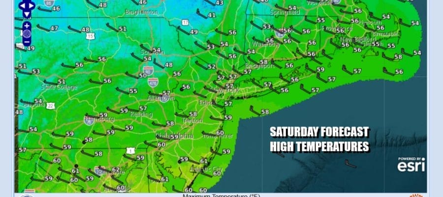
The wind advisories have been discontinued but we still have a bit of wind to deal with today. The gradient will continue to relax as we move through the weekend. There are some patchy clouds around but skies should be no worse than partly sunny today. Most highs will be in the mid to upper 50s. Radars are nice and quiet today for the most part and we do not expect any isolated showers to develop. Tonight skies will be mainly clear with most lows in the mid to upper 30s inland and the lower 40s along the coast.
SATELLITE WITH LIGHTNING STRIKES

WEATHER RADAR

There are no issues for Sunday. Dry air will be in control. High pressure will be holding near the coast. Skies Sunday should be partly to mostly sunny. Most highs will be again in the middle to upper 50s. For the New York City Marathon, conditions will be close to ideal with reasonable temperatures and not much wind.

Next week we are going to see 2 weather systems moving through in the northwest flow from Canada. There is an upper trough that will be approaching in the northern part of the jet stream and a weak weather front associated with it. There is also a low that develops off the Southeast US coast that will nudge northward.

The two system should remain separate features rather than phase together. Clouds will probably roll in later Sunday night and there will be some clouds around Monday. Some showers could reach up along the coast around midday only to be pushed out the east by late afternoon. The rain should not amount to much. Monday high temperatures will be in the middle to upper 50s.

Winds are going to pick up a bit Tuesday and we should have sunny skies with highs in the upper 50s to around 60 degrees. Another front will approach Wednesday so we will see sunshine giving way to arriving clouds and the risk for some passing showers late in the day. Highs will reach the lower 60s. Then we see the winds become strong and gusty for Thursday with some sunshine returning and highs in the 50s. Friday sees another front and the chance for late showers ahead of next weekend. No major storms are on the horizon.
BE SURE TO DOWNLOAD THE FREE METEOROLOGIST JOE CIOFFI WEATHER APP &
ANGRY BEN’S FREE WEATHER APP “THE ANGRY WEATHERMAN!
MANY THANKS TO TROPICAL TIDBITS FOR THE USE OF MAPS
Please note that with regards to any severe weather, tropical storms, or hurricanes, should a storm be threatening, please consult your local National Weather Service office or your local government officials about what action you should be taking to protect life and property.


