
USE THE COUPON CODE “SPRING2026” AND GET 10 PERCENT OFF ON ANY PURCHASE

Gloom & Doom Rain Saturday Into Sunday Morning
Monday Memorial Day Looks To Be The Better Day
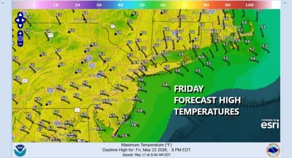
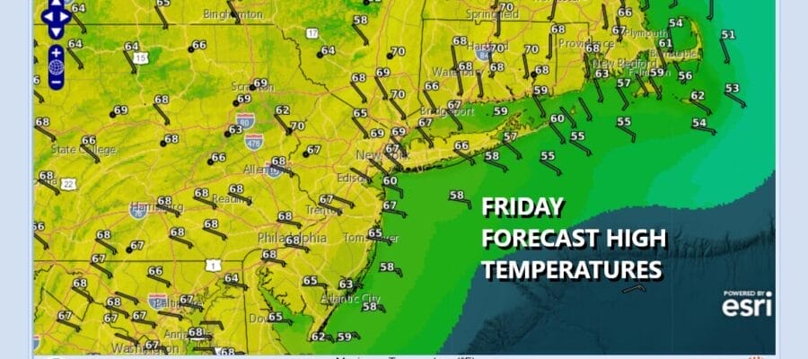
We have arrived at the doorstep of the 3 day Memorial Day holiday weekend. The two best weather days are today which is getaway day and Monday where we may have some drying out and a return to some sunshine. However in between it doesn’t look good at all. Satellite loops show clouds from New York City south streaming east northeast. Today will be a bit of an upside down type of day with more sunshine and warmer temperatures north and northeast of New York City with highs reaching the upper 60s and lower 70s’ However to the south across New Jersey, Southern Pennsylvania and points south, more in the way of clouds and highs in the 60s. There is some spotty light rain or drizzle around in some areas of South Jersey and points south but this doesn’t move north during the day.
SATELLITE WITH LIGHTNING STRIKES

WEATHER RADAR

It starts to go downhill tonight as clouds increase as does the onshore flow. Rain develops across Souther New Jersey and Southern Pennsylvania overnight and then spreads northward to the rest of Eastern Pennsylvania to Southern New England Saturday morning. From there it is rain with an east wind and temperatures that will be rather raw. Temperatures will likely hold in the low to mid 50s in most places.
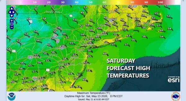
It appears that the rain will last into Sunday morning until low pressure that develops on the stalled frontal boundary to the south begins to strengthen a bit and move away to the east. That should bring an end to the rain from west to east around midday Sunday, though the timing on this is still questionable, and Sunday afternoon we will have leftover clouds from west to east. If it times out this way, look for temperatures to rebound back into the 60s and some areas to the south could break 70 degrees.
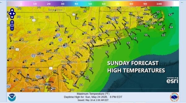
Rainfall amounts across Eastern Pennsylvania to Southern New England should fall in a rage of 1.25 to 1.75 inches though it is possible that some local amounts wind up higher. Monday, Memorial Day we should see a return to sunshine mixed with clouds. There is an upper trough that will play through and we can’t completely rule out some scattered afternoon showers but right now they should be few and far between. Highs will be back into the 70s. Enjoy the weekend such as it is, and please take a pause Monday to remember those who have given their lives in service to this great nation and for securing our freedom.
DOWNLOAD THE UPSIDE APP & EARN CASH AT GAS STATIONS, RESTAURANTS, & SUPERMARKETS

BE SURE TO DOWNLOAD THE FREE METEOROLOGIST JOE CIOFFI WEATHER APP &
ANGRY BEN’S FREE WEATHER APP “THE ANGRY WEATHERMAN!
MANY THANKS TO TROPICAL TIDBITS FOR THE USE OF MAPS
Please note that with regards to any severe weather, tropical storms, or hurricanes, should a storm be threatening, please consult your local National Weather Service office or your local government officials about what action you should be taking to protect life and property.


