
Front Passes Dew Points Plummet As Autumn Makes An Early Appearance

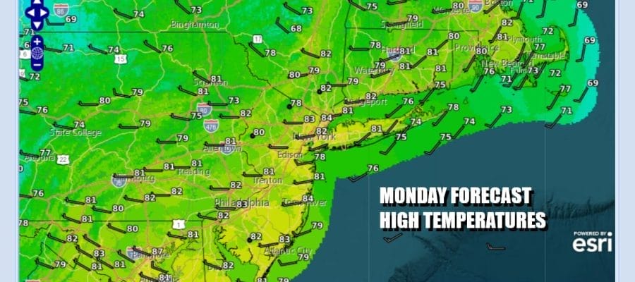
A weather front is about to pass through and then we begin the descent into a cool dry air mass. Some clouds are around this morning and the humidity is running a little high but around midday a weather front will pass. I think any showers with that front will be very few and very far between. Then dew points will come down rather quickly this afternoon as winds shift to northwest. We will have cloudy to partly sunny skies and most highs today will be in the lower 80s.
SATELLITE WITH LIGHTNING STRIKES

WEATHER RADAR

Large high pressure spreading out from Canada and into the Midwest will be the dominant weather player through Thursday. While we could see a weather front and the risk for a few showers Friday, it will only mark the leading edge of another dry air mass that will come in for the Labor Day holiday weekend! Skies tonight will be clear and most lows Tuesday morning will be in the mid 50s to lower 60s.
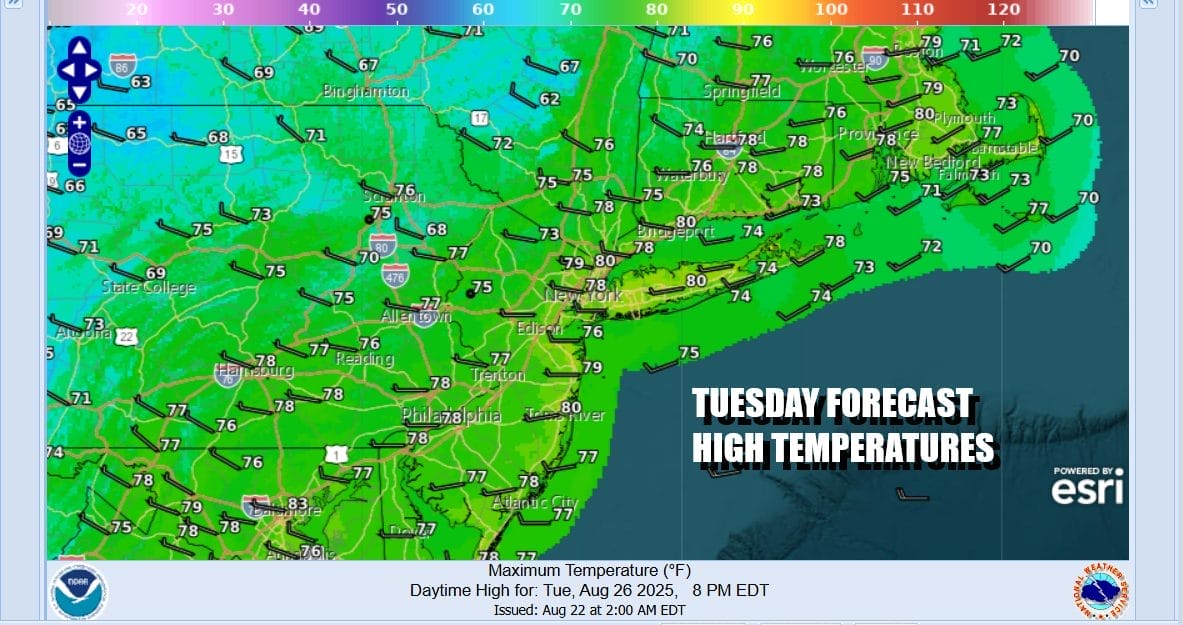
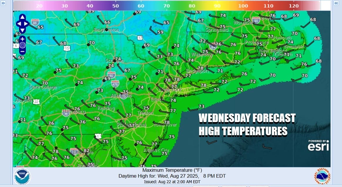
Cold air aloft might produce some instability clouds Tuesday. Otherwise skies will be mostly to partly sunny with a west breeze and high temperatures mostly in the 70s. Then we head lower and by Wednesday morning most lows will be in the 50s with 40s well inland to the north and northwest. Wednesday will be a partly to mostly sunny cool day with a nice breeze and most highs just in the low to middle 70s.
We will continue to roll along with cool nights and pleasant days with lows Thursday morning again in the 40s inland and mostly 50s coast and warmer urban locations. Skies will be sunny Thursday with highs mostly in the 70s. Friday we are going to see a cold front approach from the northwest and that might produce a few showers however the front is forecast to move along allowing for another re-enforcement of cool dry air for the Labor Day holiday weekend!
BE SURE TO DOWNLOAD THE FREE METEOROLOGIST JOE CIOFFI WEATHER APP \&
ANGRY BEN’S FREE WEATHER APP “THE ANGRY WEATHERMAN!
MANY THANKS TO TROPICAL TIDBITS FOR THE USE OF MAPS
Please note that with regards to any severe weather, tropical storms, or hurricanes, should a storm be threatening, please consult your local National Weather Service office or your local government officials about what action you should be taking to protect life and property.


