
Father’s Day Clouds Light Rain Drizzle Possible
Week Ahead Weather Only Improves Slowly
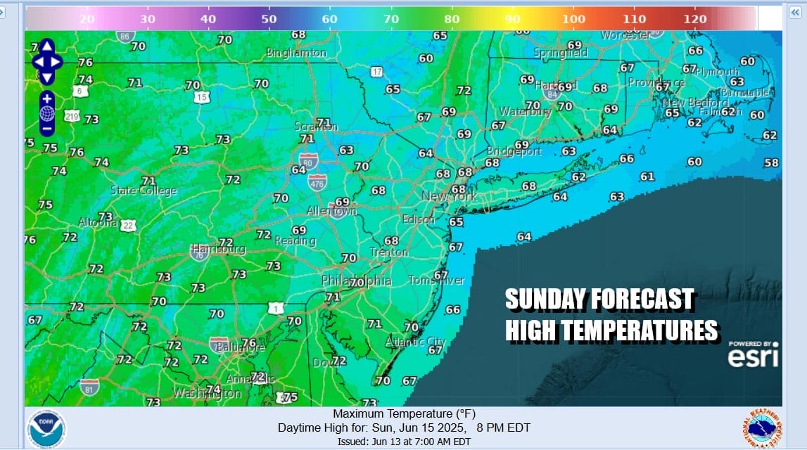
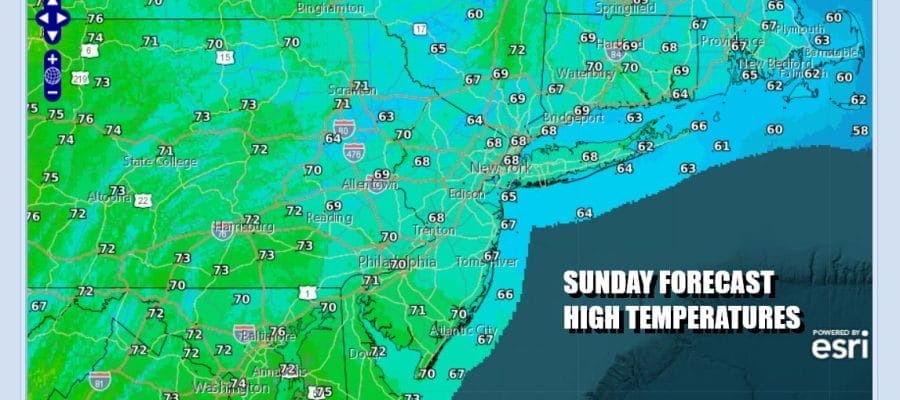
Happy Father’s Day to all the dads out there. It is not going to be a day for doing much stuff outdoors though it will be not raining all the time and in many cases, it may not rain much at all. We will be seeing patches of light rain or drizzle from time to time and from place to place but the general idea is that most of those areas will come and go. Clouds will mean for a gloom and doom looking day and temperatures are going to be a bit on the cool side as high temperatures struggle to get out of the 60s.
SATELLITE WITH LIGHTNING STRIKES

WEATHER RADAR

Radars aren’t showing much with very little going on to the north and northeast. Steadier rains and perhaps some thunderstorms will develop across Maryland and Virginia later today but much of that will stay to the south of Eastern Pennsylvania to Southern New England. Low pressure is offshore and it will mainly slide to the south and east so we have no worries about continuous rain moving northward.
 The key to the forecast over the next several days will be the relaxation of the onshore flow off the ocean and that will happen slowly but surely. It will still have some influence on weather conditions through Tuesday but this will change come Wednesday as the flow becomes more south and southwest and that will allow things to warm up and also start to bring in some shower and thunderstorm chances for the second half of the week.
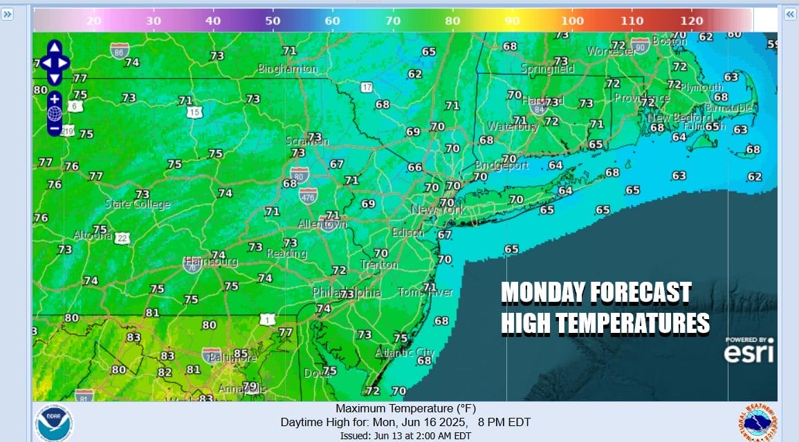
Monday is probably going to see mostly cloudy skies so there is the higher chance for some brightening of skies and maybe, just maybe some areas inland break out into a little bit of sun. The flow off the ocean means that temperatures will top out in the upper 60s and lower 70s We will leave in a low chance for some spotty light rain or drizzle and the best chance for that happening will be during the late night and early morning hours.
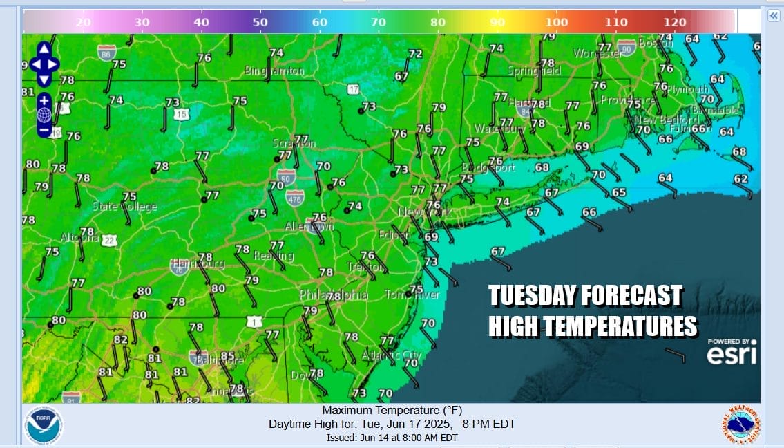
Wednesday brings us more of a south to southwest flow so we will break out into some sunshine. There is the chance for some scattered mostly inland showers and thunderstorms during the mid and late afternoon. Temperatures will finally warm back into the 80s. Thursday we likely see a higher chance for showers and thunderstorms developing in the afternoon and evening as a cold front approaches. Highs Thursday will be very warm to hot as we will reach the upper 80s to near 90 degrees in most places. Friday looks a little drier and a little cooler with highs in the low to middle 80s along with some sunshine.
BE SURE TO DOWNLOAD THE FREE METEOROLOGIST JOE CIOFFI WEATHER APP &
ANGRY BEN’S FREE WEATHER APP “THE ANGRY WEATHERMAN!
MANY THANKS TO TROPICAL TIDBITS FOR THE USE OF MAPS
Please note that with regards to any severe weather, tropical storms, or hurricanes, should a storm be threatening, please consult your local National Weather Service office or your local government officials about what action you should be taking to protect life and property.


