
Erin Moving Northwest Toward Outer Banks
While Sun & Low Humidity Cover Northeast

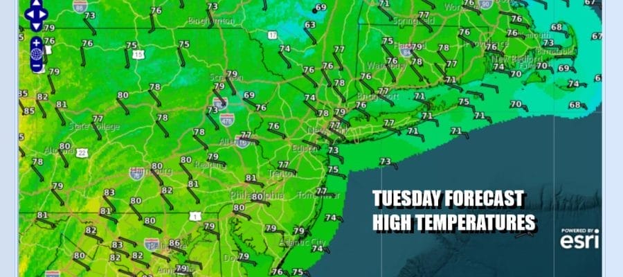
We are going to squeeze one more nice day of weather on this Tuesday. High pressure is to the north pressing southward. Dew points remain very low in spite of an onshore wind. Satellite loops show nothing more than some patchy clouds around so we think today should be no worse than partly sunny. High temperatures today will be in the 70s across Eastern Pennsylvania to Southern New England. You will have to go well inland into Pennsylvania and Maryland to find high temperatures above 80 degrees. Radars are nice and quiet today with no rain issues.
SATELLITE WITH LIGHTNING STRIKES

WEATHER RADAR

The satellite loop above shows Hurricane Erin on the lower right continuing to inch its way northwestward. Tropical Storm Watches are up for the Outer Banks of North Carolina. Erin has weakened some overnight and has top winds of 115 mph but it is also beginning to expand its circulation and this is going to become an issue for areas from the Outer Banks to Southern New England.

Also take note of an upper trough with an area of rain approaching Wednesday for Eastern Pennsylvania to Southern New England. This upper trough will eventually turn Erin northeastward Thursday but ahead of all that Wednesday will be showery rains. In fact there is a chance that we could see some heavier rain over parts of Northern New Jersey, New York City, Long Island and Southern Connecticut as the tropical environment of Erin begins to establish itself offshore. Sometimes set ups like these can be problematic rainfall wise especially with an east to southeast wind helping to enhance moisture.
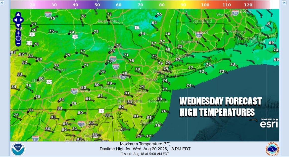
Showery rains could last into early Thursday morning and in general, sky conditions likely improve Thursday. However the expanding wind field of Erin is likely to bring tropical storm force wind gusts up the coast of New Jersey and touching Long Island as the European model of wind gusts shows. These gusty winds will start around 1am Thursday and actually continue into the first part of Friday. We will see a gradual decrease in clouds and an increase in sunshine as the day wears on. Thursday highs will be mostly in the 70s. Friday will still be breezy with sunshine but winds turn more south and southwest as Erin is long gone and the onshore flow basically goes away as well. Highs Friday will be in the low to mid 80s. Additional coverage of Hurricane Erin is available on Patreon as well as tonight at 7:35pm on the Joe & Joe Weather Show Podcast.
BE SURE TO DOWNLOAD THE FREE METEOROLOGIST JOE CIOFFI WEATHER APP \&
ANGRY BEN’S FREE WEATHER APP “THE ANGRY WEATHERMAN!
MANY THANKS TO TROPICAL TIDBITS FOR THE USE OF MAPS
Please note that with regards to any severe weather, tropical storms, or hurricanes, should a storm be threatening, please consult your local National Weather Service office or your local government officials about what action you should be taking to protect life and property.


