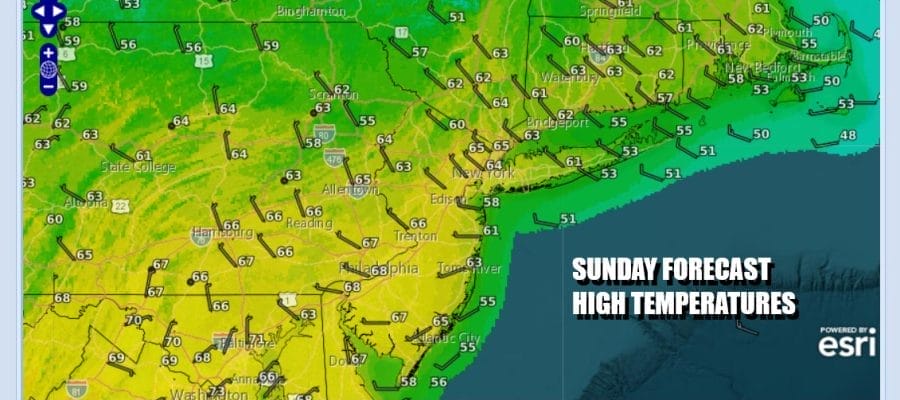

Easter Sunday Brings Cooler Temperatures & Sunshine, Week Ahead Outlook
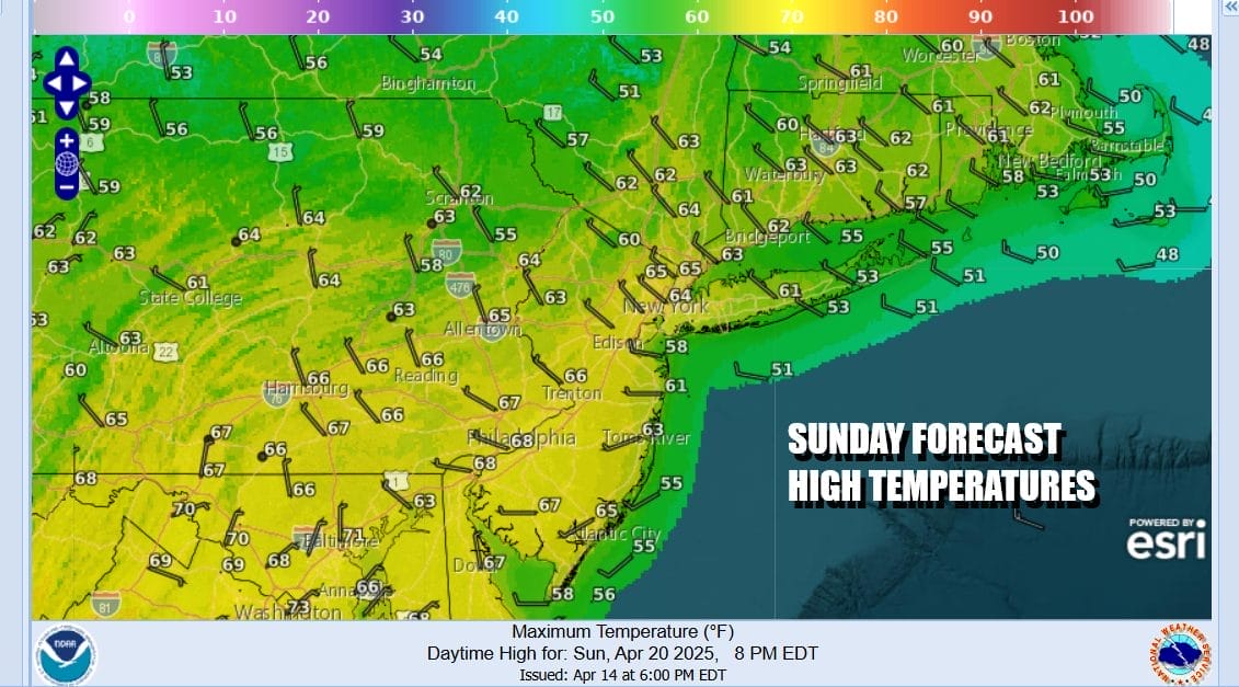
Yesterday we enjoyed a late spring type day with temperatures in the 80s and some widely scattered thunderstorms. On this Easter Sunday we are on the other side of the cold front that passed through last night. Patchy clouds are continuing to sink southward and we will see partly to mostly sunny skies for today day. Temperatures however will be some 15 degrees cooler this afternoon with highs reaching just in the mid 60s to around 70 degrees. We do have breezy conditions with northwest winds gusting into the 20 mph plus range but the wind should not get out of control. Radars are nice and quiet across Eastern Pennsylvania to Southern New England.
SATELLITE WITH LIGHTNING STRIKES

WEATHER RADAR

While our weather here is tranquil we have a strong storm developing in the Plains that is headed to the Western Great Lakes. Widespread severe thunderstorms and tornadoes are possible today across much of the Mississippi & Missouri River Valleys. The track of the storm system is well to our west and by the time the cold front with this system reaches the East Coast late Monday and Monday evening it will be much weaker.

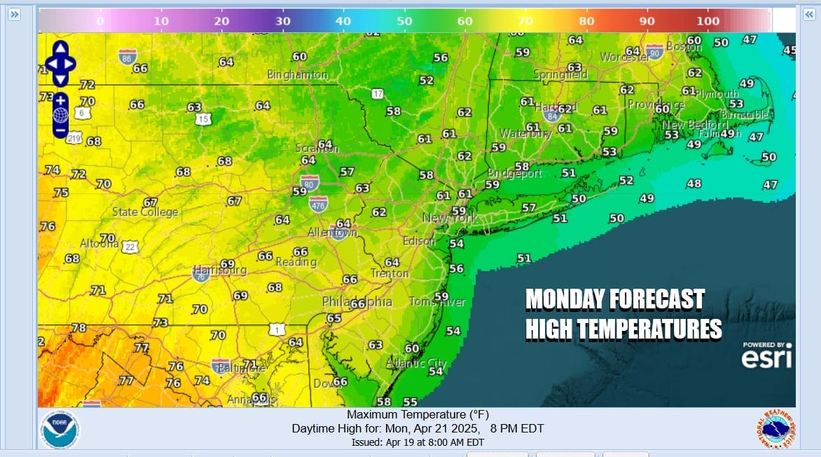
Skies may start off clear tonight but we will likely see some clouds develop as winds turn more onshore. Temperatures will likely settle in the 40s ovenight. Monday we will see clouds around with a southeast wind. Most highs will reach the upper 50s and lower 60s. An approaching front might set off some scattered showers or a thunderstorm Monday night.
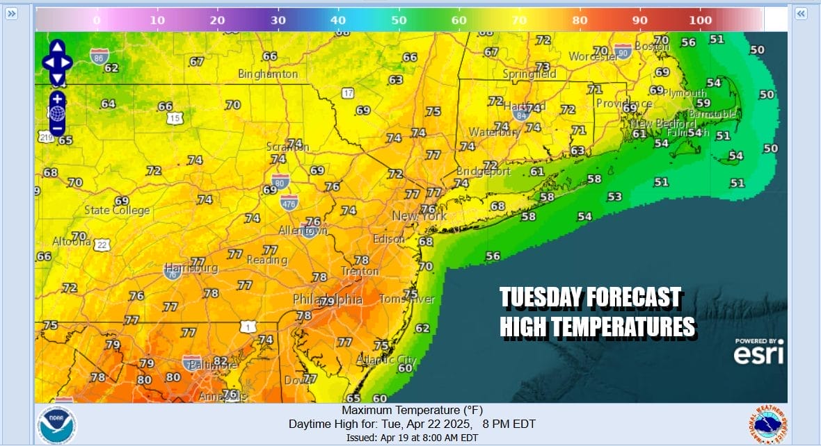
Tuesday looks to be a drier day with sunshine returning. There isn’t much in the way of cold air behind this next cold front so temperatures should be able to reach the low and middle 70s in most places. It will probably be cooler along south and east facing shorelines where local sea breezes develop.
The rest of the work week looks to be dry and on the warm side of normal. We should see at least some sunshine Wednesday through Friday with not much in the way of wind and daytime highs that will be in the 70s except cooler at the coast. Nighttime lows will be mainly in the 40s to near 50. The next chance for showers and thunderstorms likely comes next weekend. Happy Easter Sunday to all and enjoy your holiday.
BE SURE TO DOWNLOAD THE FREE METEOROLOGIST JOE CIOFFI WEATHER APP &
ANGRY BEN’S FREE WEATHER APP “THE ANGRY WEATHERMAN!
MANY THANKS TO TROPICAL TIDBITS FOR THE USE OF MAPS
Please note that with regards to any severe weather, tropical storms, or hurricanes, should a storm be threatening, please consult your local National Weather Service office or your local government officials about what action you should be taking to protect life and property.


