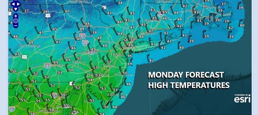

Dry Colder Next Few Days Cold Front Parade Continues
We have been in a pattern where we are lined up for a parade of cold fronts. 3 such fronts have moved through in the last 10 days and today the latest front is sliding offshore. A wave is developing on the front to move it along so rain will be moving offshore and by midday we should see increasing amounts of sunshine developing. Gusty northerly winds will bring down colder air so the highs of the day have already been achieved and we should see temperatures settle in the 40s this afternoon over much of Eastern Pennsylvania to Southern New England.
SATELLITE WITH LIGHTNING STRIKES

WEATHER RADAR

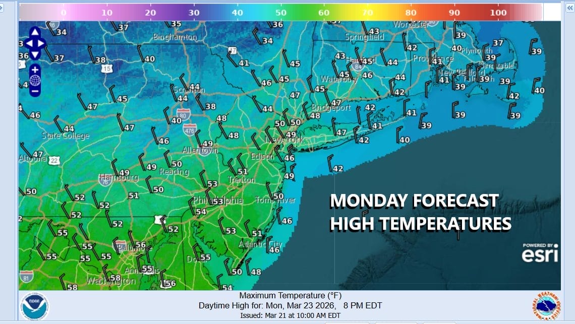
Skies tonight will be mostly clear and by Tuesday morning we will see lows in the mid 20s inland and mostly low 30s along the coast and in warmer urban locations. Tuesday should be a nice day overall with some sunshine. The core of the cold air will be making an exit to the east during the afternoon. Still temperatures will be held back some and highs will be mostly in the 40s to around 50 degrees.
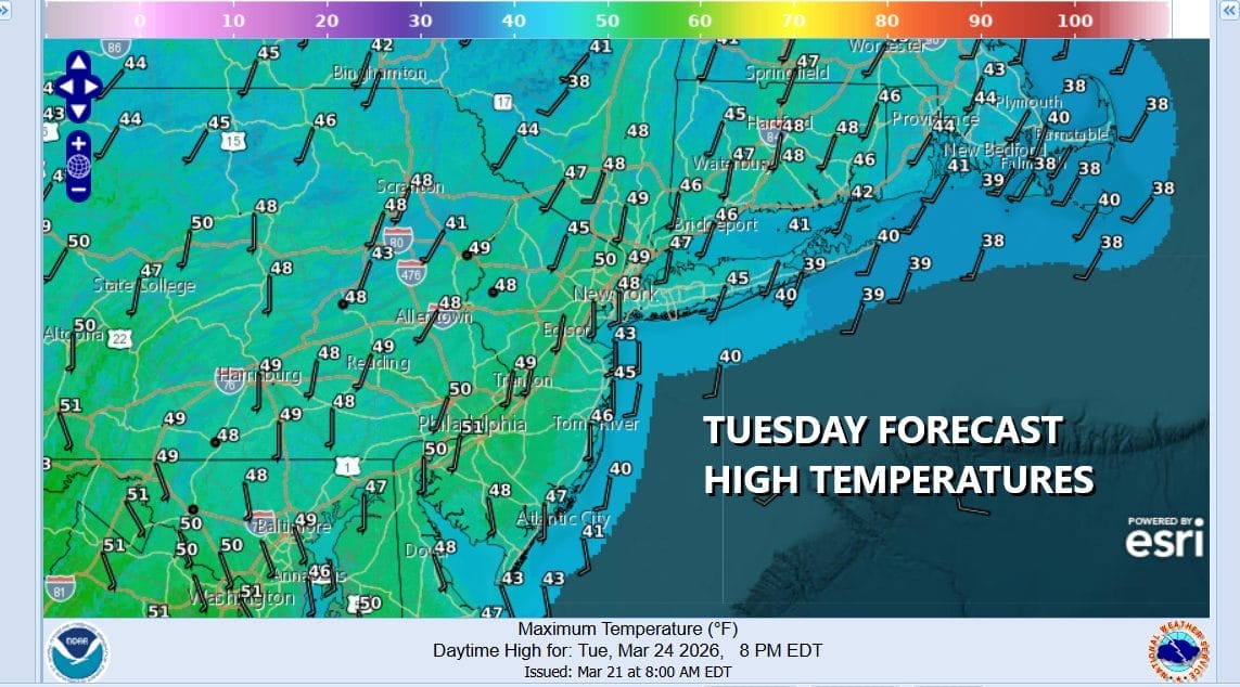
We will see temperatures moderate some Wednesday ahead of a cold front dropping southward from Upstate NY. The front is weak and will eventually sag south but it does put a limit on how much of a warm up occurs. We should see some sunshine Wednesday mixed with some clouds. Highs will be back into the 50s. We do not expect this front to produced any precipitation.
Winds will turn more southwest Thursday ahead of another cold front dropping southeast from the Great Lakes. It looks similar to what we went through last night and this morning so we will play it the same way. Sunshine will give way to arriving clouds. Highs away from the ocean will be in the 60s. We will see some showers Thursday night into early Friday morning and that will be followed by another shot of colder air as we head into the weekend.
BE SURE TO DOWNLOAD THE FREE METEOROLOGIST JOE CIOFFI WEATHER APP &
ANGRY BEN’S FREE WEATHER APP “THE ANGRY WEATHERMAN!
MANY THANKS TO TROPICAL TIDBITS FOR THE USE OF MAPS
Please note that with regards to any severe weather, tropical storms, or hurricanes, should a storm be threatening, please consult your local National Weather Service office or your local government officials about what action you should be taking to protect life and property.


