
Dry All Week Long As Imelda Humberto Move Out To Sea Cool Mid & Late Week

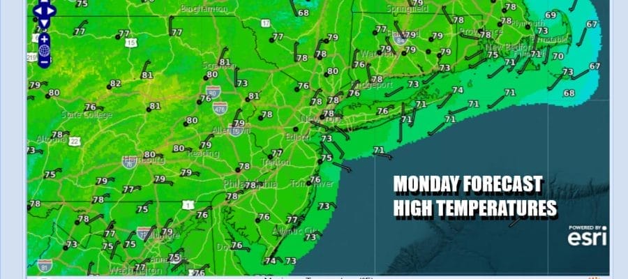
Two tropical systems are in view on the satellite loop. Humberto is a major hurricane well out to the southeast in the Atlantic while Tropical Storm Imelda is moving northward off the Florida East Coast and passing through the Bahamas. Neither storm is a risk to the Northeast and Mid Atlantic states other than rough seas that will be developing over the next couple of days. With that risk off the table we are enjoying a Monday of sunshine and warm temperatures. Highs this afternoon will reach the mid to upper 70s with warm spots near 80 degrees. Some warm spots might touch 80 degrees. Radars are nice and quiet throughout the region.
SATELLITE WITH LIGHTNING STRIKES

WEATHER RADAR

The reason that neither of these hurricanes are coming up the East Coast is due to a deep trough that is developing in Eastern Canada and that trough extends southward to the latitude of Bermuda. The trough is picking up Humberto and turning it east. Imelda also will feel the impacts of that trough and follows right behind and it appears to be on a course to pass very close to Bermuda later this week.

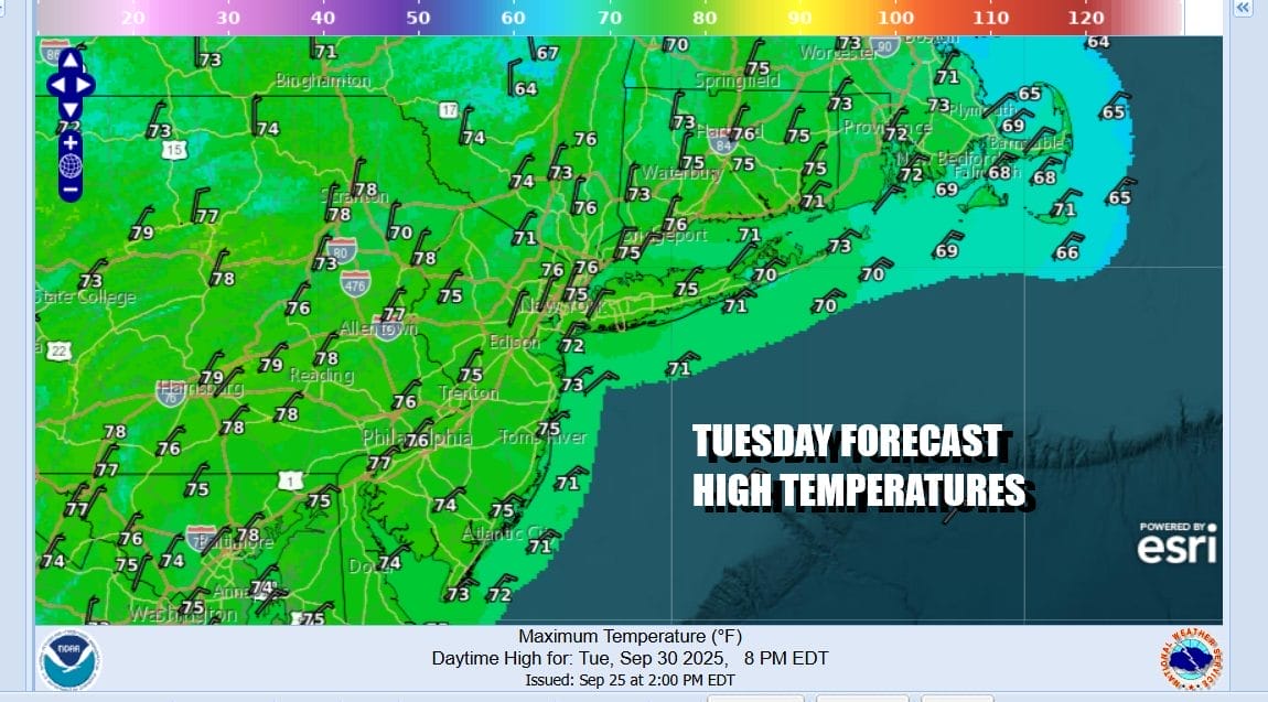
A blockbuster large high will build southeastward into Eastern Canada and New England and eventually it will settle in the Middle Atlantic states late this week. We are going into another long stretch of dry conditions and no rain is forecast for at least the next 7 to 10 days. Tuesday we will see sunshine and highs in the 70s . Winds will begin to turn north and northeast later in the day as the high builds southward.
Very cool air will be building down the East Coast giving the area a very autumn feel to things. Tuesday will be no worse than partly sunny with temperatures in the 70s for highs. Then we head down into the 40s inland and 50s along the coast. Wednesday will be cool with lots of sunshine. Highs will be in the 60s to around 70.

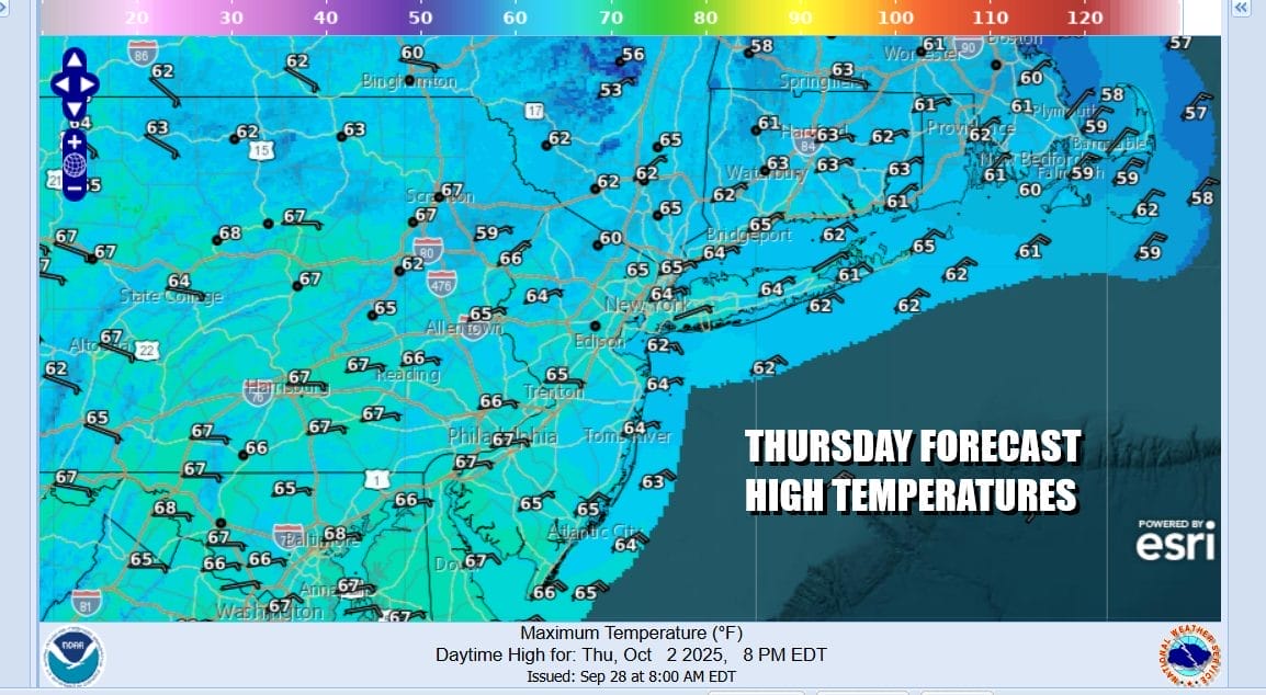
Wednesday night will be clear and it will the coolest night of the fall season so far. Thursday morning lows will be in the lower 50s along the coast with lots of 40s inland and even some 30s. Thursday will be a sunny and very cool weather day with highs just in the low and middle 60s. We also will have a gusty northeast wind that will develop and we could see gusts over 30 mph especially along the coast.
Friday the high pressure cell settles overhead with sunshine and after a chilly start, highs will be in the mid to upper 60s. Over the weekend we will have the high to the south and a west wind. Both Saturday and Sunday should be sunny and temperatures will warming up. We will be back into the 70s Saturday and into the 70s to around 80 degrees for Sunday.
BE SURE TO DOWNLOAD THE FREE METEOROLOGIST JOE CIOFFI WEATHER APP &
ANGRY BEN’S FREE WEATHER APP “THE ANGRY WEATHERMAN!
MANY THANKS TO TROPICAL TIDBITS FOR THE USE OF MAPS
Please note that with regards to any severe weather, tropical storms, or hurricanes, should a storm be threatening, please consult your local National Weather Service office or your local government officials about what action you should be taking to protect life and property.


