
Cold Into Tuesday & A Very Cold Tuesday Morning
With Frosts & Freezes
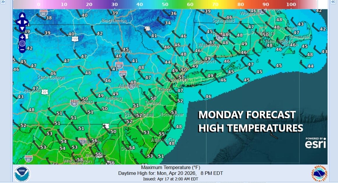
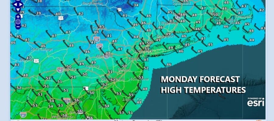
We should be up in the low to mid 60s on average for mid April but we will be well below those levels today. Cold unstable air will mean that sunshine will probably be self destructive to some extent today. There might even be a few pop up showers scattered around during the late morning and afternoon. Northwest winds will continue and it will be on the breezy side. Temperatures today will have a tough time getting much above the upper 40s and lower 50s across Eastern Pennsylvania to Southern New England.

The core of the cold air mass will be overhead tonight so winds will diminish and skies will become mostly clear. This sets up for frosts and freezes across much of the area Tuesday morning. Most lows will be in the mid to upper 20s inland and upper 20s to lower 30s closer to the coast and warmer urban areas. A lot will depend on whether winds die off completely and we get additional radiational cooling. Needless to say that temperature sensitive plants might want a warm place inside until after sunrise Tuesday morning.
SATELLITE WITH LIGHTNING STRIKES

WEATHER RADAR

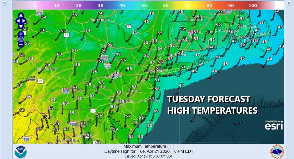
Moving through the daytime Tuesday the cold high will begin to slide off the coast and move to the east. This should allow for a slight rebound though winds turning to the south will likely cap any upside. Tuesday should be a nice sunny day and high temperatures generally should get back to the low and middle 50s.
Tuesday night into Wednesday morning with a south wind and clouds, temperatures probably don’t get much lower than upper 30s and lower 40s. Wednesday we have a disturbance that will move through and we will see clouds, some sun, and some scattered showers. Highs will reach into the 60s away from ocean locations.

Average highs this time of year are in the mid to upper 60s and rising and we should be around that range Thursday and Friday. We might even see some inland spots reach into the 70s. Both Thursday and Friday look to be dry mainly sunny days. The weekend could bring a chance for some rain or showers as low pressure and cold front come into the scene though we don’t see any major rain events for the next week or so.
USE THE JOE & JOE WEATHER SHOW PODCAST COUPON CODE SPRING 2026
MANY THANKS TO TROPICAL TIDBITS FOR THE USE OF MAPS
Please note that with regards to any severe weather, tropical storms, or hurricanes, should a storm be threatening, please consult your local National Weather Service office or your local government officials about what action you should be taking to protect life and property.


