
Clouds & Showery Rains Continue From Time to Time Into Friday

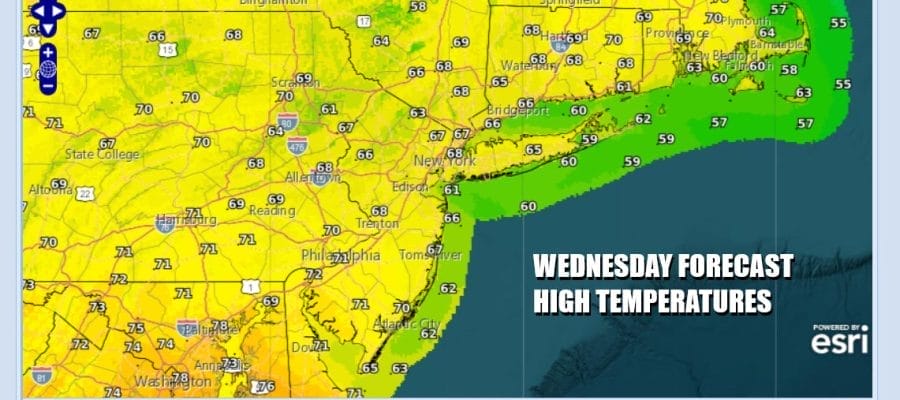
Across Eastern Pennsylvania to Southern New England and Long Island not much has changed since yesterday. We still have an upper air low pressure system sitting in the Northern Appalachians. We are waiting for something to kick it away to the east but that won’t happen until Friday. In the meantime we remain in a world of showery rains with a rumble or two of thunder. It doesn’t rain every waking minute of the day or night but the risk is there. Temperatures today will be generally in the upper 60s to lower 70s. There is always the chance that the sun might poke its nose through but if it does it won’t last.
SATELLITE WITH LIGHTNING STRIKES

WEATHER RADAR

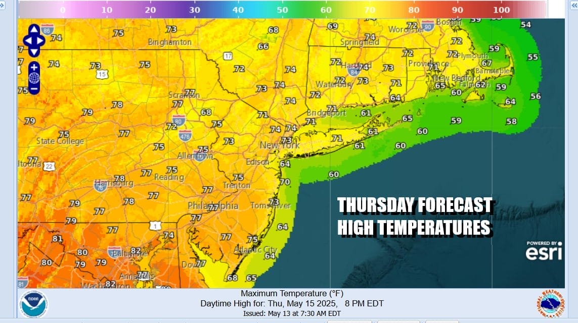
Showery rains tend to die off during the overnight but we can’t rule out the possibility. Thursday is a wash rinse repeat type of day as showery rains develop though there is a higher chance for a thunderstorm or two in the mix. We will also see temperatures warm some as winds turn more to the south and southwest. Again some breaks of sunshine are possible but those breaks won’t last long. Highs Thursday will be in the 70s to around 80 degrees.
Friday we see a distinct change in the overall pattern as weather systems begin to move from west to east once again. This is going to mean for more volatility. A powerful storm forming in the Northern Plains and Western Great Lakes Thursday moves eastward into Southeastern Canada as we move through the weekend. An upper trough approaching Friday will set off some showers and thunderstorms later in the day and into Friday evening.

Friday will be a very warm and humid day with most highs in the upper 70s and lower 80s. A second system in the form of a cold front approaches Saturday morning and this could set off some showers and thunderstorms during the first part of Saturday. The front will then pass offshore to the east so some improvement could occur from west to east Saturday afternoon. Temperatures Saturday will reach the upper 70s and lower 80s.

Behind this weather system a cooler than average temperature regime will begin and while we could still be on the warmish side of normal. Sunday should be okay though there might still be another chance for a scattered shower or two. Then it turns much cooler for the first half of next week as a cool air mass for this time of year builds across the Great Lakes Ohio Valley and much of the East Coast.
BE SURE TO DOWNLOAD THE FREE METEOROLOGIST JOE CIOFFI WEATHER APP &
ANGRY BEN’S FREE WEATHER APP “THE ANGRY WEATHERMAN!
MANY THANKS TO TROPICAL TIDBITS FOR THE USE OF MAPS
Please note that with regards to any severe weather, tropical storms, or hurricanes, should a storm be threatening, please consult your local National Weather Service office or your local government officials about what action you should be taking to protect life and property.


