
Clouds & A Little Rain Today Fast Moving Systems
Mostly Dry Conditions This Week

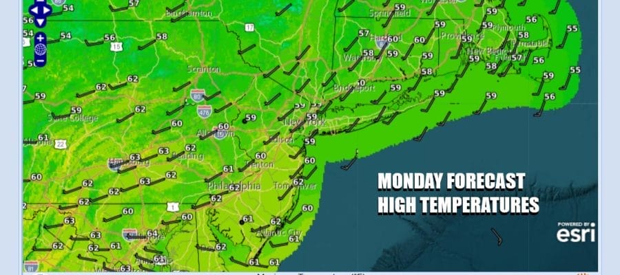
Back to work Monday’s are always tough especially when there is cloud cover and there is that gloomy feel out there. Such is the case along the coastal plain from southeast New England to Eastern Virginia. Low pressure is off the Virginia coast and heading northeast. We can also see a weather front and upper trough crossing the into the Eastern Great Lakes. Separate systems mean weak systems. When they phase together, that is when you have to worry and this is not happening until the low is east of Cape Cod and offshore. With that in mind it will be a cloudy day with a little light rain into this afternoon and then maybe a shower or two going into this evening. Highs today will be mostly in the 50s to around 60 degrees.
SATELLITE WITH LIGHTNING STRIKES

WEATHER RADAR

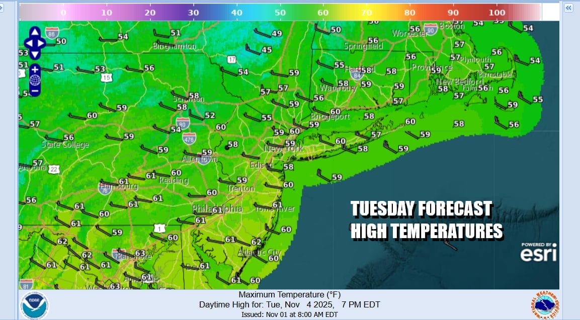
Once this all plays out we will see weather conditions improve this evening and tonight as skies partially clear out. Most lows Tuesday morning will be in the low to mid 40s with some 30s in cold spots well inland. Winds are going to pick up again overnight into Tuesday with gusts over 30 mph from the northwest. Tuesday we will have sunshine with gusty winds and high temperatures generally in the mid to upper 50s.
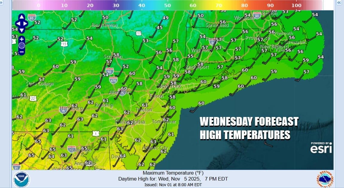
Winds will drop off later Tuesday and Tuesday night as high pressure builds in and then moves out during the day Wednesday. We will have another fast moving low pressure area moving across the Great Lakes and Northeast and with that, a cold front that passes through Wednesday night. Ahead of this we will see sunshine and clouds with highs into the 60s Wednesday.
There might be a shower or two with that frontal passage and then it is back to gusty winds and some sunshine Thursday but it will also be on the chilly side with most highs in the low to middle 50s. Friday things settle down with highs in the upper 50s to lower 60s. Another front and another chance for showers will occur Friday night into early Saturday. Such is the pattern this week of weak weather systems moving one after the other with no major impacts.
BE SURE TO DOWNLOAD THE FREE METEOROLOGIST JOE CIOFFI WEATHER APP &
ANGRY BEN’S FREE WEATHER APP “THE ANGRY WEATHERMAN!
MANY THANKS TO TROPICAL TIDBITS FOR THE USE OF MAPS
Please note that with regards to any severe weather, tropical storms, or hurricanes, should a storm be threatening, please consult your local National Weather Service office or your local government officials about what action you should be taking to protect life and property.


