

Chilly Temperatures Into Early Next Week
But No Rain Is Forecast Through Tuesday

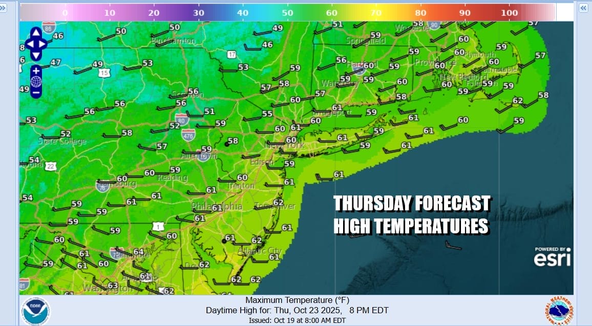
Satellite loops continue to show a strong upper air low pressure system in Southeastern Canada spinning away and not moving very much. This is creating a cold unstable atmosphere aloft but it is going to produce any major issues across Eastern Pennsylvania to Southern New England. Today starts with sunshine and then some clouds get into the mix. Some inland widely scattered light showers could develop but for the vast majority of you, it will be dry all day. Temperatures are going to be on the cool side of average with most highs reaching the upper 50s to around or just barely over 60 degrees.
SATELLITE WITH LIGHTNING STRIKES

WEATHER RADAR

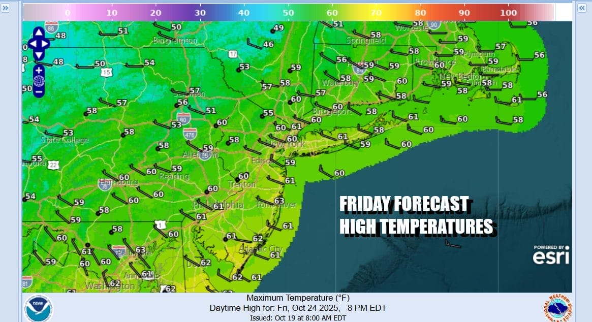
Winds from the west and northwest coming off the Great Lakes are producing some Lake Effect showers in Western NY and Western Pennsylvania. It won’t be long where set ups like this start to bring the lake effect snows but it is still a bit to warm at the moment. Skies here should at least partially clear tonight with lows in the 40s coast and 30s inland. Friday will be a repeat of today with early sun, then some clouds, and that outside chance for a brief shower inland. Highs again will be in the upper 50s and lower 60s.
Over the weekend we will continue to see high pressure dominating weather in the Eastern US. In fact that high is going to rebuild in Eastern Canada and New England and even colder air will funnel southward for Sunday and into the first part of next week. However while all this is happening, we will see dry conditions all weekend long with sunshine.

Low pressure is going to move across the Gulf States over the weekend as it is forced to take the southern route. Blocking is keeping this storm from heading to the west toward the Ohio Valley and Great Lakes. The low will make the turn and spread rain into the Southeast US and eventually into the Mid Atlantic mid week. A coastal storm is likely to develop but at this stage it is too early to tell where it will move northward or be blocked by that high to the north to some extent. These will be among the many issues we will grapple with over the weekend.

In the meantime Saturday will be chilly with sunshine and highs will be in the mid to upper 50s. By Sunday morning lows will be in the 20s and 30s inland and near 40 along the coast. Sunday will be mostly sunny and chilly with highs in the low to middle 50s and another cold night follows Sunday night into Monday. Monday and Tuesday will be dry.
BE SURE TO DOWNLOAD THE FREE METEOROLOGIST JOE CIOFFI WEATHER APP &
ANGRY BEN’S FREE WEATHER APP HE ANGRY WEATHERMAN!
MANY THANKS TO TROPICAL TIDBITS FOR THE USE OF MAPS
Please note that with regards to any severe weather, tropical storms, or hurricanes, should a storm be threatening, please consult your local National Weather Service office or your local government officials about what action you should be taking to protect life and property.


