
Chance of Snow or Rain Sunday Morning
Short Lived Cold Shot Follows

The weekend is underway and this Saturday is moving along nicely. We have sunshine with passing patchy clouds around and we are also warming up ahead of a cold front that arrives later today. In the meantime we are seeing temperatures rising into the upper 40s to mid 50s across Eastern Pennsylvania as the snow melt continues. South and east facing shorelines of New Jersey, Long Island and Southern Connecticut will see their temperatures fall into the low and mid 40s as the ocean sea breeze takes hold. Radars are nice and quiet.
SATELLITE WITH LIGHTNING STRIKES

WEATHER RADAR

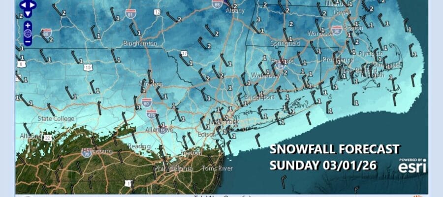
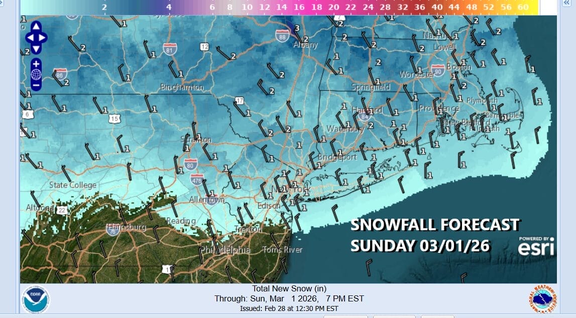
Winds will turn northwest and north tonight as a cold front passes. Clouds will increase some and most lows by morning will be in the upper 20s and lower 30s. A wave develops on that front and passes by to the south putting us into an area of snow Sunday morning into early afternoon. It is a fast moving ripple on the front and it will not produce much. Depending on temperatures it could be a coating to at most an inch in some places…and other places especially south of New York City where it could be a mix of rain and snow.
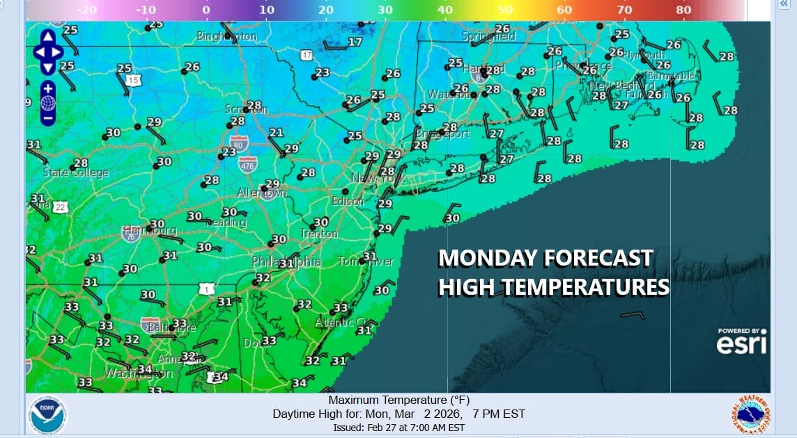
Once that wave goes by northerly winds will bring down what looks to be the last shot of cold air for the Northeast and Northern Mid Atlantic states for at least the next 10 days and possibly a bit longer. The high temperatures for the day will be leftover from midnight tonight. Gusty winds clouds and some sunshine Sunday afternoon will prevail and temperatures will hold in the low to middle 30s before dropping into the teens to near 20 degrees by Monday morning.

Monday will be a very cold day as the center of a cold air mass will be moving overhead. We will see sunshine and there should be less wind as the day goes on. High temperatures Monday will just be in the upper 20s and lower 30s. Temperatures Monday night will not drop as low as Sunday night as the next weather system comes into play for Tuesday.
Tuesday we will see increasing clouds as low pressure heads up to our west and north. Rain will arrive late Tuesday and last into early Wednesday. The rain could start as some snow or sleet for a short time inland. A short break follows Wednesday into Thursday. Then another low will bring rain with a cold front Thursday night into Friday. Expect temperatures to rise and may see 50s and even 60s Thursady
BE SURE TO DOWNLOAD THE FREE METEOROLOGIST JOE CIOFFI WEATHER APP &
ANGRY BEN’S FREE WEATHER APP “THE ANGRY WEATHERMAN!
MANY THANKS TO TROPICAL TIDBITS FOR THE USE OF MAPS
Please note that with regards to any severe weather, tropical storms, or hurricanes, should a storm be threatening, please consult your local National Weather Service office or your local government officials about what action you should be taking to protect life and property.


