
Breezy Chilly Through Friday Showers Likely Saturday Night & Sunday
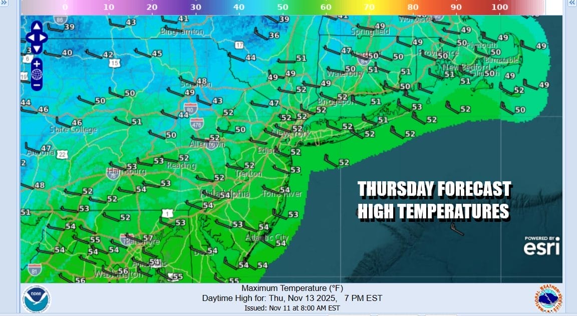
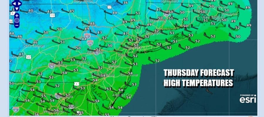
The northwest flow from Canada continues and that means we are not going to see much change in temperatures over the next 2 days. In the flow we have some clouds that will be moving through from time to time but there should be some sun in the mix especially near the coast. Winds have been an issue for the last few days and they will continue to be an issue as they will gust to 20 to 30 mph at times. Temperatures this afternoon will be topping out in the upper 40s to lower 50s. Even though we will have some clouds in the mix we are not forecasting any shower activity.
SATELLITE WITH LIGHTNING STRIKES

WEATHER RADAR

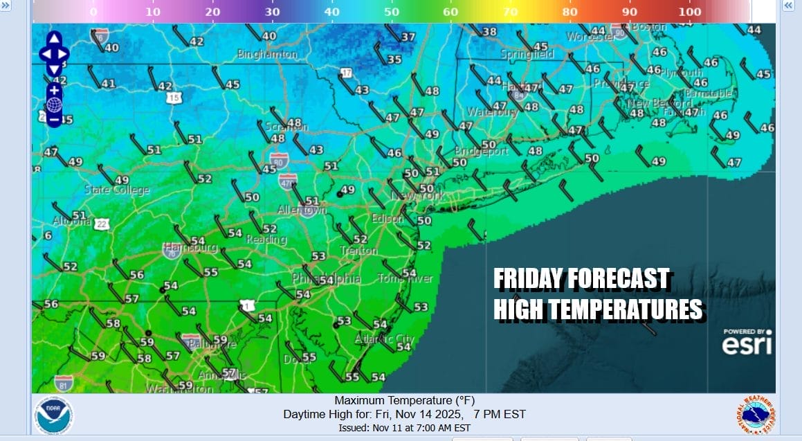
Skies tonight should partially clear out at times and it will remain breezy. Overnight lows will be in the 30s except for some 20s in colder spots well inland. Friday will be a repeat performance of today but the wind may ease a bit more. It will still be breezy however with some sunshine. High temperatures will again be in the upper 40s to some lower 50s.
The northwest flow shows no signs of abating over the weekend. In fact it will likely strengthen again as low pressure over the Northern Great Lakes moves eastward and a warm front approaches from the southwest. Ahead of the warm front some showers will develop but they should hold off until Saturday night. We might see a pause in the shower activity Sunday morning as the cold front associated with this system moves offshore and winds turn to the northwest.

With clouds increasing Saturday, temperatures will likely be capped with highs in the upper 40s to lower 50s. Sunday there could be some leftover warmer air around at least for awhile with clouds giving way to some sunshine Sunday afternoon. Highs will be in the upper 50s to some lower 60s before it turns colder Sunday night into Monday. Next week will start off on the cold side of average with high pressure, sunshine, but highs Monday just in the low to middle 50s
BE SURE TO DOWNLOAD THE FREE METEOROLOGIST JOE CIOFFI WEATHER APP \\\&
ANGRY BEN’S FREE WEATHER APP “THE ANGRY WEATHERMAN!
MANY THANKS TO TROPICAL TIDBITS FOR THE USE OF MAPS
Please note that with regards to any severe weather, tropical storms, or hurricanes, should a storm be threatening, please consult your local National Weather Service office or your local government officials about what action you should be taking to protect life and property.


