

Below Average Temperatures Last Through Friday
Though Temperatures Will Be Less Harsh
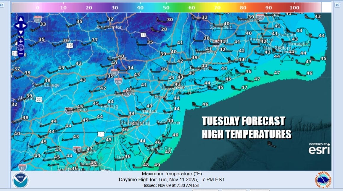
It is a cold Veterans Day and to our veterans thank you for your service. We have a wintry day in store with gusty winds, in and out sunshine, and the risk for snow showers coming through thanks to this strong upper trough in the Eastern US. Temperatures hit their lows this morning in the mid 20s to a few lower 30s in the warmest locations. Highs this afternoon will only reach the lower 40s in most places and some inland spots may have a tough time breaking 40 degrees. Winds will be gusting to 30 mph or more at times so you can knock of 10 to 15 degrees for the windchills.
SATELLITE WITH LIGHTNING STRIKES

WEATHER RADAR

Lake effect snows are active today as the radar shows snow in Upstate New York and Pennsylvania where we have various Winter Weather Advisories and Lake Effect snow warnings. occasional a patchy or two will break away and make it down to the coast. Skies tonight will be mostly clear but it will still be windy and cold with most lows Wednesday morning in the mid to upper 20s inland and low to mid 30s coast.

The upper trough will move offshore tonight but we will remain in a cold northwest flow for the remainder of the week though the coldest air will be moving out. There will be some moderation in temperatures Wednesday with some sunshine but highs will only make it back to the upper 40s and lower 50s which is still a few degrees below average. Gusty winds will continue throughout the day and for the rest of the week.
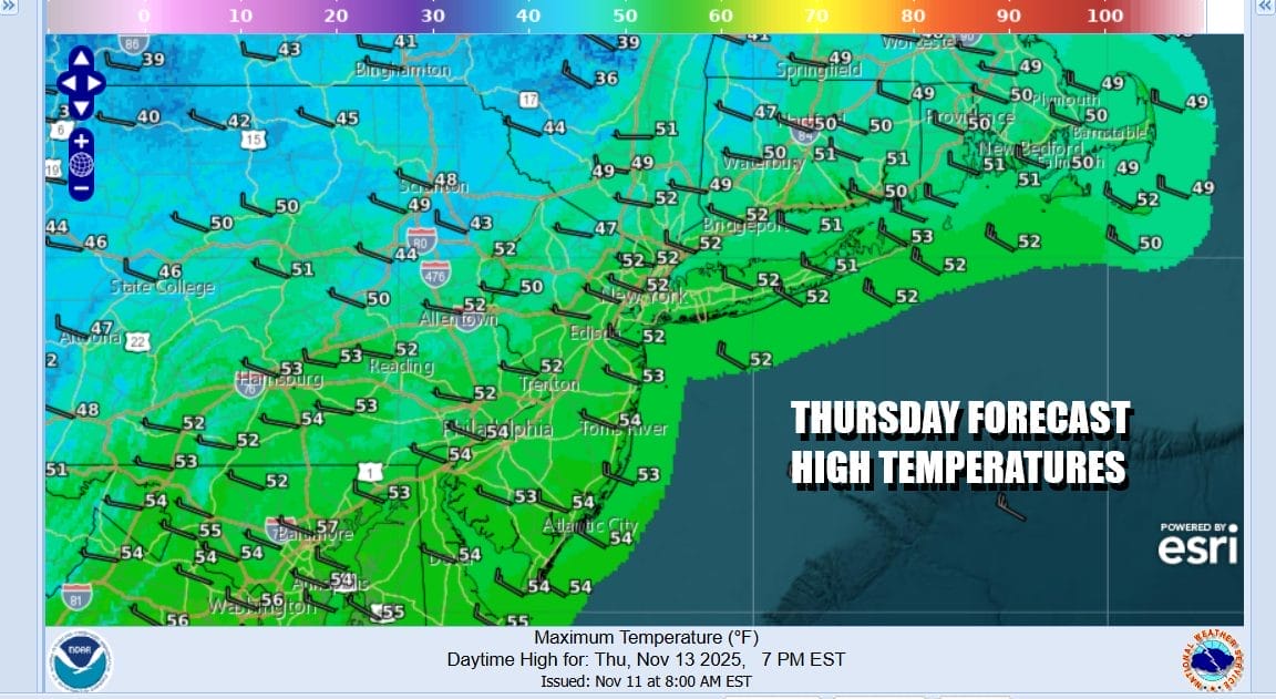
A slight reinforcement of cold air will come in for Thursday as a weak upper trough moves through Wednesday night. Thursday we will see some sunshine but again it will be breezy with most highs in the upper 40s to some lower 50s. We should nudge up a little higher for Friday but still running on the chilly side with most highs in the lower 50s. Over the weekend we should start to see temperatures rise a bit. A warm front from low pressure will approach bring the risk for showers Saturday night and then a cold front follows with a chance for showers Sunday.
BE SURE TO DOWNLOAD THE FREE METEOROLOGIST JOE CIOFFI WEATHER APP \&
ANGRY BEN’S FREE WEATHER APP “THE ANGRY WEATHERMAN!
MANY THANKS TO TROPICAL TIDBITS FOR THE USE OF MAPS
Please note that with regards to any severe weather, tropical storms, or hurricanes, should a storm be threatening, please consult your local National Weather Service office or your local government officials about what action you should be taking to protect life and property.


