

USE THE COUPON CODE “SPRING2026” AND GET 10 PERCENT OFF ON ANY PURCHASE

Back to Normal As Coastal Storm Pulls Away
Very Warm Late Week
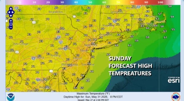
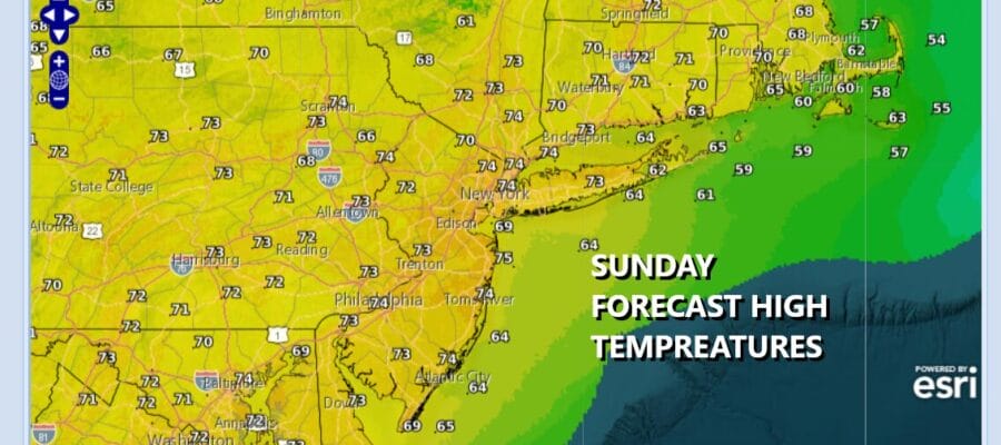
Yesterday could either be considered the last gasp of early spring or and early look at October weather. The unusual blocking pattern over North America with upper air storms from Atlantic Canada to the Azores & the northerly flow from Hudson & James Bays will begin to break down this week. Yesterday’s storm system is off shore as the satellite loop shows but another upper trough is dropping southward from Eastern Canada into New England. We should see some sunshine today across Eastern Pennsylvania to Southern New England and that should allow temperatures to head back into the 70s everywhere. Winds have eased considerably as well.
SATELLITE WITH LIGHTNING STRIKES

WEATHER RADAR

The upper trough to the north will have some showers with it and one or two could make it as far south as Northern New Jersey and New York City later this afternoon and early evening but this is no big deal. In fact much of this week will feature little to no rain across Eastern Pennsylvania. Skies should clear out overnight and Monday morning lows will be in the 50s except near 60 warmer urban locations.
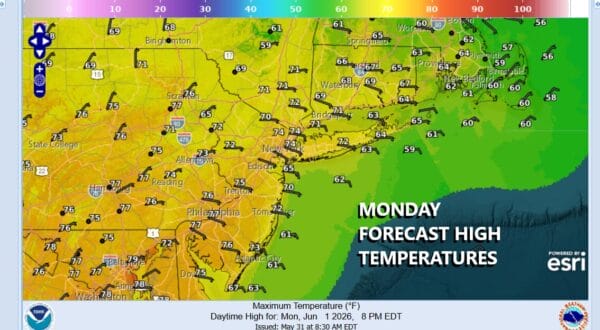
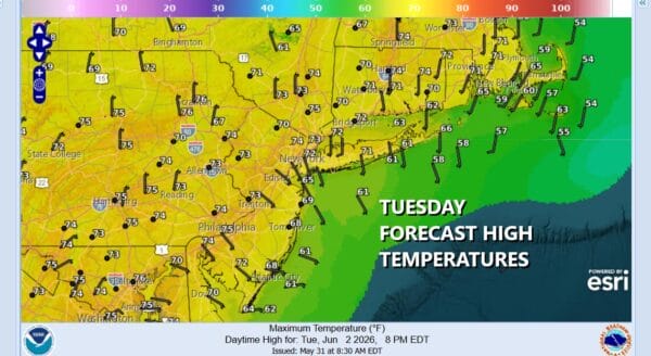
Monday we will see a bit more in temperature recovering though we will have a wind from the east and that will hold temperatures down some. Most highs will reach the low and middle 70s except about 10 degrees or so cooler along immediate coastal sections of New Jersey, Southern New England and Long Island. Tuesday looks to be about the same with highs in the low to mid 70s and we should have some sun both days.
High pressure over the Northeast and Middle Atlantic will gradually shift southward and that will begin to turn winds a round to a more westerly direction late this week. This is due to the omega block breaking down. As a result it will be dry through Friday and temperatures will trend higher. We will reach the mid to upper 70s Wednesday with some warm spots closer to 80 degrees. Highs will reach into the 80s Thursday and upper 80s to lower 90s by Friday. All three days will feature sunshine and dry conditions. We will probably have a cold front come though sometime next weekend as another trough drops into the Eastern US.
DOWNLOAD THE UPSIDE APP & EARN CASH AT GAS STATIONS, RESTAURANTS, & SUPERMARKETS

BE SURE TO DOWNLOAD THE FREE METEOROLOGIST JOE CIOFFI WEATHER APP &
ANGRY BEN’S FREE WEATHER APP “THE ANGRY WEATHERMAN!
MANY THANKS TO TROPICAL TIDBITS FOR THE USE OF MAPS
Please note that with regards to any severe weather, tropical storms, or hurricanes, should a storm be threatening, please consult your local National Weather Service office or your local government officials about what action you should be taking to protect life and property.
