
Arctic Air Bitter Cold Strong Winds Into Super Bowl Sunday,
Snow to the East Ends Later Today
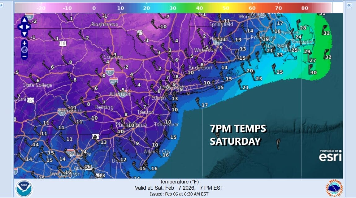
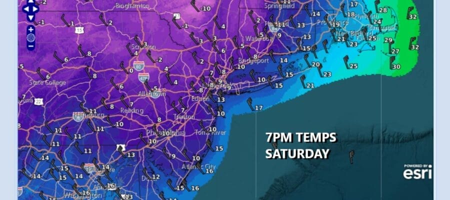
We begin the decent today into the “arctic abyss” thanks to an arctic cold front passing through and a developing storm offshore that is helping to pull the arctic air southward. The resulting combination has lead to a coating to an inch of snow overnight in most places but for areas to the east like Long Island, Central and Eastern Connecticut and points eastward, the snow could last into the mid or late afternoon.

These areas that snow this afternoon could see a few inches in some places but really the big story today is the arriving cold air. Temperatures by sundown will be down in the single digits and low teens, and winds will be increasing as the day wears on to where we will be gusting over 40 mph at times. Wind Advisories are posted and for the Coastal Counties of New Jersey from Ocean County southward as well as into Delaware we have High Wind Warnings in effect for gusts over 50 mph.
SATELLITE WITH LIGHTNING STRIKES

WEATHER RADAR

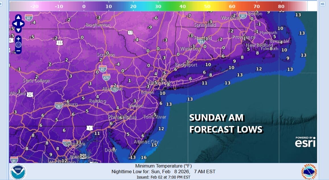
Tonight will be bitterly cold. Wind chills will down around minus 10 to minus 15 in terms of how it fees. Actual air temperatures will be below zero just inland of the coast and warmer urban areas. In the “warm spots” lows will be in the low to mid single digits Sunday morning. Winds will gust 30 to 40 mph at times all night long but they should start to come off their peak gusts beginning Sunday morning.
It will still be on the windy side during the day Sunday but a little less harsh. We will have plenty of susnhine and high temperatures will be mostly in the 20s. In terms of extreme cold, this may be the last of the brutally cold air masses but much of this week is going to be on the cold side of average but at least we will begin moderating Monday with highs in the 20s. We should head toward the 30s Tuesday as a warm front approaches and goes by to the north. Not much in the way of precipitation is forecast through at least mid week.
BE SURE TO DOWNLOAD THE FREE METEOROLOGIST JOE CIOFFI WEATHER APP &
ANGRY BEN’S FREE WEATHER APP “THE ANGRY WEATHERMAN!
MANY THANKS TO TROPICAL TIDBITS FOR THE USE OF MAPS
Please note that with regards to any severe weather, tropical storms, or hurricanes, should a storm be threatening, please consult your local National Weather Service office or your local government officials about what action you should be taking to protect life and property.


