
Another Warm Day Isolated Severe Weather Well North
Upstate & Northern New England
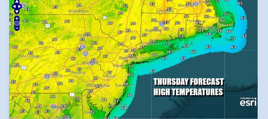
It is day 3 of highs in the 80s and skies no worse than partly sunny. For much of Eastern Pennsylvania to Southern New England including Long Island there are no weather issues to worry over today. However we do see the risk for thunderstorms setting up well inland and north of Route 84. The Storm Prediction Center is indicating a marginal risk for isolated severe thunderstorms well inland but we expect those storms to form later today and then disappear after sunset. More humid conditions are taking hold today as dew points rise into the 60s.
SATELLITE WITH LIGHTNING STRIKES

WEATHER RADAR

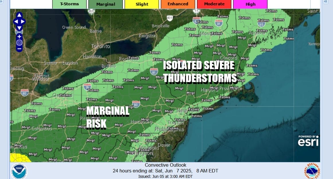
A weather front across Upstate New York will begin to make progress Friday and drift southward while a wave on the front beings to push the southern portion of that boundary to the east across Pennsylvania. This sets up for a higher chance for downpours and thunderstorms later in the day Friday and Friday night. The Storm Prediction Center is indicating a marginal risk for isolated severe thunderstorms from Northern New Jersey to the Hudson Valley and points northward.
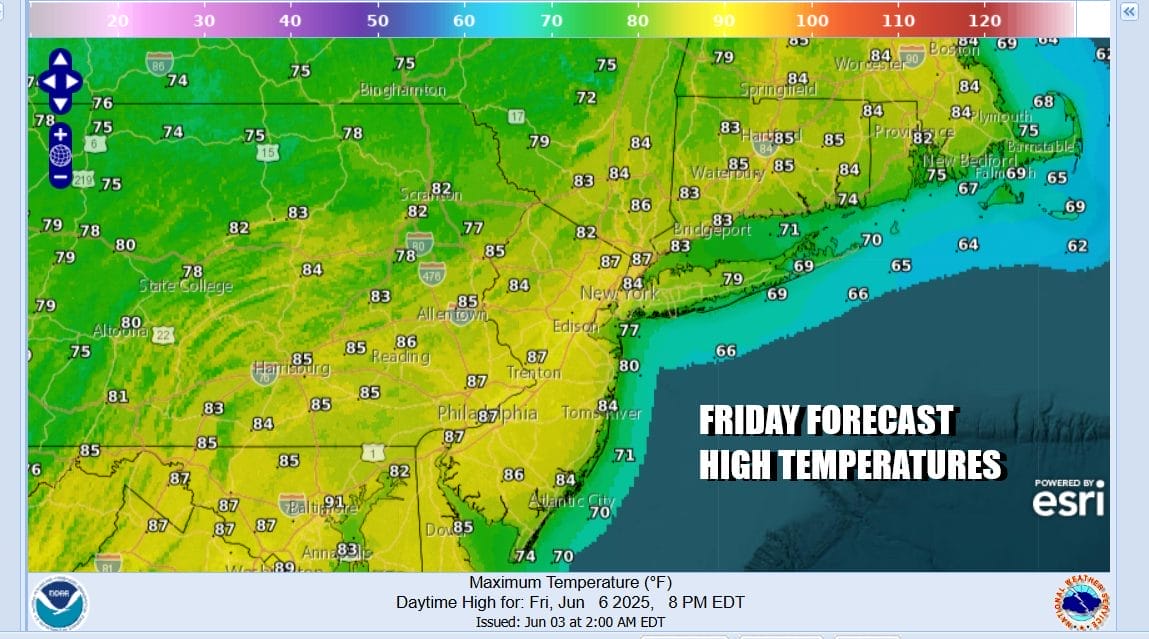
After a warm humid night with lows in the 60s, Friday will be a partly sunny day, at least into the afternoon before we see showers and thunderstorm risks rise going into the evening hours. Note that north of NYC and Philadelphia there will likely not be much of anything as far as storms go into Friday night. Highs Friday will once again be in the 80s.
As far as the weekend goes, we will see clouds Saturday and the risk for showers and thunderstorms running around though it is not going to be raining all day long. There will be dry stretches in the mix. The front is going to eventually push through but it will take much of Saturday and Saturday night for that to happen. Temperatures Saturday will be mostly in the 70s. Sunday there should be some improvement so we will call it a cloudy to partly sunny type of day. Highs Sunday will again be in the 70s.
BE SURE TO DOWNLOAD THE FREE METEOROLOGIST JOE CIOFFI WEATHER APP &
ANGRY BEN’S FREE WEATHER APP “THE ANGRY WEATHERMAN!
MANY THANKS TO TROPICAL TIDBITS FOR THE USE OF MAPS
Please note that with regards to any severe weather, tropical storms, or hurricanes, should a storm be threatening, please consult your local National Weather Service office or your local government officials about what action you should be taking to protect life and property.


