

Another Summer Day Scattered Storms Possible West & South
Severe Weather Risk Today & Tuesday
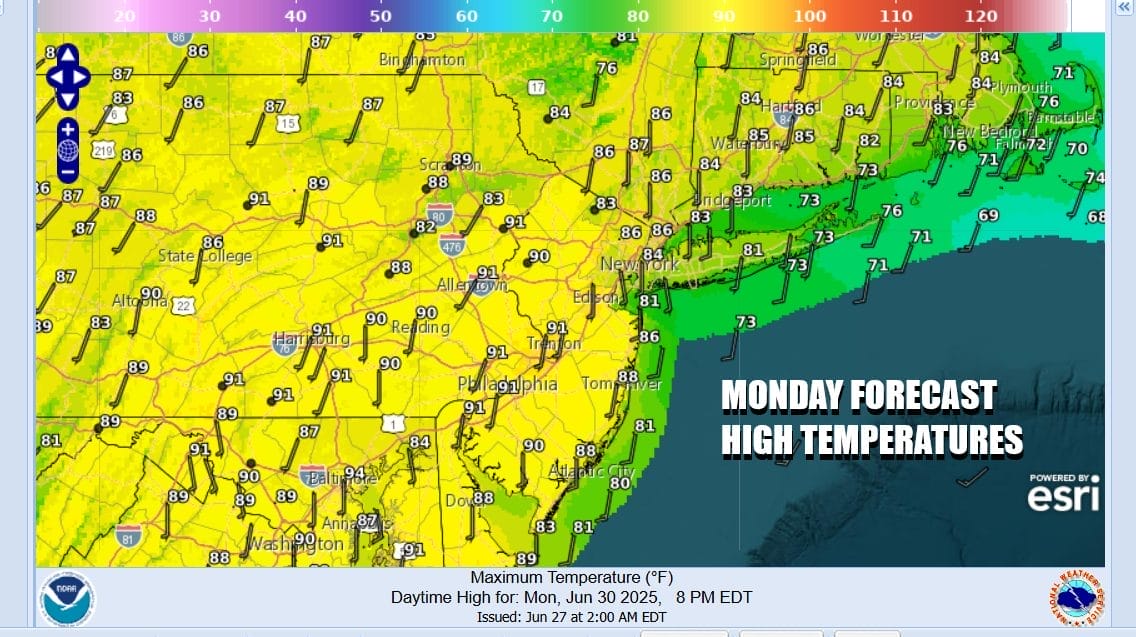
The short work week begins with Friday being the July 4th holiday, Independence Day. We start the week off where we left off the weekend. It is going to be another very warm to hot day inland. South winds will keep the south and east facing shorelines a bit cooler so beaches will be a nice place. We will have sunshine for awhile today. However scattered thunderstorms are possible especially inland in Eastern Pennsylvania, Western New Jersey and points south have a higher chance.

The Storm Prediction Center does indicate a marginal risk for isolated severe thunderstorms this afternoon and evening. The coast will likely be somewhat protected thanks to the south to southwest wind. High temperatures inland this afternoon will be in the upper 80s to some lower 90s while along the coast it iwll be in the 80s and probably 70s at area beaches.
SATELLITE WITH LIGHTNING STRIKES

WEATHER RADAR

Any storms will die out after sundown and it will remain warm and humid overnight. Lows Tuesday morning will be in the upper 60s inland and low to mid 70s coast and warmer urban areas. Tuesday will start with sunshine however we have an upper trough and a weather front that will be approaching in the afternoon and evening.
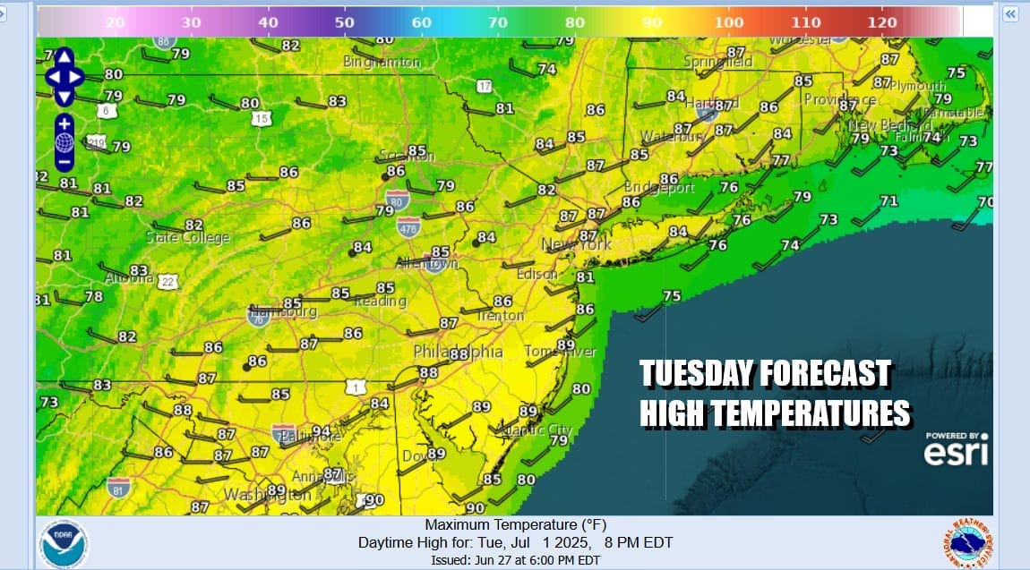
The Storm Prediction Center is indicating elevated risk for severe thunderstorms with this weather front and weather models show more widespread activity Tuesday. In fact we could see a line of strong to severe thunderstorms developing in Pennsylvania and the heading eastward toward the coast by Tuesday evening. It will be a very warm to hot day again. Mid to Upper 80s will be the highs inland and 80s coast with 70s at the beaches. Humidity levels will remain elevated.
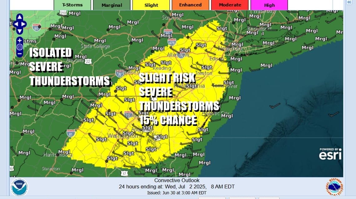
The highest risk time for thunderstorms will be in the afternoon and evening across the “slight risk” zone. Models are showing a possible squall line of thunderstorms forming from northeast to southwest from the Hudson Valley in NY southwestward to Virginia. The biggest risk from these storms are strong gusty winds in excess of 55 mph and hail up to 2 inches in diameter.

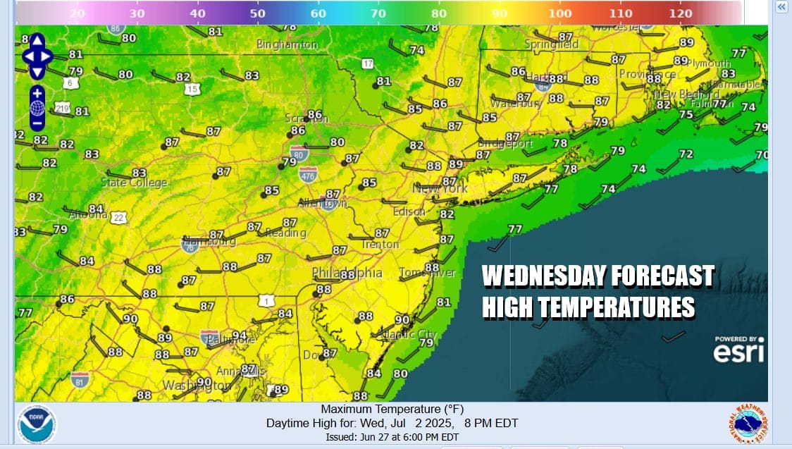
Thunderstorms will move offshore and weaken Tuesday night as they head eastward. There could be some leftover clouds around early Wednesday but we should see increasing amounts of sunshine from west to east and skies should in general be partly to mostly sunny. No additional storm activity is forecast for Wednesday afternoon. Highs will be mostly in the 80s.
Thursday we have a strong disturbance that will be moving quickly southeastward into Southeastern Canada and eventually finding its way to New England. This will push a cold front southward Thursday through New York and New England and eventually passing offshore. We are going to throw in the chance for showers and thunderstorms with that frontal passage for Thursday afternoon.
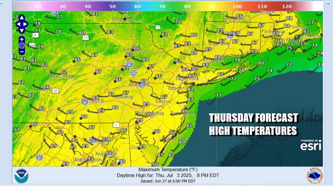
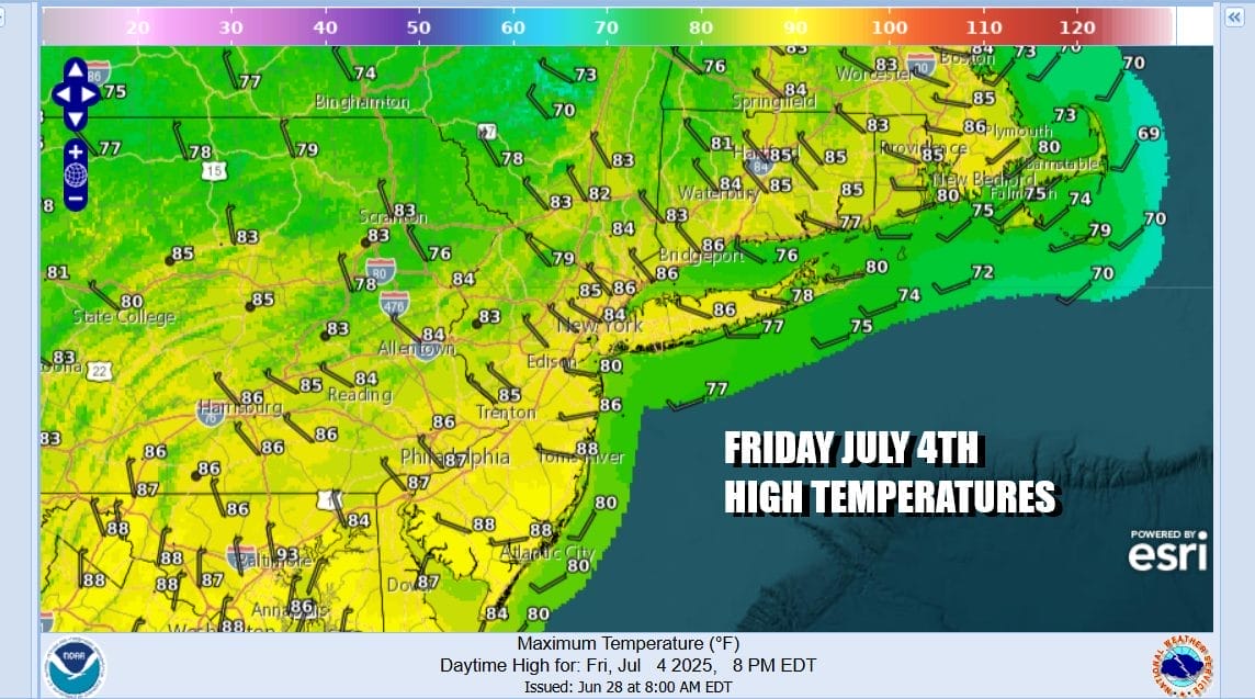
Ahead of any storm activity Thursday we will see clouds and some sunshine, a west wind, and highs in the 80s to around 90 degrees. The front will mark the leading edge of drier and cooler air that will arrive for Friday, the 4th of July. We should see plenty of sunshine, no showers or thunderstorms in the forecast for Friday along with cooler temps and lower humidity. Highs Friday will be in the lower to a few middle 80s.
We would expect to see temperatures and humidity levels rise somewhat over the weekend but we are going to avoid any shower or thunderstorm activity from what we see from here. Saturday and Sunday should be no worse than partly sunny. Highs Saturday will be in the mid to upper 80s. Sunday highs will be mostly in the upper 80s to some lower 90s. Temperatures both days will be cooler along coastal and shore locations.
BE SURE TO DOWNLOAD THE FREE METEOROLOGIST JOE CIOFFI WEATHER APP &
ANGRY BEN’S FREE WEATHER APP “THE ANGRY WEATHERMAN!
MANY THANKS TO TROPICAL TIDBITS FOR THE USE OF MAPS
Please note that with regards to any severe weather, tropical storms, or hurricanes, should a storm be threatening, please consult your local National Weather Service office or your local government officials about what action you should be taking to protect life and property.


