

Another Day of Sunshine As The Dry Lovely Weather Streak Continues
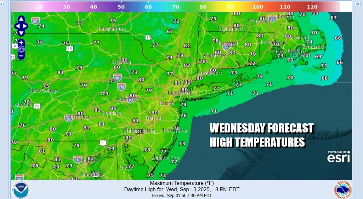
Another day of sunshine and no rain which isn’t exactly breaking news. It is has been like this for the most part for the last 10 days or so. Satellite and radar loops show mostly dry conditions up and down the East Coast. Temperatures this afternoon will reach the upper 70s to lower 80s with the humidity still on the reasonable side. Temperatures will be about 5 to 8 degrees lower along south and east facing shorelines thanks to an ocean wind.
SATELLITE WITH LIGHTNING STRIKES

WEATHER RADAR

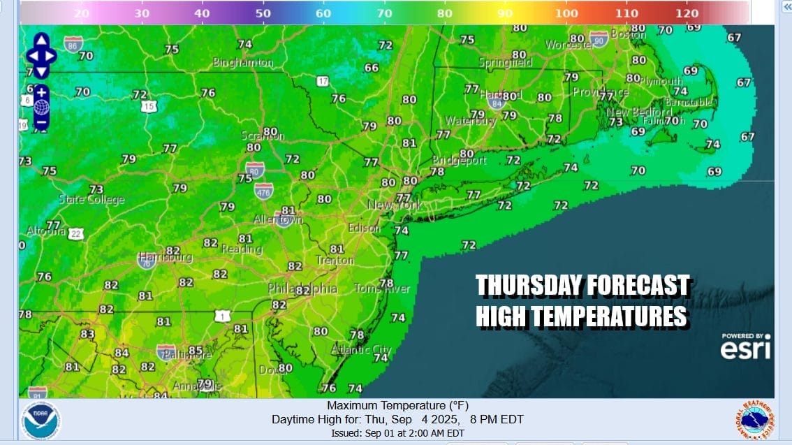
The south wind will keep temperatures from dropping overnight and Thursday morning lows will be in the mid 50s to lower 60s. Thursday we see high pressure finally far enough offshore to allow an approaching weather front from the Great Lakes to head eastward across New York state, Pennsylvania and points south. The amount of moisture with this cold front is somewhat limited.

We haven’t seen this in quite awhile but the Storm Prediction Center is indicating the risk for isolated severe thunderstorms in an area from New York state southward through Pennsylvania, Maryland, West Virginia and Virginia. However notice that the risk area fades as the cold front heads toward the coast. The highest risk for severe thunderstorms will be along and west of the Interstate 81 corridor in New York State and Pennsylania.
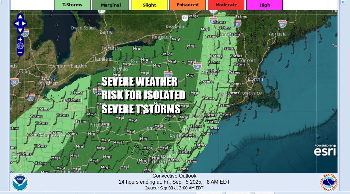
As far as timing goes, storm risk for Eastern Pennsylvania to Southern New England is probably during the evening hours and this leaves much of the dayside dry with no worse than partly sunny skies. Temperatures Thursday should reach the lower 80s in most inland locations and 70s along the shore thanks again to an ocean wind.
The air behind the cold front is actually about the same as the air ahead of it so we will wind up with warmer temperatures Friday. In fact Friday will be the warmest day of the week and the warmest day of the last couple of weeks. Skies should be no worse than partly sunny and Friday highs will be in the low to middle 80s. Over the weekend we have another cold front approaching and there is the risk for showers and thunderstorms Saturday. Following the front will be another very cool air mass for Sunday and especially for the first half of n
BE SURE TO DOWNLOAD THE FREE METEOROLOGIST JOE CIOFFI WEATHER APP \\\&
ANGRY BEN’S FREE WEATHER APP “THE ANGRY WEATHERMAN!
MANY THANKS TO TROPICAL TIDBITS FOR THE USE OF MAPS
Please note that with regards to any severe weather, tropical storms, or hurricanes, should a storm be threatening, please consult your local National Weather Service office or your local government officials about what action you should be taking to protect life and property.


